WILDFLOWERS ARE BLOOMING
EVERYWHERE, IN EVERY COLOR, ALL AT ONCE
along the Lyons Creek Trail!
 |
| Alpine Lilies |
 |
| Leichtlin's Mariposa Lily |
 |
| Fireweed |
 |
| Assorted Indian Paintbrush, lupine, and other wildflowers. |
 |
| Single-stemmed Groundsel |
 |
| More Alpine Lilies |

 |
| This is the creek just before the Lyons Lake Junction sign looking SW into the woods. |
Difficulty: At 10 miles I would rate any hike "Strenuous", and there are a couple of shallow creek crossings this year. A plus is the elevation gain is accomplished going in, and coming out is downhill. Not for strollers, but babypacks work!
Distance: 10+ miles round trip, upward, some loose rocky sections.
Elevation gain: + 1875 feet up and -1875 back down.
Driving Directions:
You could stop at Fresh Pond for gas, restroom use, drinks and snacks before you get off of Highway 50. For backpacking, see the notes near the end of this page. For even a small cooking stove, have your fire permit with you. Also bring your fishing license with if you bring your pole.
Driving Directions:
- Take Wrights Lake Road north off of Highway 50 near Kyburz.
- Follow the signs to Lyons Creek Trailhead. There is parking, but no restrooms are available. If you reach the Bloodsucker Lake parking, you have gone too far.
You could stop at Fresh Pond for gas, restroom use, drinks and snacks before you get off of Highway 50. For backpacking, see the notes near the end of this page. For even a small cooking stove, have your fire permit with you. Also bring your fishing license with if you bring your pole.
A great website is Desolation Wilderness Volunteers. It includes a photo gallery and a wealth of information if you plan on visiting the area.
I just returned from hiking to both lakes on the Lyons Creek Trail and the weather was, as expected, random! Sunny and hot on my first day and then on my way out after my over-nighter and day hiking, a thunderstorm blew in. In Desolation these weather changes are not uncommon, so be prepared.
I just returned from hiking to both lakes on the Lyons Creek Trail and the weather was, as expected, random! Sunny and hot on my first day and then on my way out after my over-nighter and day hiking, a thunderstorm blew in. In Desolation these weather changes are not uncommon, so be prepared.

Walk along a barely used roadway for forestry related activities. In a short distance though it becomes trail, first leading you through an large open meadow.
 |
Take one of the "use paths" to your left when you hear the water, and
at some of those locations you can refill your water in Lyons Creek
or maybe splash to cool off.
|
The following photos will take you through to Sylvia Lake.

Enter the woods on a hard packed soil trail.

I get excited when I reach this point, feeling closer to my destination.
Some hiker's goal is Pyramid Peak. Sylvia Lake is in the bowl beneath the peak though, so you won't have to climb it unless you are prepared to do so. Lyons Lake is a steep climb north marked with a forestry post at the trail junction.
Some hiker's goal is Pyramid Peak. Sylvia Lake is in the bowl beneath the peak though, so you won't have to climb it unless you are prepared to do so. Lyons Lake is a steep climb north marked with a forestry post at the trail junction.

This open area has corn lilies blooming at shoulder height right now,
along with Lupine, Paintbrush, Pennyroyal, Larkspur, Asters,
Mountain Bluebells, and many other wildflowers.
along with Lupine, Paintbrush, Pennyroyal, Larkspur, Asters,
Mountain Bluebells, and many other wildflowers.
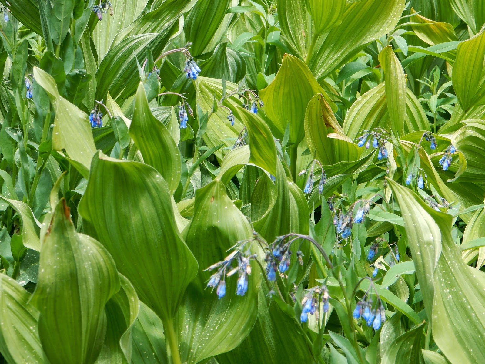 |
| Corn Lilies and Mountain Bluebells |


The view to the south side.

 |
| We have arrived! Bring your fishing pole if you have one. There were fishermen along the WNW shore of Sylvia Lake and also at Lyons Lake. |

 |
| Larkspur |
Please, please, please respect fire restrictions in place. More than ever before, Desolation Wilderness could be lost in fire due to the extreme drought, and even lasting effects from dead and dying trees that resulted from the drought. Fires mar the surfaces and change the resources, but at the end of the day, fire hazards are very high regardless of how careful you feel you are. Build fires in campgrounds designed with safe fire rings rather than in the wilderness.
- Day use fees: none; permits available at some trail heads after Memorial Day weekend, specifically at Lyons Creek, Rockbound, and Twin Lakes Trailheads.
To obtain passes or for assistance in trip planning:
- You can make online reservations for Desolation Wilderness Permits for a small reservation fee at Recreation.gov,
- or visit Pacific Ranger Station Fresh Pond, 7887 Highway 50, Pollock Pines, CA or call (530) 647-5415 .
- If you are from the Tahoe side, check with Lake Tahoe Basin Management Unit at (530) 543-2600.
Other regulations and restrictions can be found on the website, too.

I highly recommend you bring water and some snacks or lunch. No campfires are permitted in the wilderness. Have your Wilderness Permit to use your stoves and lanterns.
Please Leave No Trace and enjoy your trip!
Please Leave No Trace and enjoy your trip!
Happy Trails!
Related Posts
|
Desolation
Wilderness
|
|||
|
2015-07
|
10+ miles
|
Strenuous
|
|
|
2014-08
|
30 miles
|
Moderate to Strenuous/Difficult
|
|
|
2014-07
|
18 miles
|
Moderate-Difficult
|
|
|
2014-06
|
12+ miles
|
Moderate to Strenuous
|
|
|
2013-06
|
13+ miles
|
Moderate to Strenuous
|
|
|
2012-09
|
Umpa Lake & Enchanted Pools
|
8+ miles
|
Cross country ~ Moderate
|
|
2012-08
|
Horsetail Falls via Pyramid Creek TH
|
Aprox. 10 miles to lakes at
the top of the falls
|
"Difficult, and potentially
dangerous" miles
|
|
2012-07
|
10 miles
|
Moderate
|
|
|
2012-07
|
8 miles
|
Moderate-Strenuous
|
|
|
2012-06
|
Lyons Lake via Lyons Creek Trail
|
10+ miles
|
Strenuous
|
|
2012-08
|
9.2 miles
|
Moderate
|
|
|
2012-06
|
6+ miles
|
Strenuous
|
|
|
2011-07
|
Lyons Creek Trail with melting snow
|
9+ miles
|
Moderate
|
|
2011-02
|
3.8 miles
|
Moderate
|
|
|
2010-09 We hiked 12 days.
|
167 total
|
Moderate to Strenuous
|
|