


Trinity Alps Backpacking June 2010

We chose this trip to upgrade our skills and fitness levels. I've seen photographs, read blogs and trail reviews about the Trinity Alps which planted visions of sugarplums in my head about what it would be like. The weather turned on us a bit and the Forestry informed us most of the lakes are inaccessible from snow and trail damages, and they are as much as 90% iced over! It is mid-June!!!

Furthermore, most of the trails are unmaintained due to a huge shortfall of funding so climbing over fallen trees and crossing swollen creeks that were unpredictable from one hour to the next. Many trails have become impassable due to lack of travel and maintenance. With the worst and best cases presented to us, we took our maps and GPS and made a run for it.
The trail head we chose was an hour drive up a dirt road, with a conveniently located campground very nearby. As the day grew short, we decided to do an over-nighter there then start out refreshed and organized in the morning.

The camp was secluded, a mile down a narrow dirt road; we were there on a weeknight anyway, with recent stormy weather, and with rain forecast for the next couple of days. Not all brochure ads for drawing crowds! So we did have the area almost entirely to ourselves.

A runoff creek tumbled over mossy rocks alongside our chosen campsite giving us easy access and a nice stereo effect from that and the river. A small trail wandered uphill beside it and made a pleasant evening walk. We also walked up the dirt road to the trail head to take a peek.


Along the way was an old wood building, looked like it could house a couple of pack animals, and a nearby old "outhouse" of sorts. There was a great sawed out bench seat and a fire pit.
We meandered further up the road, checking out the scenery and vegetation, and stretching
our legs from the drive. So far, the weather was holding out for us.
We set up camp, finally deciding to use the rain fly just in case, and kept most of our gear in our
vehicle. They say "Early to Bed", and so we were! Yes, the rain came through and our insurance of having the rain fly paid off! In the morning, the ground was only damp, and the air was warmer thanks to the clouds. Breakfast was oatmeal, as usual, for an energy boost! And of course we indulged in our personal luxury, COFFEE! Not powder, brewed! Ah, cowboys knew how to do it!
We did spend some time reading the trail head signs and checking out our options at the map there, counted creek and river crossings and tried to minimize those due to advice from the forestry. We made a plan and after the obligatory first photos, we stepped off into the woodlands, lazy, excited, anxious, and determined. Prepared for almost anything! From there it becomes self hypnotic for me, one foot in front of the other, listen, look around for photo opportunities, and keep pressing on at a steady pace.
 Our first creek crossing was small, but an exciting gateway into the alps, and into our fantasies of what we would be able to see.
The trail of course diverged and left us wondering where to go...up, up, up? To the right but only 5 or 6 miles? or to the unknown left that we thought might be the trail to the lake we hoped to get to. We turned left and hiked through a thickly forested area, fire bitten in the last few years, but recovering well.
This is me returning on a trail that is supposedly in good condition, but we hiked a section without our gear to see how it looked...where are my trekking poles and a rope?!?!?! No wait! A parachute!

Wildflowers dotted wet areas, and even bamboo grew around one of the creek areas. It seemed to me the creeks were growing and I found us looking for logs to cross or bigger, less slippery rocks, doing a little bushwhacking (or we were on untraveled and unmaintained old trails) searching for better, safer routes. We found a great log crossing and several of our efforts to reroute ourselves proved unfruitful so we backtracked.
 Finally, the great challenge we were forewarned about...the river. We could COULD cross there, but there was one fairly deep area with a swift current. Now that was okay, but what about a sunny day (it was raining just then) or how the rain would effect the melt and runoff had to be considered too. At that point we weren't even sure that to get to our destination, this was the best or only route. Deliberation lasted about 45 minutes, and we tried the high road of unused but visible trail on our side of the river but up higher along the canyon walls. LOTS of tree falls made it difficult, but also allowed great backpack rests here and there. We took a break and contemplated our options again, and studied maps again. Meanwhile, we ate and got some electrolytes in us to prepare for whatever challenge we took. We finally decided to return to the Up up up trail we left behind and give it a try, thinking it may get us closer to the lake. We backtracked. There it loomed. Up. So we climbed. The further we went it seemed like this may have been where we should have gone all along.
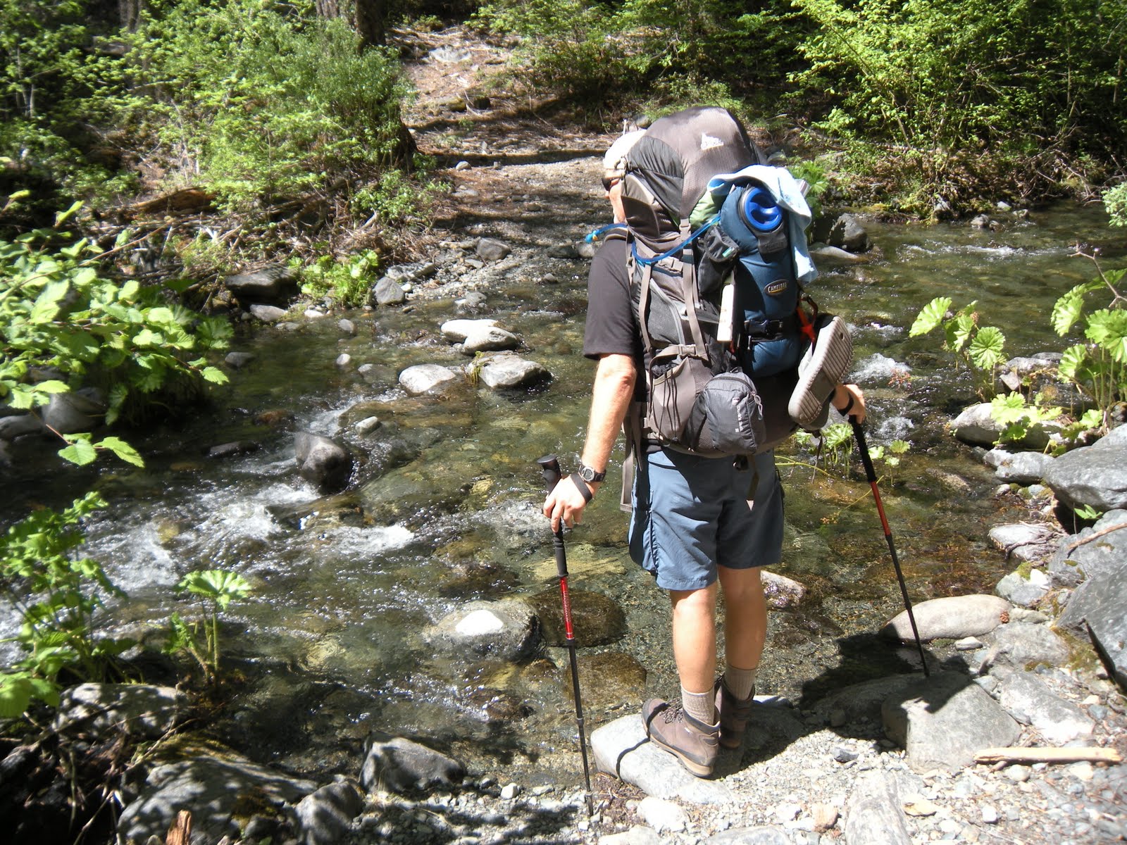 We were able to log many more miles back this way with less dangerous creek crossings and found a camp at a trail junction called Rattlesnake Camp. Quietly nearby were some other backpackers, well hidden, and two more passed us later in the day after we had settled in. The next day was enjoyable, and our bear canister and food bag we had hung were both untouched. Our ritual of cowboy coffee got us off to a great start and after a nutritious dehydrated meal, we made it back onto the trail.
At long last we "car-camped" in Hobo Gulch Campground, with a table, fire pit, the river just across the way, and deer wandering through to the river. We waded in the river, played with a little sunning snake, and took in a little sun ourselves. That evening we had fun watching the deer pass through and we played our camera games capturing Ken's knees, then feet, and close ups of the tent netting, my ridiculous expressions, ...arm pits, you know, good old fashioned fun! It gave us the day to relax and review the funny things, options we could have taken, food issues, future packing ideas, and get our things and selves organized before returning to city life!
Peachy Hiker's Table of Contents


