Trails in Northern California

Trails in Northern California

Leave No Trace!

Visit desovw.org for more information about Desolation Wilderness. Visit Recreation.gov or call 1- 877-444-6777 to make park reservations. Visit Campfire Permits to get a permit online. More about Leave No Trace principles.

June 28, 2011

Our Poison Oak Controversy, Identification and Prevention

Prevention and Treatment of Poison Oak/Sumac

Updated 8-2012
It is not contagious, but you can get it from pets or equipment from the oil still being on them and transferring it to you. The rash doesn't occur immediately and can take up to a week.  It spreads as places less exposed react after severely exposed patches are already erupting with itchy, oozing rash.
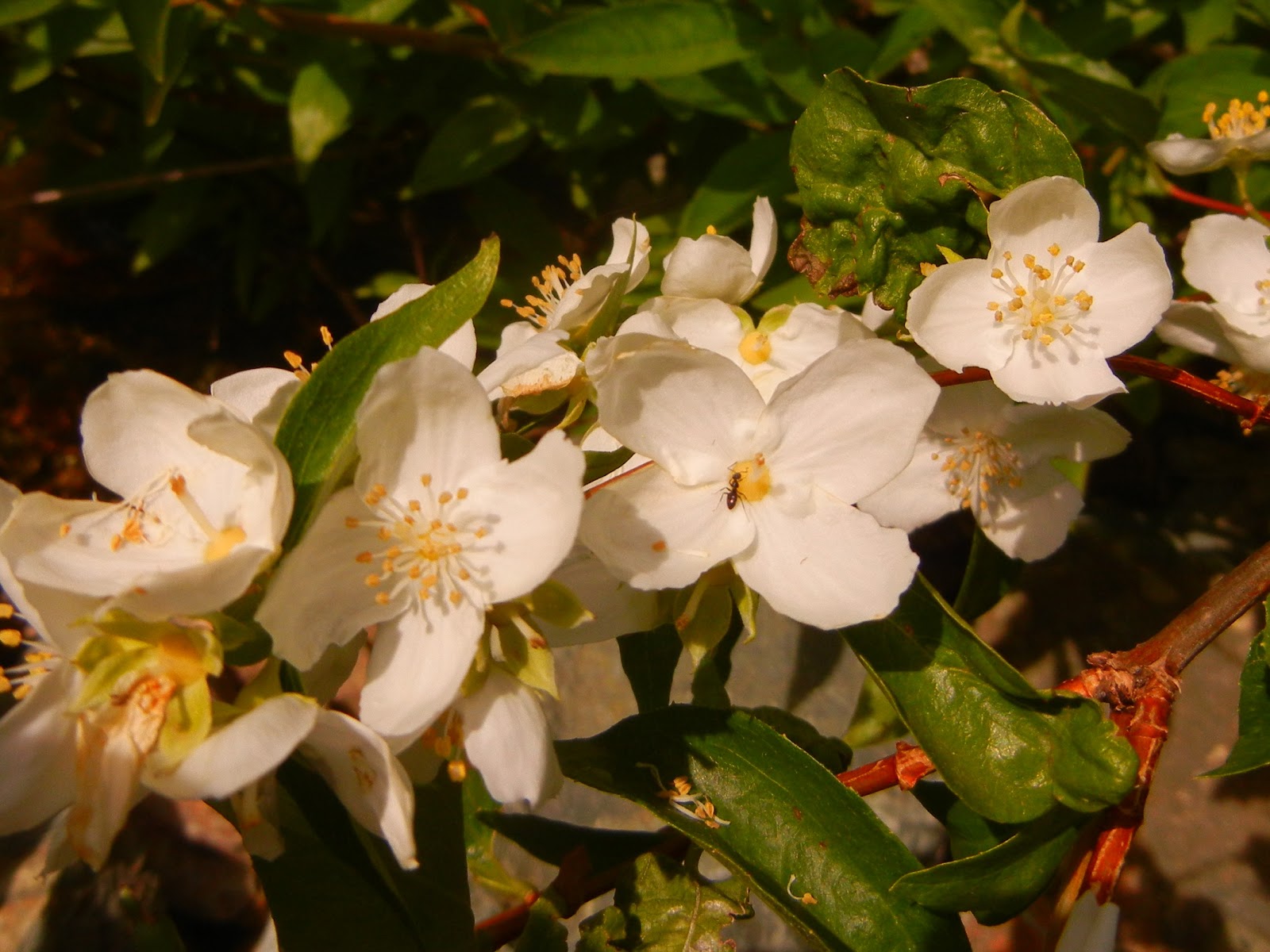
POISON OAK in the fall.  The leaves are glossy, unlike oak leaves. It is active whether you touch dead or live leaves, stems, or even roots!  The best preventions are to avoid elevations it grows in or don't come in contact with any part of it.
Summary: It will grow from sea level up to 5,000 feet.  I find it less the higher I go.  Your pet rubbing by it can expose you to the oils also.  Clean your gear while wearing gloves.  I use rubbing alcohol for skin and equipment.  Soap is okay if you have running water to wash it all away.


Prevention:
Recently, the U.S. Food and Drug Administration approved the use of bentoquatam, which is available over the counter, to prevent poison ivy. It comes in a lotion that should be applied to the skin at least 15 minutes before exposure to poison ivy, oak, or sumac. It provides a barrier that protects against or reduces the severity of the rash caused by the plants. Susceptible persons should reapply it every 4 hours for continued protection while they are in settings where they might become exposed to poison ivy, oak, or sumac. Bentoquatam should not be used if people already have a rash from these plants. It is especially useful for those who find it difficult to avoid contact with poison ivy, oak, or sumac, such as park rangers and hikers. It is not recommended for children under age 6. http://www.8004asthma.com/poison_ivy_allergy.htm
☺Wear long pants, long sleeves, hat and gloves if you know you will be exposed to these plants, even if they are believed to be dead since the poison remains for up to several years! Note that sap can seep through fabrics and even latex gloves though, so continue with pre and post exposure treatment to help avoid reactions.

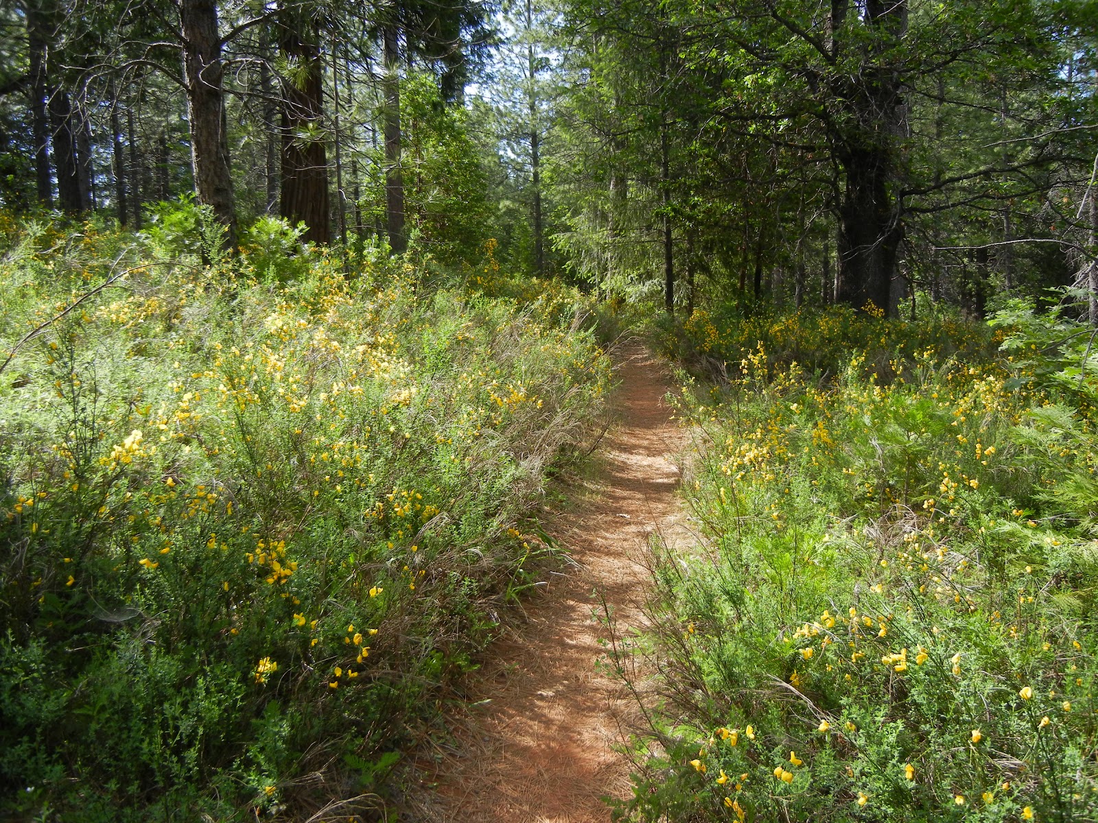
HOW TO DRESS TO AVID POISON OAK EXPOSURE
This hiker GOT poison oak on this trail to Traverse Creek despite wearing covering including hat and gloves! Unbelievable!
Plan your outings in elevations these plants can't grow.
Don't take pets out in areas with poison oak or ivy, or avoid touching pets until they and their equipment are washed.

Recognize plants (even when dormant of dead) and avoid touching the plants. All parts are poisonous, including even the roots.
Once Exposed: by direct contact, indirect contact (pets and equipment) or even air contact:
If you have been exposed to poison oak, poison ivy, or sumac, it is advisable to:
Remove all of your clothes. (My allergic companion's preference is to use gloves and to put the clothes straight into the washer.)  Your gloves should be cotton and washable too.
Wash all exposed body areas with cool running water as soon as possible. Use soap and water if possible, being sure to clean under your fingernails (where some internet sources say the oil can stay for days)! A running stream is reported to be effective in removing the oil, too. The sooner you wash it off, the less of a reaction there should be. Strong soap and scrubbing merely irritate the skin and are not more effective than mild soap and gentle washing. This was my friends' experience with one of those scrubs for poison oak....we think it may have just spread and rubbed in the oils because they got it allll over that time.
Wash all of your clothing and equipment that came in contact with the plants.
Bathe pets that were exposed to the plants. My additional comment is that good sense would suggest not letting them in the house or to touch anything, even their beds, that could leave oil residues which may expose you.

     See a doctor if your symptoms are of concern. 
If you aren't sure your rash is poison oak then see a doctor for diagnoses. Rashes shouldn't last more than 3 weeks. If it spreads over large areas, gets into your mouth, eyes, etc, or if or for fever or infection of affected areas, you should go to a doctor.  Prednisone can be perscribed if over the counter products are not relief enough and seems like the choice treatment of my allergic friends.

Relief at home:
  • Cool compresses and cool showers might help. 
  • 1% hydrocortisone helps some peoples' symptoms, as advised by labels or your doctor.
  • Using over the counter antihistamines helps some people. 
  • Your rash is not contagious, but may spread.


POISON OAK/IVY MYTHS
http://www.corbamtb.com/Resources/poisonoak.shtml gives a great informative list of myths and facts regarding poison oak and poison ivy, from prevention, exposure, intermediate treatment to a solid explanation of how it spreads (and doesn't) and what follow-up helps.
Sources used for information shared in this post:

Our story:
Old Rubicon Trail


Hiker dressed to avoid poison oak contact.
My hiking cohort went on a hike along a river in the foothills (The Old Rubicon Trail) at a higher elevation than the hikes we do in the lower elevation Gold Country area where poison oak is known to thrive. I didn't think it would be poison oak territory since there was none on our recent Grizzly Flats hike. My companion noticed it almost right away, and is allergic, but he was wearing long pants, long sleeves, and a hat....no gloves. I teasingly said he should have an OSHA suit!
My hiking partner said he must have gotten it from my gear or clothers or my skin that had been exposed by wearing shorts and short sleeves.
Peachy Hiker in poison oak territory.
Today we talked and I told him my research says I am innocent; he said he did research too and it confirmed that I am the cause of his poison oak outbreak!  The whole discussion and research are a bit funny....if you want someone to agree with almost ANYTHING, the research is out there on the net!  I would LOVE your comments and stories (haha, preferably supporting my views!).
Again, please share your suggestions, experiences and remedies! 
None of the suggestions for products are endorsements by Peachy Hiker.  I am not allergic, so I couldn't test them.  Everything I suggest is based on the first hand experience of people I hike with and research.

Peachy Hiker's Table of Contents
 
Happy Trails!

June 24, 2011

Carr Lake under Snow!

Our goal was to hike around Carr, Feeley, and maybe Island and Penner Lakes along the Crooked Lakes Trail in the Grouse Ridge Area, toward Bowman Lake. We took 80E from Sacramento area, and got over to 20 then followed the signs to Bowman, Carr and Freeley Lakes.  The last road to the lakes is dirt and recommended for high centered vehicles although you might be able to maneuver around potholes and bumps, it would be a gamble.
Along the way we crossed South Yuba and it was roaring with swifter runoff than I have ever seen!
As it turned out, we hiked 5.85 miles, round trip, ascending from 5842 to 6703 feet at the backpackers campground, largely on snow!  We actually ascended and descended more than 1500 feet according to our GPS route.
The dirt road in was blocked with snow so we, along with others, parked alongside the road and began hiking up it.
Naturally the higher we got, the deeper and more consistent the snow.  Dog, cougar, deer, and bear tracks dotted the snow, some deep and fresh like our own, but no animal contact.  Water rushed out from under the fringes of the snow banks and made the snow unstable and potentially unsafe.
Some other hikers had their snowshoes, but we were able to hike in our regular hiking shoes.  The snow was just soft enough for our feet to sink in most of the time without slipping, or having the snow fill our shoes!  Our hiking poles came in handy for stabilizing our steps.
Good sense would indicate waterproof shoes and extra hiking socks, along with some layers for warmth.  Unexpected weather changes are not uncommon!  The weather was short-sleeve-warm and sunny, but I should mention that SAR recommends wearing long sleeves and long pants because falls can cause road rash like burns.  They also recommend carrying an ice ax to capture yourself in the event you do break through the snow.  The ground warmth melts the snow underneath and creates pockets of water and air you can't see to navigate around.  
Another recommendation is to avoid going too near trees and plants when traveling over snow because the roots create warmth that melts the snow near the ground and that you can fall through.
Once at the backpackers campground overlooking Carr Lake it was apparent we couldn't get further safely due to snow melt.  We hung around taking photos of the snow and even a few wildflowers!  The snow trek was similar to hiking in sand, and the final stretch to the lake was steeper and more work.

These are photos of Carr Lake: The first shows the lake covered in snow at the bottom of the "hill" in the background.

There was a thick layer of snow, submerged and yet interestingly visible around the edges.  From the opposite side of the lake a wind was blowing towards us, pushing the snow across the lake and chilling our bones!

We found wildflowers blooming even in this unexpected place.

The photograph below was of the gate to the parking area (used when the snow melts)!  It wasn't an "illusion" shot; the snow thickly covered the rest of the gate!


Any snow precipice could have crumbled down at any time.

Another view of the lake through the budding willows that had provided us camouflage for our golden tent last fall.
The lake was stunningly bright and beautiful! 
I am reminded of my goosebumps simply reviewing our photos!
As we hiked lower in elevation, in the afternoon heat, the more mud and water we hiked through.  Snow was melting fast!  Overall it was a fun hike, but for us, a long drive to be able to see only one of the numerous lakes in the area.
Check out Google Earth for the Grouse Ridge Area and plan some hiking and backpacking once the snow melts and it becomes accessible.  There is another blog entry here from our "Survivor" camp up there with photos of what you can expect to see after snow melt.  (In fact, the photo used as my standard headline photo was taken in that area!) The trail we primarily used was "Crooked Lakes Trail".  It is fairly well marked and by following it you can get fabulous views of distant ridges, and local finds including a variety of plant life, many small lakes and suitable swimming holes, not to mention fishing, and if you are so inclined, there is a hunting season for game as well.

Peachy Hiker's Table of Contents

Happy Trails!

June 16, 2011

Balderson, Dru Barner, & Little Silver Loop Hike

Mysterious Bald Mountain in a Snowstorm

This is up a little further but shows winter is settling in and my trip to Bald Mountain Nov, 12th, 2012  had sections of forest roads covered in snow.  I would recommend checking with the local Foresty Station for conditions.  Office information below the map.)
That wasn't fog, but snow that turned into a white out!  I can't wait to return!

     Park at the Balderson Equestrian Staging Area (before Balderson Road) off of Wentworth Springs Road, about 5+ miles out of Georgetown.  My GPS read 38.93142105,-120.75691709.

There is really only room for one vehicle with a horse trailer to park near two picnic tables in the shade.  I parked closer to the actual trailhead.  I started hiking at the sign for the Dru Barner Trail.

***During the snow season this area warns drivers to have snow tires or not enter the area.  Snow plows may not come by!

Below are photos and hiking notes made during the regular "hiking season".

This is the trail head I used in June of 2011.
Another view of the same trail head.


A short distance away you'll cross this ditch.  Note that I found no potable water
or porta potty so go prepared.
Continue hiking this way and you will see the sign below.
At this point I took the turn to the right. Having never explored these trails,
I opted to go with the GPS suggested trail.
Of course part of the fun was finding the wild blooms and photo moments!  There trail has a random mix of sun and shade making it a nice hike in sunny weather. You don't get to hike along a stream though so carry water.
Next you'll come to this junction and I went to the left, only because
the trail tracks I loaded from Wikiloc took that route.
Most of the views were very local woodsy trail views but here the trail broke into this wide open distant view and a bit of sunshine!
This was quite a find because the color red and the bug were not visible to my naked eye!  The flowers are small and I used a macro setting to photograph it.  What a nice bonus when I got it home and viewed it!

The trail meandered through the woods and areas of tall manzanita, easy on the feet and ankles.
This sign was on the right and the one below on the left!
At this junction I decided to stay on Little Silver Loop, which meant continuing straight ahead.
What a cooperative and colorful find!
This was a bit of trail returning to the car, AKA, "the Holy Grail".
This old cattle loading corral is weathered and reminiscent of the good ole' days.  It sits right near the picnic tables and the trail head.  Overall I hiked 6.11 miles and my total elevation climb totaled just over 1000 feet, so then about as much down as well.  But it was all gradual, easy slopes up and downward.  Parking was free.  Lots of options as you can see, so it could be shorter or longer as you decide!


GPS tracks for this hike.

Georgetown Ranger District Patricia Trimble, District Ranger
7600 Wentworth Springs Road
Georgetown, CA 95634
530-333-4312
TTY 530-333-5511
Summer Schedule: Open 7 days a week until November 17
Winter Schedule: Open Monday - Friday
8:00 am - 4:30 pm


Updated 11-2012

June 12, 2011

Ruck-A-Chucky Towards Ford's Bar


I took Foresthill Road to Drivers Flat Road and followed it down to Ruck-A-Chucky where there is a campground and a day use parking area.  There is a whopping $10 fee!  I paid it this once.  My starting point was 38.58.013N  and 120.57.113W  The hike is about 4.5 miles, moderate to difficult.

One of the remnants you'll see along the way.
"It's not in bloom yet--it's in bud. It's Gum plant, Grindelia camporum, a native wildflower
. When it opens, it will reveal a yellow flower reminiscen
t of dandelion. The gum is thought to deter ants from damaging the flower or stealing nectar (without pollinating)."  Tato


Paradise Falls start 100 feet above the bottom of the creek.  Hard to see in the photo, and not completely visible from top to bottom either.  I hiked upward and saw less; there is no trail and its rocky, steep, wet, and another "machete" sort of hike if you climb the hillside.


"Party animals"

Sunbathing butterfly.  Groups of several varieties floated playfully around, while others competed for shade and water.


I climbed this "path/deer trail" to go back up to the road.  It was dicey!  Steep, very few rocks or roots to grip, dirt that would crumble in some places, and stickers for free!

I could hear these rapids for quite a distance before the trees gave way for a full and wide open view!
Not only were they thunderous, but ran for a long stretch!
Zoom lenses were made for moments like these!

I loved whitewater rafting with a guide, but never saw a view like this!  It could give me the jitters to think of riding through them!
Upriver not only calmed down, but became placid and still looking, and the thunder faded.
There are a few picnic tables in shade available to rest in.  Beautiful settings and near enough to the water to still be cooler than the sunny stretches of road and trail.
This is the road described as best suited for high centered vehicles.  In all but one area, my little car could negotiate it, but all it takes is one area to stop you.  I parked near the Ruck-A-Chucky raft pull out area.  There are port a potties there, too.

Behind the tree, you can see remnants of an old rock wall.
This was my parting view of the canyon for the day and with the setting sun, it was magnificent!