Trails in Northern California

Trails in Northern California

Leave No Trace!

Visit desovw.org for more information about Desolation Wilderness. Visit Recreation.gov or call 1- 877-444-6777 to make park reservations. Visit Campfire Permits to get a permit online. More about Leave No Trace principles.

June 29, 2014

Lyons Creek Trail to Lake Sylvia-June 2014

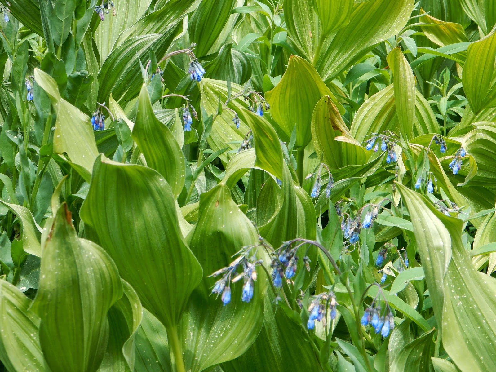
WILDFLOWERS ARE BLOOMING 

more profusely than I have ever seen along Lyons Creek!

EVERYWHERE, IN EVERY COLOR, ALL AT ONCE!  

Lake Sylvia, Desolation Wilderness, June 2014
Distance:  12+ miles round trip, upward, some loose rocky sections.
Difficulty:  At 12 miles I would rate any hike difficult, but aside from length, there are several creek crossings (one could be ankle deep).  A plus is the elevation gain is accomplished going in, and coming out is downhill!
Elevation gain:   + 1875 feet up and -1875 back down.
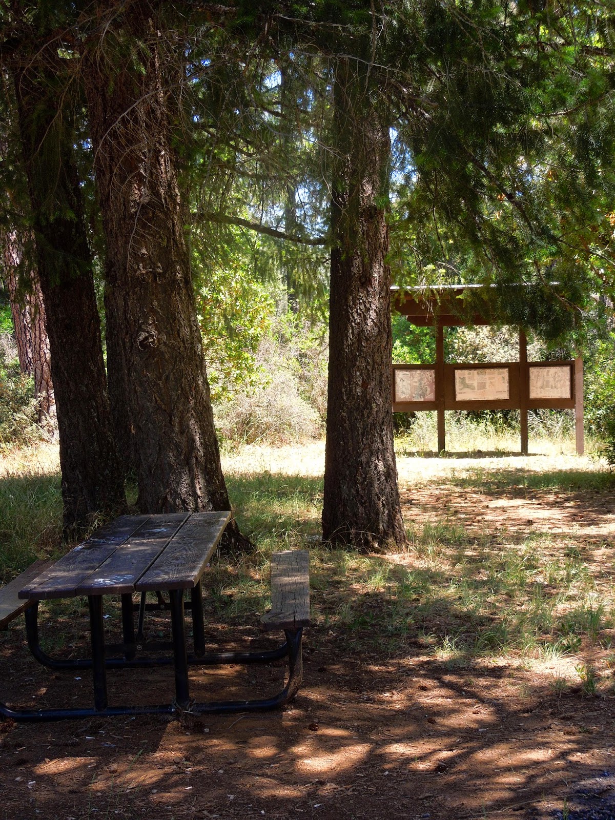
Notes: Day passes are available at the trail head. There is parking, but no restrooms are available. You could drive up to the Bloodsucker Lake parking, or stop before you get off of Highway 50. For backpacking, see the notes near the end of this page.  More notes at the end of the article.

Photos of the trail and views  are arranged chronologically.  Click on one and you can see them enlarged.  Another great website, with photos posted by me and others, is Desolation Wilderness Volunteers.  It also includes a wealth of information if you plan on visiting.

Walk along a barely used roadway for  forestry related activities.  In a short distance though it becomes trail, first leading you through an large open meadow.
Take one of the use paths to your left when you hear the water, and at some of those locations you can refill your water or maybe splash to cool off.
The following photos will take you through to the lake.
Enter the woods on a hard packed soil trail.
I get excited when I reach this point, feeling closer to my destination.  Pyramid Peak is 
some hikers' goal.  The lake is in the bowl beneath the peak though, so you 
won't have to climb it unless you are prepared to do so.  That is another story.
This open area has corn lilies about hip high, not yet in bloom, intermingled with wildflowers.


The creek crossings are usually shallow.  Step across the rocks and head into the woods again.
The view to the south side.  
As you get closer to the lake, the trail is composed of loose rocks.  If you are prone to twisting an ankle, mid boots will help prevent injury.  I have seen people hiking out here in flip flops!
Although this is not the crossing, it is the last creek you will cross to get to Lake Sylvia.  I included this shot so you can get an idea of the creek depth at this time.
We have arrived!  Bring your fishing pole if you have one.  There were a handful  of fishermen along the west shore and I could see fish swimming along the south side where I had lunch.  Please note that this lake is a sensitive area with recent restoration work done.  Please respect the effort.  These signs will show you the areas to avoid:

Vicariously, enjoy blooms in Desolation this June and July

without driving up and hiking by viewing the photos below:


and more can be found at  Desolation Wilderness Volunteers website under the media heading.
Driving Directions:
  • Take Wrights Lake Road north off of Highway 50 at Kyburz. 
  • Follow the signs to Lyons Creek Trailhead. (No restroom here) If you reach the Bloodsucker Lake parking, you have gone too far.  
Fees:  
  •  Day use fees: none; permits available at trailheads seasonally.   
  • Backpacking: $5.00 for the first night, and $10.00 for 2-12 nights.  Children 12 and younger are free.  
To obtain passes or for assistance in trip planning:
  • or visit Pacific Ranger Station Fresh Pond, 7887 Highway 50, Pollock Pines, CA or call (530) 647-5415 .  
  • If you are from the Tahoe side, check with Lake Tahoe Basin Management Unit at (530) 543-2600. 
Other regulations and restrictions can be found on the website, too.
 I highly recommend you bring water and some snacks or lunch. No fires are permitted in the wilderness. Have your fire permit to use your stoves and lanterns. 
Get your permit here: Fire permits
 Please Leave No Trace and enjoy your trip!

Happy Trails!

Related Posts you might be interested in for nearby trails:

Desolation Wilderness
2015-07
10+ miles
Strenuous
2014-08
30 miles
Moderate to Strenuous/Difficult
2014-07
18 miles
Moderate-Difficult
2014-06
12+ miles
Moderate to Strenuous
2013-06
13+ miles
Moderate to Strenuous
2012-09
Umpa Lake & Enchanted Pools
8+ miles
Cross country ~ Moderate
2012-08
Horsetail Falls via Pyramid Creek TH
Aprox.  10 miles to lakes at the top of the falls
"Difficult, and potentially dangerous" miles
2012-07
10 miles
Moderate
2012-07
8 miles
Moderate-Strenuous
2012-06
Lyons Lake via Lyons Creek Trail
10+ miles
Strenuous
2012-08
9.2 miles
Moderate
2012-06
6+ miles
Strenuous
2011-07
Lyons Creek Trail with melting snow
9+ miles
Moderate
2011-02
3.8 miles
Moderate
2010-09 We hiked 12 days.
167 total
Moderate to Strenuous

See the Full Table of Contents.
Added updated links and Table of Contents 06-2016

June 25, 2014

El Dorado Trail from Jacquier Road in Placerville

This is the first paved eastern section of the El Dorado Trail, designated for multiple uses including joggers, bicycles, dogs walking their people, and equestrians.  It is wheelchair and stroller accessible!

Hike through the Placerville hills with views of
vineyards, farms, a lake, rolling hills, and mountains. 
Distance: I hiked about 6 miles on this stretch of trail.
Difficulty:  It's up to you, but easy if you are simply taking a walk.  Put all the energy you want into it though, bicycling or jogging.
Important Notes: 
  • There is poison oak along the side of the trail so before you step off of the pavement, double check the plants!
  • Carry water.  It gets hot (in the 90's this month).
  • Always watch for rattlesnakes.
  • Sunscreen is advisable.  Perhaps a hat and sunglasses, too.
  • Two vault toilets available next to the parking area.
This parking lot has an exercise and stretching area for warm ups.
 It is large and designed to accommodate horse trailers.

Driving Directions:  Take Exit 49 off of Highway 50 in Placerville, CA, toward Point View Drive. Go north (under the freeway if you were heading east) and turn right into the El Dorado Trail parking (most suitable for horse trailers).

Enjoy the photos of The El Dorado Trail views: ( I recommend clicking on the first photo and then scrolling through.)


I tried to find access to the eastern end of the trail to no avail. It should be around the Camino Road area but it was all fenced private property.  My idea was to walk the entire length, described in various literature, in sections.  If you know more, please post a note on my Google+ page!


Look out for the poison oak which is turning red, is full and healthy, 
and growing right alongside the pavement!

Below are some of the wildflowers that are still in bloom along the way, 

despite this heat and drought, to brighten your day!


Thank you for taking the time to enjoy the displays of color, and just think, you don't have to pull weeds in a garden to enjoy the display!


Please refrain from picking any of these wild gems.  They are having a hard time with drought and need to be allowed to reproduce in such adverse conditions.


Still in bloom in June: monkey faces, bachelors buttons, blackberry blossoms,  gum plants, mustard, peas, chicory, morning-glories, dog fennel, Williams clarkia, and some unidentified ones.

This trail is located with parking conveniently near the freeway, and close to businesses in Placerville. This section is less shaded than the other two I have written about, but has better views.  I recommend getting an earlier start during the summer months for the best wrokouts and most pleasure.  You don't travel through any part of town although you do hear the freeway noise at times.  The hills are good for conditioning and lend to the "getting away from it all" feeling.

El Dorado Trail Chapter 2
El Dorado Trail Chapter 3

For more trails, see Trails By Location.

Happy Trails!


June 13, 2014

Traverse Creek Botanical Special Interest Area

Stifle Claim Trail


For a picnic, a hike along a creek, and a display of numerous wildflowers, this is the spot for you!

Distance: You can just go a few feet from the trailhead if you prefer.  I hiked about 2 1/2 miles RT.
Difficulty:  Pretty easy.  There are no steep hills or creek crossings other than by bridges. 
Cautions:  Always watch your steps here.  Due to old mining, there may be holes and depressions.  Another caution is to watch out for rattlesnakes.  Make a little noise as you hike so they have a chance to get away. The surface may have some loose rock.  Wear good shoes, preferably providing ankle support.  Hikers may step over or around larger rocks, mossy roots, and mounds of vegetation. Another note is that I got too hot (93 in the shade) and my water got hot.  I used my little purifier and drank the creek water....also warm.  Bring an iced drink in an insulated container on a warm day.  (Snacks are a must, too!)
Driving Directions:  
From Georgetown, CA, drive 4.3 miles south on Highway 193. Turn left onto Meadowbrook Road. In 1.3 miles, Meadowbrook Road ends at Bear Creek Road. Reach the parking lot by doing a short zigzag left, then right, over the small bridge, as you cross Bear Creek Road.  It is posted "Day Use Only" but you won't see the name of the area.  Horse trailers can park there too, and equestrians use it to access a trail heading to the south (Det Mar).
OR
From US-50 in Placerville, turn left onto Spring St.  Turn left onto CA-49 N/Coloma Rd.  In 7.7 miles, turn right on Marshall Road.  In 5.6 miles turn right onto Black Oak Mine Road.  At the end of the road in .5 miles, turn left to stay on Black Oak Mine Road.  In .7 miles, at the end of the road, turn left onto CA 193 W.  In about 300 feet turn right onto Meadowbrook Road.  As above, in 1.3 miles it will meet Bear Creek Road.  Head to your left then quickly look to your right and enter the parking signed "Day Use Only".

In around a total of 2 miles, I found many wildflowers;  here are some for you to preview:


 To view wildflowers, please try not to crush other plants.  You never know if something beneath your feet is endangered.

The creek offers shady rests and a splash.
 As you can see, the creek is lined with ferns, willows, wild roses, blackberries, sedge, and other plants that compose this lush riparian area.  The surrounding hills are chaparral with serpentine (green rocks), grey pines, holly leaf redberries, azaleas, and conifer trees.
Leave the beauties where you find them.  They will wilt before you get very far, and fewer blooms will lead to fewer seeds. The survival of some of these species depends on their limited opportunities to reproduce.  Take photos!

  The valley is 220 acres with hills surrounding it.  The plants growing here have to be tolerant of the serpentine conditions in which many plants cannot survive.

 These plants are endemic or have adapted to the high magnesium, nickle, and chromium levels that would kill most nursery plants.  The soils also tend to be low in other nutrients most plants need, and conversely, these specialized plants cannot grow in soil with high nutrients.  (No use in taking them home!)

 Another feature of these plants is that many have little leafy foliage, and short blooming seasons.  Some plants have adapted by becoming smaller versions of their species with smaller blooms.


The popcorn flowers are an example of adaptation in size.  The ones in my area are taller with larger blooms.


Look closely at this paintbrush (enlarged) and check out the hairs all over it.  That is another adaptation to this environment some plants have developed to help retain moisture.


Established in 1988, the Traverse Creek area has the designation of being a Special Interest Area in an effort to preserve the unique plant communities that grow in the serpentine soil. The historical values are related to the mining that took place here for the emerald-like gemstones known as vesuvenite, and chromite.

For more technical information, check out El Dorado National Forest.

Happy Trails!

For more hikes in this area:

Trails by Locations


Edited 6/17/14, spelling correction