Trails in Northern California

Trails in Northern California

Leave No Trace!

Visit desovw.org for more information about Desolation Wilderness. Visit Recreation.gov or call 1- 877-444-6777 to make park reservations. Visit Campfire Permits to get a permit online. More about Leave No Trace principles.

June 13, 2014

Traverse Creek Botanical Special Interest Area

Stifle Claim Trail


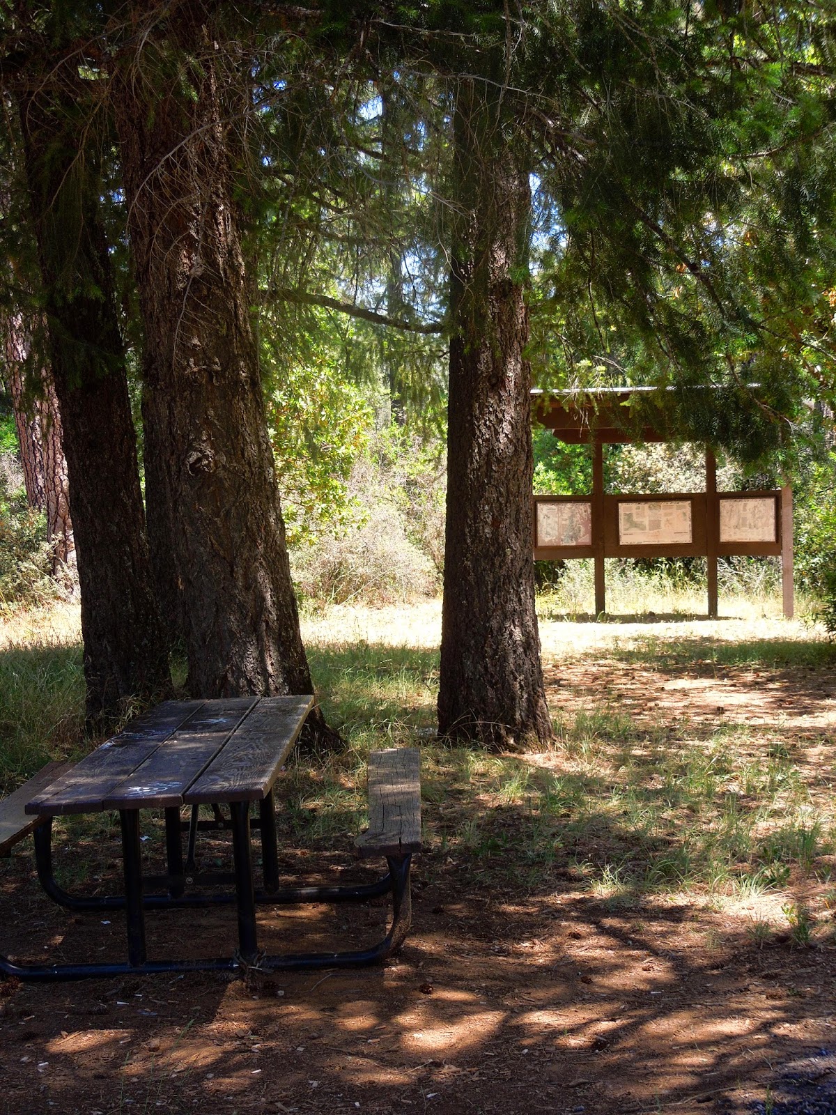
For a picnic, a hike along a creek, and a display of numerous wildflowers, this is the spot for you!

Distance: You can just go a few feet from the trailhead if you prefer.  I hiked about 2 1/2 miles RT.
Difficulty:  Pretty easy.  There are no steep hills or creek crossings other than by bridges. 
Cautions:  Always watch your steps here.  Due to old mining, there may be holes and depressions.  Another caution is to watch out for rattlesnakes.  Make a little noise as you hike so they have a chance to get away. The surface may have some loose rock.  Wear good shoes, preferably providing ankle support.  Hikers may step over or around larger rocks, mossy roots, and mounds of vegetation. Another note is that I got too hot (93 in the shade) and my water got hot.  I used my little purifier and drank the creek water....also warm.  Bring an iced drink in an insulated container on a warm day.  (Snacks are a must, too!)
Driving Directions:  
From Georgetown, CA, drive 4.3 miles south on Highway 193. Turn left onto Meadowbrook Road. In 1.3 miles, Meadowbrook Road ends at Bear Creek Road. Reach the parking lot by doing a short zigzag left, then right, over the small bridge, as you cross Bear Creek Road.  It is posted "Day Use Only" but you won't see the name of the area.  Horse trailers can park there too, and equestrians use it to access a trail heading to the south (Det Mar).
OR
From US-50 in Placerville, turn left onto Spring St.  Turn left onto CA-49 N/Coloma Rd.  In 7.7 miles, turn right on Marshall Road.  In 5.6 miles turn right onto Black Oak Mine Road.  At the end of the road in .5 miles, turn left to stay on Black Oak Mine Road.  In .7 miles, at the end of the road, turn left onto CA 193 W.  In about 300 feet turn right onto Meadowbrook Road.  As above, in 1.3 miles it will meet Bear Creek Road.  Head to your left then quickly look to your right and enter the parking signed "Day Use Only".

In around a total of 2 miles, I found many wildflowers;  here are some for you to preview:


 To view wildflowers, please try not to crush other plants.  You never know if something beneath your feet is endangered.

The creek offers shady rests and a splash.
 As you can see, the creek is lined with ferns, willows, wild roses, blackberries, sedge, and other plants that compose this lush riparian area.  The surrounding hills are chaparral with serpentine (green rocks), grey pines, holly leaf redberries, azaleas, and conifer trees.
Leave the beauties where you find them.  They will wilt before you get very far, and fewer blooms will lead to fewer seeds. The survival of some of these species depends on their limited opportunities to reproduce.  Take photos!

  The valley is 220 acres with hills surrounding it.  The plants growing here have to be tolerant of the serpentine conditions in which many plants cannot survive.

 These plants are endemic or have adapted to the high magnesium, nickle, and chromium levels that would kill most nursery plants.  The soils also tend to be low in other nutrients most plants need, and conversely, these specialized plants cannot grow in soil with high nutrients.  (No use in taking them home!)

 Another feature of these plants is that many have little leafy foliage, and short blooming seasons.  Some plants have adapted by becoming smaller versions of their species with smaller blooms.


The popcorn flowers are an example of adaptation in size.  The ones in my area are taller with larger blooms.


Look closely at this paintbrush (enlarged) and check out the hairs all over it.  That is another adaptation to this environment some plants have developed to help retain moisture.



Established in 1988, the Traverse Creek area has the designation of being a Special Interest Area in an effort to preserve the unique plant communities that grow in the serpentine soil. The historical values are related to the mining that took place here for the emerald-like gemstones known as vesuvenite, and chromite.

For more technical information, check out El Dorado National Forest.

Happy Trails!

For more hikes in this area:

Trails by Locations


Edited 6/17/14, spelling correction


June 09, 2014

Desolation Wilderness Updates Summer 2016

Year around the Wilderness is known for rapidly changing and unpredictable conditions,

so always go prepared for storms, even in the summer months!


Wilderness Permits are available online or from ranger stations, and day use permits are available at some trailheads.  Due to weather and trail conditions, check with the forestry at that link before you go.

Call the Pacific Ranger Station at (530)644-2349


Desolation Wilderness aspen grove along Lyons Creek Trail in the fall of 2012.

Although it is a tradition, please refrain from carving initials into these colorful, soft bark trees.  It weakens their resistance to disease.

Visit Desolation's Volunteer website and join in on topics of discussion, check your trail mileages, trail conditions, use links, and give us your two cents worth! Here is an image of our site, using the menu bar at the top of the page, in this case, the Information tab.
http://www.desowv.org/
Here is the Desolation Volunteers Forums Page view.  You are invited to add notes, too.  My favorite item is the discussion topic "Defining Wilderness".  Some entries are inspiring!
Desolation Wilderness website view

 Thank you for coming and maybe the links can help you find another place to enjoy the outdoors.  

Until next time ~ HAPPY TRAILS!

Related Posts you might be interested in for nearby trails:

Desolation Wilderness
2015-07
10+ miles
Strenuous
2014-08
30 miles
Moderate to Strenuous/Difficult
2014-07
18 miles
Moderate-Difficult
2014-06
12+ miles
Moderate to Strenuous
2013-06
13+ miles
Moderate to Strenuous
2012-09
Umpa Lake & Enchanted Pools
8+ miles
Cross country ~ Moderate
2012-08
Horsetail Falls via Pyramid Creek TH
Aprox.  10 miles to lakes at the top of the falls
"Difficult, and potentially dangerous" miles
2012-07
10 miles
Moderate
2012-07
8 miles
Moderate-Strenuous
2012-06
Lyons Lake via Lyons Creek Trail
10+ miles
Strenuous
2012-08
9.2 miles
Moderate
2012-06
6+ miles
Strenuous
2011-07
Lyons Creek Trail with melting snow
9+ miles
Moderate
2011-02
3.8 miles
Moderate
2010-09 We hiked 12 days.
167 total
Moderate to Strenuous

See the Full Table of Contents.
Added updated links and Table of Contents 06-2016

Updated June 9, 2014

June 08, 2014

El Dorado Trail Ch 3

El Dorado Trail "section 3" stretches between 

Missouri Flat Road 

and Forni Road in Placerville, CA.

You will cross this trestle too!

Equestrians, strollers, wheelchairs, runners, hikers, walkers, and bicyclists all come to enjoy this paved section of the famous El Dorado Trail.  There are benches along the way and exercise equipment is staged every so often.

Distance:  I clocked 5.7 miles.  Allow a couple of hours depending on your pace.
Difficulty:  Easy depending on your mode of travel and how much energy you put into it.  The hills are rolling, the path smooth, and there is enough shade.  The benches help break it up with little rests if you wish.
Driving Directions:  Take the Missouri Flat Road exit at Placerville.  Head south.  When you see the Walmart on your right, stay in the left lane.  As soon as there is a middle lane look for the parking on the left, as shown below:

There are vault toilets near the jail-side parking shown below:


From Missouri Flat Road, turn left onto Forni.  There is limited parking there as you can see.  

Here are some photos I took along the trail:
Wildflowers
Morning walkers along the El Dorado Trail
An exercise stop along the El Dorado Trail
Wildflowers along the El Dorado Trail
A narrow section of the El Dorado Trail
El Dorado Trail trestle
Weber Creek, Placerville, CA
Bring water and a snack.  I did not see any poison oak along this section of the trail.
Happy Trails!

For another section of this trail, see El Dorado Trail
and Trails by Location for more hikes.

June 06, 2014

El Dorado Trail Chapter 2

Bikes, strollers, runners, dogs, equestrians, 

and hikers welcome.

El Dorado Trail 6-2014

This section runs from the quaint "Placerville Station" to the parking 

at Jacquier and Highway 50.  

Placerville Station
Distance: 4.5 miles of wheelchair and stroller accessible trail.
Elevation Change: About 900 feet.
Difficulty:  Easy- to as hard as you make it. This section is all paved and hills are very long, and not too steep.  By taking the trail westward of Jacquier parking you will have to go uphill on the return trip.  You can park at the Placerville Station at Mosquito Rd and Highway 50.
Driving Directions:
To the Placerville Station: Take Highway 50 to Mosquito Rd exit.  You will find the Station east of the freeway, on your left. There is a massive parking there.  The trail heads south into town or cross at Clay Street and head in an easterly direction
El Dorado Trail Parking: Take Exit 49 toward Point View Drive.  Go east and you can park alongside the road in marked parking spots or go a little further and turn in tot he El Dorado Trail parking (most suitable for horse trailers).
Other Notes:  At the Placerville Station I understand there are restrooms, and in the Jacquier Parking there are two vault toilets.


El Dorado Trail parking on Jacquier Rd. in Placerville, CA.
On the down side, along the way, there is heavy road noise at times.


This winding paved trail meanders through the sun and shade with inviting benches stationed every so often for travelers to soak in the wildflowers colors and the enjoy the outdoors.

Clarkia and Tincture Plant
Among  the wildflowers, be beware of poison oak; it lines some areas of the trail.

Gumplant

Himalayan blackberries with pink blooms.


Pink blackberry blossoms, gumplants, and a variety of other plants are blooming on this 90 degree day, in a drought, and cheer the weary into actviity.


Tincture Plant
Other wildflowers in bloom included brodiaea, vetch, groundsel, 
arnica, thistles, Jepson's pea (above), and more!

These In Memory plaques are placed alongside the trail. 

El Dorado Trail taken June of 2014.
Happy Trails!
For more trails near this area, check out Trails by Locations.


August 11, 2013

Silver Lake, Hidden Lake, Granite Lake, & Amy Lake

We backpacked this moderate loop but spent our first night in the Silver Lake Campground.  It cost over $20/night.  The hosts were friendly, warm, and helpful.  There are vault toilets, firewood for sale, and each site had flat tent areas and well positioned fire rings.  There are short trails from the campground over to various lake areas.

One of Silver Lake's islands; have you been anyplace more idyllic?  I imagined meeting Tom Sawyer wading out to the boat.

Pastures a few miles from Silver Lake.  Horses grazed as lazily as the clouds that floated overhead.

 The jagged cliffs overlooking the Silver Lake basin.  As the sun rose and fell the cliffs took on dramatic shadows and depths. 
 
 Silver Lake in the evening.  The area is a mixture of mountain meadows, granite slabs to cross, and pine forests to meander through.  You'll find a variety of geological features.
 
 The brown in the skies was from a recent fire in San Joaquin.
 
 Another beautiful island that you can swim or paddle to near the campground.
 

 Granite Lake is large and a better place camp than other lakes we passed.  The water was less grassy and it is deeper so a swim is possible.
 
This is my least favorite.  It is surrounded by old cattle droppings and moss grows on the water.  More later.

 There are rental horseback riding stables, and a camping area that is set up for visitors with horses.
 
 Silver Lake came into view.
 
 The bugs were thick on the entire Amy Lake.  It is shallow and muddy, unsuitable for swimming.  There are fire rings around the lake, but it really looked unappealing to me since the water might be difficult to purify and filter, too.
 
 Amy Lake, okay, this one view of it is pretty.
 
 Wildflowers were at eye level and in full bloom!
 
 This trail is mostly well maintained and other than distance, if you do our loop, it is fairly easy.  On the flip side, there are numerous trails that break away from Hidden Lake Trail and head to Silver Lake for a swim, and maybe a shorter hike.  There are more fire ring sites to be found, too.
 
 We apparently took a turn that got us off-trail so we crossed the fallen tree (over a stream) to return to the correct trail.
 
 As you can see, there are plenty of hiking options, and Plasse Resort would also be a good starting point.  Note that if you enter Mokelumne Wilderness, you need to have obtained permits ahead of your hike.
 
 This was taken from Plasse parking.  There is a nearby boat ramp for Silver Lake. There are water faucets and picnic tables near the creek and "Shanty Town".  It is a trailer type park and next to it are campsites with small horse enclosures for the equestrian crowd.
 
Silver Lake at sunrise. 
We camped near Treasure Island without a campfire ring, off the trail.  Bears are common so we did hang our supplies in nearby trees.  The campgrounds have nice large metal "bear proof" storages in each site.  For reserving sites, I liked the ones along the creek which have a pleasant sound, and I avoided pond-side sites.  Mosquitoes like those sites!  There are sites for two vehicles parked side by side, for an extra fee.
 
To Plasse
 
East of CA88 is the campground we enjoyed.  We camped on the side closer to 88.  To get to the trailhead we drove along Kit Carson Road to the dirt parking.  (There is a fork in the road, go left.)


Driving Directions:
From Sacramento,
Take Highway 50E towards Lake Tahoe.
Take the Sly Park Exit.
Turn left on NF-5 Northern Emigrant Trail. Drive 24.6 miles.
Turn left on CA88.
Follow the signs to either Plasse Resort or to Silver Lake Campground for a great basecamp.  We chose the campground to the north of the lake, but there is another one across CA88 also.
This takes about 2 hours from Sacramento.

Silver Lake Campground
We drove through the cabin "neighborhood" along the west side of the lake to the road's end where there was ample free parking at the trailhead.  We started our hike by passing the green gate (locked) and following the old road for a short distance where we broke away from the road then walked through the old girls camp.

ASAP I will post our map and GPS tracks for you.

Happy Trails, and if you feel like finding more trails, check out Trails By Locations.