Trails in Northern California

Trails in Northern California

Leave No Trace!

Visit desovw.org for more information about Desolation Wilderness. Visit Recreation.gov or call 1- 877-444-6777 to make park reservations. Visit Campfire Permits to get a permit online. More about Leave No Trace principles.
Showing posts with label Wrights Lake. Show all posts

June 14, 2012

Lyons Creek Trail to Lake Sylvia updated 8-2012

  Check road conditions before you go early (May-June) in the hiking season).

Photo of Lake Sylvia on June 13, 2012

Lyons Creek Trail conditions updated July 2015 in this post: Lyons and Sylvia Lakes in Desolation Wilderness with current photos.

 Lake Sylvia is the reward of this 9.2 mile round trip,

out and back, hike on Lyons Creek Trail. 

The trail starts out wide but becomes single file.  Some sections are nice firm dirt and some areas are loose rock and tree roots.  Most of the climb is fairly steady and slow going in, but once you are close to the lake it is a bit steeper.  (The graph at the bottom of this page will show you what to expect.)  Remember that it means your reward is imminent!

(June) This day was perfect weather and we picnicked and waded in the lake to refresh ourselves from the hike up.  There is less snow already as of June 21, 2012.  With the nice days it is quickly melting!  The weather is a relief, being degrees cooler than a couple thousand feet lower in elevation.  There are nice places to wade and picnic.
     As you hike there are three markers to help you know your way.  The first is a sign where Bloodsucker Trail meets Lyons Creek Trail.  The next is Desolation Wilderness Entry and is a large sign.  The last is a post that points to the left for Lyons Lake and ahead for Sylvia.  If you get that far don't despair!  The trail climbs, but keep in mind that the lake is gorgeous and a welcome reward! You are almost there!

Difficulty:  Moderate, due to 9 mile length and elevation.
Elevation Change: 6719-8080 feet
Location:  El Dorado National Forest (and partway along the hike you enter the Desolation Wilderness which requires a permit you can obtain and fill out at the parking lot). 
  • Take Wrights Lake Road north off of Highway 50 at Kyburz. 
  • Follow the signs to Lyons Creek Trailhead. If you cross Lyons Creek you just passed the good sized parking lot available at the trailhead. No restroom there.
Lyons Creek in June 2012
In some areas the water is a bit gross, just sitting on the trail, a muddy bug breeding ground.
Just this week, June 21, 2012 The water is less of a mess. There are still some fun blankets of snow, though smaller and only the higher elevation ones!  None are blocking the trail.  The creek crossing is deeper than shoes are tall, so bring extra socks at least, and I try to go from rock to rock across.
Generally better conditions than I expected, fairly dry and firm mud to walk on.


This is Lily, having a great time playing in the snow!

This was the only tree fall between entering Desolation Wilderness and the trail junction.  It was easy to go around, so the trail was easy and fun to follow.  You hike on mostly a rock bed that will give your knees and ankles a workout!  The water on this trail does tend to run all along the trail instead of elsewhere, so good hiking shoes are an advantage.  You will need to cross places that are rocky stream beds with water runoff pouring along, but again, I try to use rocks to hop across.  None is very deep like knee high!
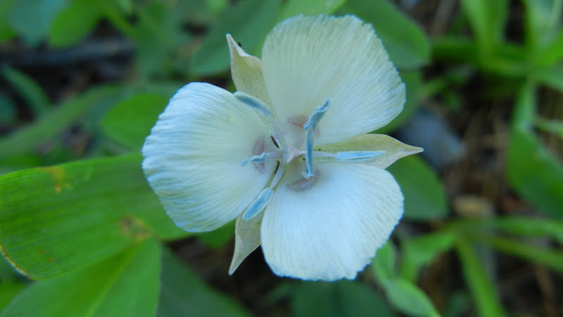
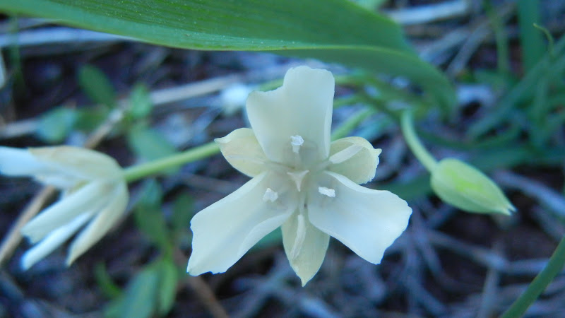
Wildflowers abound on this trail!  


 From  this junction you can hike up to Lyons Lake or go on to Sylvia Lake. There are creek crossings along the way, so again, good shoes help.  The water levels vary.  At least bring extra socks!

We called this a mini-geyser because from a distance it looks like a geyser. 
The current in these nice resting areas is swift so beware but the water isn't anywhere near as cold as we expected and where it was safe, it was cooling and perfect for wading in!
This is what is called a widow maker.  Best not to hang around these because they come by that nickname honestly...falling and killing or injuring people.  

 Trail data:
 I highly recommend you bring water and some snacks or lunch. No fires are permitted in the wilderness, and a fire permit is needed even for your small campstoves.  
Please Leave No Trace 
and enjoy your trip!


Related Posts
Desolation Wilderness
2015-07
10+ miles
Strenuous
2014-08
30 miles
Moderate to Strenuous/Difficult
2014-07
18 miles
Moderate-Difficult
2014-06
12+ miles
Moderate to Strenuous
2013-06
13+ miles
Moderate to Strenuous
2012-09
Umpa Lake & Enchanted Pools
8+ miles
Cross country ~ Moderate
2012-08
Horsetail Falls via Pyramid Creek TH
Aprox.  10 miles to lakes at the top of the falls
"Difficult, and potentially dangerous" miles
2012-07
10 miles
Moderate
2012-07
8 miles
Moderate-Strenuous
2012-06
Lyons Lake via Lyons Creek Trail
10+ miles
Strenuous
2012-08
9.2 miles
Moderate
2012-06
6+ miles
Strenuous
2011-07
Lyons Creek Trail with melting snow
9+ miles
Moderate
2011-02
3.8 miles
Moderate
2010-09 We hiked 12 days.
167 total
Moderate to Strenuous
Happy Trails!  Thanks for dropping by!

Updated links and facts, irrelevant facts deleted. 06-2016


Updated this page July 2015 with a link and removing fee information that has changed.

August 27, 2011

7-2018 updates Grouse, Hemlock & Smith Lakes in Desolation Wilderness


Above is called Chappell Crossing and is located as you approach the trail head. Follow the path to the right before the bridge after filling out your day permit at this trail head and attaching it to your gear. The trail to the Desolation Wilderness lakes starts at the posting board heading into the meadows away from Wrights Lake.


Hike Length: 6+ miles; I inevitably find I have done 7 round trip, out and back trail.
Difficulty and Grade: Strenuous.  (Like doing a stair stepper all day!  Mostly steep and rocky tread, some marshy areas, creek crossing, spaces of regular forest floor.)  You do get a variety of trail tread and shade/sun. Well maintained. Out and back trail.  Steep and boulder scrambling up to Smith Lake. 
Elevation: 6967.4 to 8840.5;  if you bushwhack up to the ridge over Smith, is 2123 feet and with descent totals 4246.
Located: in Desolation Wilderness, so a permit can be filled out at the trail head for day hikes but online or at Pacific Ranger Station for backpacking.  No campfires allowed.  (Day permits are free and are to assist the park with information about park use for funding and grants, knowing how much use areas are getting, and in the rare event someone doesn't make it back, finding information from their permit could be helpful in locating them.)

Directions:  
Take Highway 50  and turn north on Ice House Road.  Follow the signs to Wrights Lake and park at the Twin Lakes Trail head. 
OR  (a better drive if you ask me):

Take the Wrights Lake Road north (between the 36 mile tract and the 39 mile tract) in the vicinity of Kyburz off Highway 50 and follow the signs to Twin Lakes Trail head.  

The trail begins heading through a moist colorful meadow, with a wide fairly flat trail.  Even with strong bug repellent here, you are a target for varieties of black biting flying torpedoes.  Early on you will see a sign at a Y, go to the right.  Later you will come across two more signs to keep you on track.  One is the Desolation Wilderness entry point and the other sign is to Grouse Lake.  At that sign (just an engraved post) keep to the right.
As you can see, the lilies are bright bursts of color amoung the corn lilies and other wildflowers, as tall as eye level, and growing by the acre.  I did not edit the color on this shot!

Grouse Lake Trail ascends very aggressively and is not for the faint of heart!  
It is quite vigorous and requires good footing as well.  
Hiking poles help me climb these sections.
There is a tree fall (in 2018) that you hunch down a bit to get under. 
Take water because you will sweat for this prize!  Please wear reliable shoes and check out these real photos if in doubt that it matters Shoes with Soles.
***I often find people ready to quit with exhaustion and uncertainty at the runoff crossing where the trail veers to your left.  Don't give up here!  You don't have to get your feet wet.  There are stable rocks to step on, and just up around the bend, a very very short jaunt, is the first lake, Grouse Lake.
To get to the granite beside the lake, use the small user path to the right.

Grouse Lake is in a granite bowl and invites swimmers on hot days.  I've seen fishermen who throw back what they catch.  Take your fishing license and check current Desolation regulations.  One side of the lake is rocky with nice boulders to bake on and the other side is marshy and buggy.

As I looked back on my way from Grouse to Hemlock Lakes, this excellent view took me by surprise.  Many more views do the same as you hike higher, believe me!
Here is Hemlock Lake.  It is small but has some 
nice sandy areas and rocks also to 
spread out a picnic.  The grassy side and the shade 
are sometimes offerings for bugs more than humans!  
The trail becomes briefly obscure so GPS can help but  

if you look around you should find the recognized trail using 
other clues without too much trouble. Head toward that peak. *
This was a fun shot of Hemlock because the water is beautifully clear as you can see.  The peak in the background is along toward our next destination, Smith Lake.  
 The trail is nice woodsy track from Hemlock Lake 
until you reach the next big ascent. 

Be prepared to climb. 

This is the trail heading up to Smith Lake.  Most of it is just this way.  I scrambled up the boulders according to my GPS's location of the forest's recognized trail, but found on the way down, there is a mostly clear trail that runs fairly parallel to the runoff from the Smith Lake dam.  It traverses mildly and heads downward more directly, without bushwhacking, and gets you on a more level easy trail pretty quickly.
These were fading and few, but a lovely sight! 
Little gems scattered all around the trails.
This is beyond the icing on the cake. (There is less snow in July 2018, and none was on the trail.) The area this side of the lake has forest and shade, and the footing is easier.  As you can see, across the lake is uninviting for hiking, beautiful even breathtaking!  Snow remains along the granite side but less of it.  It is possible to hike all the way around the lake.
  • I scrambled up the rocks to see over Smith Lake for that previous photo showing the whole basin, but the bonus was the completely unobstructed view of everywhere else!  I enjoy a good boulder scramble and this was dizzying standing on the next highest boulder I could climb for photos.  People also hike to the ridge over Smith and across the saddle over to Lyons Lake and make it a loop with Lyons Creek Trail. Only try it if you are skilled and energetic.  The climb down this way is steep and can be visually intimidating, or even frightening, to some.


    **** I found blog note that explains clearly why it is unwise to follow cairns (rock towers or stacks). From an excellent hiking resource, this account describes just that experience : 
    "...trail led right up to the edge of a creek, and I thought I might need to cross it. But there did seem to be a trail, although not as distinct as the trail leading up to it, heading directly up. I went that way, and encountered a difficult climb with no clear trail, but cairns set out all over the place that made me think I was going the right way." 
    and later, 
    "There are cairns every which way. In 2006, I started climbing too quickly straight up to the west, rather than making a more gradual ascent to the southwest. Following cairns that shouldn't have been left there, I often found myself backing up to find an easier route--which followed other cairns. When I made my return, I added more cairns to the easier route, and knocked away some that had led me to dead ends." 
    taken from NorCal Explorer blog.  
    My daughter and I had that same experience looking for Enchanted Pools and worried a little and wasted time following cairns.  Use of a compass and map would have served us much better.  The cairns died out and we bushwhacked to cross the creek we knew we had to cross to get to our destination.

    Cairns are not set up by the forestry, but hikers who are finding their  way back to stashed gear, or goofing off.  They are not reliable, and may intentionally get a person completely lost.  

    *If you lose sight of the trail:

    • Use clues by looking ahead, from a higher point if possible.  
    • Look for fallen trees cut away from the trail, and rocks and branches that are blocking what looks like a possible trail.  
    • Keep looking in the general direction the trail should go.  
    • The forestry tries to keep the vegetation off of the trail to keep it visible on recognized trails.
    • Use your map to locate peaks or visible landmarks and identify the compass direction you should be headed.  
    • Look for the place you are and how to intercept the trail (like heading to a certain side of a lake).  


    For similar hikes:
    Desolation Wilderness
    2015-07
    10+ miles
    Strenuous
    2014-08
    30 miles
    Moderate to Strenuous/Difficult
    2014-07
    18 miles
    Moderate-Difficult
    2014-06
    12+ miles
    Moderate to Strenuous
    2013-06
    13+ miles
    Moderate to Strenuous
    2012-09
    Umpa Lake and; Enchanted Pools
    8+ miles
    Cross country ~ Moderate
    2012-08
    Horsetail Falls via Pyramid Creek TH
    Aprox.  10 miles to lakes at the top of the falls
    "Difficult, and potentially dangerous" miles
    2012-07
    10 miles
    Moderate
    2012-07
    8 miles
    Moderate-Strenuous
    2012-06
    Lyons Lake via Lyons Creek Trail
    10+ miles
    Strenuous
    2012-08
    9.2 miles
    Moderate
    2012-06
    6+ miles
    Strenuous
    2011-07
    Lyons Creek Trail with melting snow
    9+ miles
    Moderate

    2010-09 We hiked 12 days.
    167 total
    Moderate to Strenuous

    Peachyhiker's Table of Contents

    Happy Trails!
    Updated links 06-2016
    Updated trail conditions, made grammar and spelling corrections, changed a font, added signage details 07-2018