Trails in Northern California

Trails in Northern California

Leave No Trace!

Visit desovw.org for more information about Desolation Wilderness. Visit Recreation.gov or call 1- 877-444-6777 to make park reservations. Visit Campfire Permits to get a permit online. More about Leave No Trace principles.

February 24, 2011

Deer Attacks Child and Poodle!

I have no photos and I bet you're suspicious about the title.  It really happened, to ME, in around 1965 or so!  My profile mentions the amount of time I have spent alone in the woods.  Something bad was bound to happen!  We were on one of our regular trips but had stopped for a break.  I took our poodle named "Jeep", ya, "Jeep".  She was a well trained, adorable grey little poodle.

My pup, and I around 9 years old I think, took off into the woods, just like always.  She was not on a leash, but she never had a problem staying close to me.  We were wandering around and out of nowhere, here came flying hooves at us.  A doe was striking us both, rearing like a wild horse in the movies!  We dodged her and ran while I screamed!

Fortunately and unbelievably, here came a forest ranger, out of nowhere too!  He and my stepfather both grabbed the doe around the neck and drug her away from me and my pooch.  We were both shocked and scared...no, not crying!  But really, the forester said she probably had a fawn nearby and was afraid of us, defending her baby.

The lessons are: deer are not necessarily Bambi, children in the woods are at risk, and a pretty doe does attack people!

Peachy Hiker's Table of Contents

Desolation Wilderness Grouse Lake

This is Grouse Lake in Desolation Wilderness, CA. 
It is a 3.8 mi round trip hike round trip. Rewards can include swim, fishing, photography, wildflower viewing, or just a picnic and rest!

Difficulty: Moderate (due to some steepness and rocky areas, but you can take it slow, too.)
Trail tread: solid dirt, to rocky, to some giant flat boulder slabs to cross, even rocky "stairs" to climb.
Elevation change 1249 feet,  per Garmin BaseCamp.
Map of hike below with link to download GPS tracks for the hike.

Driving Directions:  Take Highway 50 to Wrights (Lake) Road north from the Kyburz area.  The Wrights Lake Road will be between tract 36 and tract 39 along Highway 50.  Follow the signs to Wrights Lake Recreational area.  Follow the signs, passing Lyons Creek Parking, and Bloodsucker Lake parking, following signs to Twin Lakes Trailhead parking. When you get to the Wrights Lake Welcome Cabin and parking lot on your left, turn right.
To the Trailhead:  From the north side of the parking lot you'll see a closed metal gate.  Go around it and follow the pavement a short distance until you see a sign for the Twin Lakes Trail and Grouse-Hemlock Trail that points to your right.  Follow that and there is a big sign at the trailhead where you need to fill out a day permit, no fees, for entering Desolation Wilderness.


It was my first "adopted trail" as a volunteer for Desolation Wilderness.  The area is designated as a special area, and campers are limited.  This shot if from a grassy shore but there is granite next to the lake's west shore that is great for picnics and swimming.


Wildflowers seem to bloom all season, and seeing all  the colors and varieties feels like someone brought me a bouquet for some special occasion!


On the way up, you encounter various types of ground to cover.  Everything from dirt, rocky, some giant boulder slabs to cross, even rocky "stairs" to climb. Oh, I look forward to those evil things, just to drive myself forward for the pleasure of making it to the top.


The hike is vigorous. On the granite sections of trail, there are some large rocks placed to show you the way.


When I get this far, I take awhile to just sit somewhere and absorb the peace.  Watching fish swim and occasionally leap, then following the ripples is, according to studies, an excellent stress reliever.  Healthier than medication!!!  More fun too.  I swim sometimes in the lake which is quite cold...also a great stress reliever!  Honest.  Try it.  Let the fish nibble at your heels. Brave the cold water; just jump or dive in...forget the idea of easing in~ ~ ~


Above is Grouse Lake, in a giant granite bowl.  Though mostly rocky, there is a shady meadow area on the far side of the lake, too, but sometimes plagued by mosquitoes.

To continue to Hemlock Lake, hike along the north side of the lake, and begin another climb, although it's easier than what you just passed.  It will wind through vegetation, and I found wildflowers blooming en masse.  


If you like to scramble, like me, this is a playground!  My inner child just can hardly pass by and is compelled to climb! The rewards are sweat, a great view, and if you want to work on muscles and work off flab, here is your best gym!


And after I accomplish the work I came to do, or if I run out of sunlight, I return looking across these fantastic views!  Few things are so satisfying after a day of hard work!  (You can backpack with a permit obtained online or from the Pacific Ranger Station along Highway 50, and there are a few authorized campsites around the lakes.)


The trail runs beside the creek part of the way, so you can cool off on a hot day with a microfiber towel worth its weight in gold about that time!  There are more lakes ahead. The link for Grouse, Hemlock and Smith Lakes in one hike is in the list below.  That's a 7 mile round trip hike.


At dusk this is the final view.  Serene even with fishermen and hikers and occasional mountain bikers cruising by outside of the Wilderness.  People like to fish with their kids here from the bridge where you can look down and watch the fish. Okay, if you don't want to be mosquito food, take some spray.


Wikiloc GPS Tracks  for this hike and more.

Maybe I will see you there taking a dive, this coming hiking season?  


For more hikes check Peachy's Trails by Location
with mileage and difficulty ratings, and
these Desolation Wilderness Trails:
6.8+
Strenuous
·         Tahoe Rim Trail
165
9.2
Strenuous
10+
Strenuous
7.95
Strenuous
9.2
Strenuous
6+
Strenuous
3.8
Moderate
·         Horsetail Falls & Pyramid Creek
3-11
Easy to Strenuous and Difficult
 10-18+ RT
Moderate- Strenuous
·         Rockbound Trail to Maude Lake
10
Strenuous


Peachy Hiker's Table of Contents
updated 7-2014 
with new map, GPS link, updated 
Table  of Contents

2018 updates Crooked Lakes Trail Survivor Night


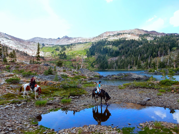
*** My grandson and I just got back from Carr-Feeley Campground as our basecamp for the Crooked Lakes Trail, and what a shock!  Unlike the solitude I am accustomed to in that area, the parking lot was FULL.  There were two large groups of backpackers, fishermen, dayhikers, and outdoors enthusiasts!  Along the lakes and trails were a practical stream of people and some well-behaved dogs.
The campground wasn't being used except for us and a family at the other end.  They were expecting to use the road you see on maps that goes to the Feeley Lake Dam.  They brought kayaks for fishing but had not planned on having to carry them and all of their car camping gear back in. 

Weather Forecast
Distance and difficulty:  Crooked Lakes Trail is about 7 1/2 miles, out and back but our experiences have been more of a freestyle hike so we could visit as many lakes as possible, and our miles hiked varies. Other websites rate it strenuous, but without a big elevation change and no bushwhacking necessary, it seems more of a moderate hike, and that being for distance. Nothing requires you to go too far though and lakes are close enough to adjust it to your own fitness level. Allow at least 6 hours if you use only Crooked Lakes Trail and make your final destination Rock Lake before you turn around.
Elevation:  6,285 ft-6,900 ft.
Driving Directions: 
  • I-80 to Hwy 20 (Nevada City) Exit 161
  • Hwy 20 3.8 mi
  • Right on Bowman Rd 8.4 mi
  • Right on dirt road NF 17 (Called-Lindsey Rd) 2.9 mi or right on earlier dirt road following sign "Carr Feeley TH" for 4 miles.
Advisories: The gate is always locked and used only by personnel, so you pack your gear in to the "backpackers camp". No permits required, but using the backpackers camp near the trailhead has fees you pay there, otherwise there are no fees. There is a bathroom in the backpacker's camp. Parking is pretty large.  There is fishing; your permit must be on hand. Fire permits are also required. On one fall trip we found very large cat footprints not at all far from our camp (in July 2012) so we advise take bear spray and keep food secure. 
SURVIVOR NIGHT:
I had a knee injury and really was not supposed to be doing anything serious on my feet....Mistake 1.

We loaded the truck with food and gear for an over-niter, but planned about a 3 hour hike. Since we had a limit in mind, we opted to leave almost everything we packed in the back of the truck.
Mistake 2.

The day was brisk and at times, overcast.


I had layers with me and we had our bladders full. Ken brought some granola he snacked on. Our cameras were part of our gear for this day hike, too. Views were beckoning; I had cabin fever and there was more to see than would be possible in a week! We chose to drive above Emigrant Gap area (Bowman Lake, and many small lakes) which we had not hiked before, so we were on a discovery hike.
Oh surprise!  It was deer hunting season!  At least I had a bear bell and reflector on my pack. (Are you wondering if this was sane?  We do too.) Mistake 3.
We viewed lake after lake and the trails were mostly easy for even me with the knee injury! Tantalizing!


Our schedule for what we endearingly refer to as our "3 Hour Tour" was being monitored by my dear Data Man, who tried to stop the soul of an explorer set free. In an hour and a half, he tried to turn us around but I had seen a sign for a glacier lake ahead....with a tall rock outcropping to the right.


I think I childishly begged, "Let's just go to the top and see if we can see the lake"....then, "Just around the bend."  No view and no lake. P.S. I had no business climbing the outcropping and paid the price in pain. Mistake  4.

We agreed the sky was getting dark early and we were running late so we turned back toward the truck. So many photo ops there, we "had to stop" periodically and that set us back, too. Mistake 5....when running late...DON'T dawdle!


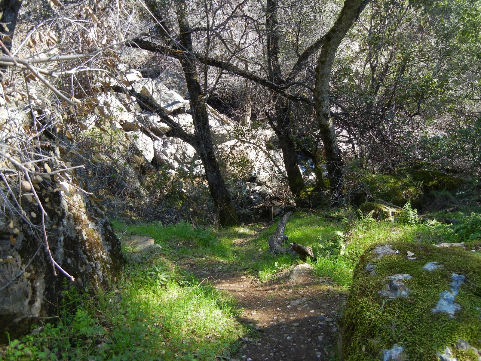
We trekked along while the sun was fading and the storm was brewing.  Much of the trail had been easy to follow, but we had bushwhacked too, and now with little light, and my knee hurting, our hike was becoming more difficult.
Finally we saw snow flurries. We were hungry, tired, anxious, and unprepared for this. No headlamps or flashlights. (Well, they were back at the truck.) Mistake 6.
Finally we agreed we would have to stop for safety because though there was a full moon,  a thick blanket of storm clouds had grown to cover it. I could not see DM's (Data Man's) boots, much less the trail. We thought we may even have lost our way. We looked for a safe place to ride out the stormy night. While trying to make a plan, we discovered we had no means to start a fire easily! Mistake 7.

Building our shelter:
  • We built away from the water and from a large boulder outcropping. 
  • There were no "widow makers" near our chosen site. 
  • Another concern was for no animal trail to the lake to come close to our shelter. 
  • We sought a place we would not encounter water runoff, should that become a storm issue for us. 
  • DM had a knife and he hacked out a shelter in a willow bush in our carefully chosen space.
  • I dug up arm loads of pine needles which DM used to arrange a nice thick layer in the shelter to keep us off the ground for warmth and dryness. 
  • He used his backpack for a pillow and occasionally brought it out to shelter his freezing back. The temperatures dropped into the very low 30's. DM was wearing shorts, so I shared some of the layers I packed since (thank goodness) I am easily chilled and packed accordingly. 
  • I had also carried a space blanket which we put over us and then piled pine boughs over that in an effort to insulate ourselves more. 
Jokes among friends later flew though the truth was that we weren't a couple, but we were fantastic hiking companions.  Frankly, our night was miserable.  We were both in pain.  To move or rearrange, we had to remove the boughs, rearrange, replace the boughs and try to be still again to avoid tearing the space blanket really sized for one person.  We shivered and suffered.  Spending the night in a willow shelter, perhaps lost, facing the possibility of sleeping in a snow storm without any gear, huddled together for warmth, and were uncomfortable, despite our experiences of sharing a tent on many occasions backpacking and camping. There is nothing like building trust that way!!! Laughable, but workable!
Imagine waking up covered in rotting pine needles and bugs...mm mm.  No toothpaste or gum.  No deodorant!  Hungry, weak, sick, and in pain. Ha Ha.  You must laugh like crazy to endure the humiliation of a short hike gone bad!  I still laugh!

We were not carrying a map or compass. Mistake 8. For such a short hike, we just figured that was unnecessary.


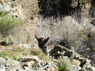
Yes, we HAD to climb back down this to get back, and I was weak and in pain, dreading falling to another injury!  It turned out to be a safe descent, but less than fun.

My water bladder was essentially empty in an area known for giardia. No water purifier of any kind.  Mistake 10.

TO SUMMARIZE:
I am proud to say we were both level headed about our self-inflicted miserable challenge, and neither of us got emotional or irrational. We comforted ourselves and each other. In the morning, we hiked uphill on loose rock to a high point to orient ourselves...very hard on my knee. We found a large lake we had never seen before and we were more oriented directionally, but still unsure of the easiest way to the truck. Down the loose rock we scrambled, past our overnight camp, and hiked onward. We had missed a turn in the nighttime hiking, and at that place had only been a bushwhacking mile or so from the truck, food, safety, warmth!
I will humble myself and add we had no first aid kit either Mistake 11, which could have been an extreme issue, but fortunately wasn't.

A MUST DO list!
ü  Follow your doctor's orders!
ü Carry items for "in the event of emergencies". You never know! Ken had a knife and I had a survival blanket for two which came in quite handy! My extra layers helped keep us both less cold. 
üBe prepared for sudden weather changes.  They are common in mountainous areas.
ü Watch for hunting seasons! 
ü Stick to your plan! Watch the clock.
ü If you get held up somehow, make up for the lost time by moving on and avoiding unnecessary pauses.
ü Carry batteries, flashlights and preferably headlamps.
ü Waterproof fire starters are always necessary for safety.
ü Carry medication you take regularly just in case.
ü Carry a means to purify water.
ü First aid kits should never be left behind.
ü Tell someone where you are going and when you expect to be back. Not mentioned above, but we had not decided we were going to a specific area and who knows when someone would have noticed we were missing.

The end of the story was that we got to the truck exhausted, miserable and hungry. The drive home was quiet, not from hard feelings; we were just pain ridden, hungry, and sleep deprived! We drove all the way home instead of stopping to eat! We found it a challenge, a huge learning and humbling experience. It did validate our confidence in survival skills, but not without a price.

My comfort in the woods has come from a lifetime of being in the woods alone, but eventually resulted in laziness and over-confidence! Nature is bigger than me and I vow to love and respect it forever!

Peachy Hiker's Table of Contents

July 2018 update: added weather forecast link, modified "To Do" list for clarity, 
notes inserted about wildlife, food storage, related permits and fees. 

February 10, 2011

Dutch Creek, Coloma, Waterfalls September 2012

For Johntown and Dutch Creek Waterfalls GPS, maps, and more thorough information, click here.

Upper Dutch Falls on Sept 30, 2012.

The affectionately named "Ancient Lady" southwest of the Upper Dutch Falls 9-2012.


The top of Johntown Falls 9-2012

Take water with you as there is none very appealing to try to purify!

Dutch Creek Trail needs serious maintenance work to become safe, and beware of the poison oak.  It is everywhere.  It is no less toxic to the allergic. 

In spring, here is what you may have to look forward to if we can get some volunteers to work on the trail:
The photo below is Johntown Falls at Coloma, CA. photographed by this blogger who lead this hiking day with a Meetup.com. hiking club.  The falls were glorious and the hikers equally enjoyable! Weather was warm and mild, the water flow was gorgeous, and the company exquisite!


The next one is a shot of the trail as it enters the woods. Looks pretty docile, huh?


A walk in the park, so to speak.


This is one of our feisty hikers...none too intimidated as the trail
becomes more rugged and less park-like.


These are more of our fantastic group with high spirits for the day, waiting to see what is in store.


     Some took this side trail down to see the Lower Dutch Creek Falls that sometimes forms two separate falls, side by side, that are dropping around, guessing here, 10 feet. At about this time, one of our hikers got hurt, and that makes this a good time to advise good hiking shoes, and for hikers to beware of the short steeper sections of this trail. It is not maintained in any way, and you'll find yourself having to go over or around obstacles like rock outcroppings or tree falls. I might as well mention there is poison oak around here too. At some times of the year it is leafless, so be careful what you grab. Stay on "the trail" and I don't recommend shorts or short sleeves if you are allergic.


When we reached Dutch Creek Falls and Johntown Creek Falls some members took a nice break, while the group I affectionately call the "Bushwhacking Maniacs" climbed higher and closer to the falls and then on up to overlook both falls from as high as we could get.


The trail to the falls is narrow, occasionally steep, but good solid tread, and do-able.  For people thrown off by viewing a steep hillside from a narrow path, this might just be too scary.


These are Bushwhackers getting closer to the falls.


Following a few minutes photographing and enjoying the falls' spray, we headed UP through loose rock, through dry weeds and stickers, over boulders, to the top!

Look, no hands!  Another hint.  Watch and listen for rattlesnakes.


This is the top of Johntown Creek Falls; the first photograph on this entry is the same falls.


From the top, we had excellent views of the entire Dutch Creek Falls.
It was worth every sticker I brought home!


Here is the view downstream of both falls. Can you find all the poison oak
Again, take precautions because it IS there!


Here are your blog writer and photographer with a fellow bushwhacker who wore, note, motorcycle pants on this adventure!
Some photos included were courtesy of our hiking club members.
This was a most excellent day!

Directions:

  • Go to Coloma on CA 49 between I-80 and Highway 50; pay for parking at the parking lot kiosk.  
  • Walk over the one lane bridge. (You can't miss it as the town is VERY small.) 
  • Turn right on Bayne and follow the paved road to the locked green gate on the left across from the house downhill by the river. It is also identifiable by small signs like rattlesnake warnings, says "State Park", and is a regular locked forestry green gate you climb over or through.
  • The trail is single file, but usually visible. It is not suitable for beginners or less fit hikers.
It leads through the grassy meadow, into the trees, and then has some steep ups and downs, but they are short. There is some brush, a couple of tree falls you have to climb over, under, or around.  The trail is hard wet soil mostly.  Hiking pole(s) are handy balancing tools. If I can give any advice, it is wear GOOD hiking shoes. Follow the trail to the falls! Have an adventurous and happy day!
Latitude: 38-47'57'' N

Longitude: 120-52'54'' W
Thank you for checking in! There is another review of this hike on this blog dated April of 2010, and has some other information, and beautiful photos showing the differences you can come across.

Peachy Hiker's Table of Contents

updated 10-2012 with photos and cautions!
Updated with spelling correction, and poison oak information. 

February 09, 2011

Codfish Creek Falls, Weimar area


* If you click on a photo, each of them can be viewed enlarged for detail.

A 60 foot? waterfall-reports vary.
Difficulty:  Easy
Distance:  3.8 miles round trip
Driving Directions:  Take I 80 to the Weimar exit. Turn right on Canyon Way, which becomes Ponderosa Way. Drive south for 5.8 miles (2 1/2 or so of dirt road) to the American River. The trail heads downstream on the north side of the river.  There are vault toilets at the trailhead now.  There is a $10 charge for parking now. You park by the bridge at the side of the road and follow the trail downstream.


Yes, the trail is narrow at times, basically single file; it is green and pleasant.  Again, check for poison oak and ticks.


The falls were quite a surprise! No clue going in they would be so dramatic so late in the waterfall season! Crossing the creek and climbing beside the falls was invigorating!!!
We happened on a great water flow time and expected a much smaller waterfall.


This is the view from the bottom of the falls downstream, very cool and pretty.


There I go bushwhacking again! I like a person in a photo to show the magnitude of a waterfall. This is a gem, and not a difficult hike.  Beware.  I am not suggesting you should climb the waterfall.  It is riddled with slippery rocks and thick berry vines full of thorns! Use caution, good gear, good judgment and technical hiking abilities.  Climb at your own risk!


Tiny little me and bushwhacking delights!

Lat/Long:38.99712, -120.95527 I give this falls a great rating, even though from Sacramento area it is a bit of a drive for such a short hike. Arrive early and take a picnic to spend the day. There are slabs of rock beside the falls in the shade where you can rest and enjoy the view. A nice cool spray floats over you and on a hot day, a little shower is pleasant! You can also climb up the hill before the falls to the top where there is a boulder two people can comfortably sit on and look down on the falls, yet not be seen from the bottom! Very Cool!

Other options include fishing the river and swimming near the bridge.

Peachy Hiker's Table of Contents

updated 7-2012