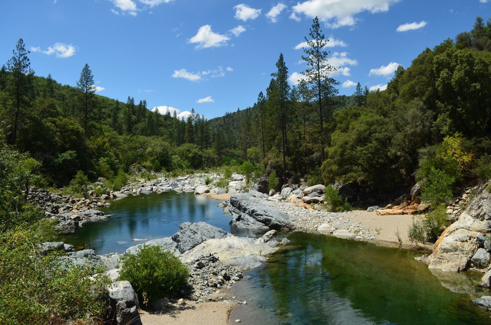
Trails in Northern California

Trails in Northern California

Leave No Trace!

Visit desovw.org for more information about Desolation Wilderness. Visit Recreation.gov or call 1- 877-444-6777 to make park reservations. Visit Campfire Permits to get a permit online. More about Leave No Trace principles.

July 12, 2013

Historic Independence Trail, CA ~ Wheelchair Accessible

Take a hike! Independence Trail near Nevada City is a dirt wheelchair and stroller accessible trail. Then, a waterfall!


DIRECTIONS:  Take Highway 49 north of Nevada City, CA to the parking shown below.  (Estimates are 5-8 miles out of Nevada City.)  South Yuba River State Park manages this area and provides a map online.  From Sacramento allow about 1 1/2 hours each way.
Difficulty:  Easy to moderate based on whether you stay on the main trail or head down to the swimming holes.
The trail is well marked so no GPS tracks are necessary, although sites do have several peoples' tracks loaded.

There are handicapped parking spots marked.

At the trail head, there are wheelchair accessible vault toilets.  Turn to the right for this hike to the waterfalls and swimming holes described in this post.  It will lead you under the highway through a tunnel that is too short to stand upright in. 

I chose to go down this Jones Bar spur on the right to see the creek, river, and swimming holes I have read about.  It is not stroller or wheelchair friendly, but is a great short, although steep hike if you came to picnic and swim.

You might endure a brief hot, sunny, section but most of it is shady on your way down, less than one mile, to the water.

This was my first, disheartening, sight of the water.  Nearly dry this year.

The previous photo was taken from this bridge.  I suggest you cross it (although there is a wide looking trail before the bridge, it is harder to get to the swimming holes from it) then take the trail on your right that is scarcely wider than a deer path.  Trust me.

It forks so take the left option and you will find this entrance to two very large and deep, perfect, adjacent swimming holes.  Do be prepared to avoid poison oak!  All of the warnings expected such as: don't dive from rocks, kids need life vests, no glass containers, and so on apply.

There are some sandy areas and lots of giant rocks to sun on.


 If you either skip the spur mentioned or return to the main trail, you are treated to excellent resting places, all accessible.  In days gone by, restrooms were stationed along the trail with wheelchair accessibility, but they are no longer maintained and are boarded up.

Continue along the trail and flumes.  The trail is mostly divided for strollers and wheelchairs on a lower level along the old flume, and the upper more narrow strip is for hikers.  There are rustic benches along the way too, some with distant views and others are places to take time to breathe in the forest and soak in the peace.

Visitors are soon rewarded with this open view of the flume in a horseshoe shape curving around
the canyon wall. The creek is gurgling pleasantly far below. Some people get squeamish here,
so maybe avoid looking down.  It is all in good repair at this time and you can't fall unless you
climb the rails and topple over. To your left will be a wooden flume traversing the canyon wall down
 to the waterfall and creek.

Small benches to rest on and absorb the views and nature are stationed here and there.  At
the bottom you can refresh with a splash or two from the creek.  And by the way, I met hikers
with dogs, all leashed and picked up after.  It was a pleasant outing for all.

I met Georgie there, a well behaved rescue who you can read about here.

This is part of the Rush Creek Falls that normally drops in a series of cascades,
the longest being a double tier falling 50 feet under the flume bridge overhead.

After a snack, splashes, and rest, I resumed hiking the trail around the bend. 
Often the trees are too tall and thick for views but I took in this gratifying view...

and nearly stepped on....

this wildlife surprise!
I decided to turn back at this point because the trail was less maintained. 

But this lone bright lily stood out!

A small reward for having continued!

This is an out and back trail I highly recommend.

In addition, check out the
Independence Trail Herb Walks
PRE-REGISTRATION REQUIRED: $20 prepaid or $35/both walks, prepaid. $25 at walk if space, but walks limited to 16 people so usually fill. Must pre-register via email, mail or phone; mail payment to secure place. Confirmation and directions 4 days in advance (payment refundable till then). Kids free, but number limited; teens half price. Rain cancels. checks/MO to Kathi Keville at: Oak Valley Herb Farm, PO Box 2482, Nevada City, CA 95959 530-274-3140 www.ahaherb.com HERB WALKS ...a botanical adventure with herbalist and author Kathi Keville.  Her 40+ years of herbal knowledge shines through energetic discussions about their science, lore and edible, medicinal, and other uses, and how to identify, prepare and use them. (You'll receive a plant list.) Trails are short and easy with 40 herbs, and we move slowly! Kathi has been giving walks on these trails for 25 years and they are her favorites! These walks are offered only once a year at peak bloom. Picnic areas if you want to bring lunch for afterwards. Taken from Meetup.com 2014

For more hikes, visit Trails by Locations

HAPPY TRAILS!

Edit: added aprox. driving time from Sacramento 7/6/2015

July 11, 2013

Cedar Park Trail, near Sly Park, CA

Wheelchair and stroller accessible trail through the woods with a nice observation deck overlooking the Cosumnes River Canyon. 

At only one half to one mile, it is a perfect woodsy getaway for youngsters.


The trail forms a paved figure 8 set of loops with rest benches situated randomly along the way.  It is located in El Dorado National Forest, on the south side of Sly Park Road, Pollock Pines, CA.  We found a nice observation deck that overlooks the Cosumnes River Canyon.  Carry water and maybe mosquito spray.  There aren't any water sources along the way.  It is accessible year around but gets snow.  Dogs are welcome on a leash.  (For a restroom, I stopped at Lake Jenkinson campground, and parked before the gate. Located near the entrance gate you'll find bathrooms.)
The paved route is easy, has an elevation range of 3640-3700 feet. Ample parking is provided.


At Cedar park, there are two more trails, unpaved, not well marked, that head out beyond the ranger's cabin.  It turned into bushwhacking for us, which was fun, but also had some steepness and makes a great "Let's go get lost" sort of hike.  There wasn't much of an understory which made off trail hiking easier, and we had a small runoff creek crossing.  Down below all of this is a creek/river where there may be good fishing. 
 
DRIVING DIRECTIONS: 5561 Sly Park Road:
We drove from the Shingle Springs on Pleasant Valley Road to Sly Park Road, to the parking on our right, across the street from the Sly Park Education Center.  I call it the scenic route, but it is curvy and slower driving. The park is well marked with a standard forestry sign.
The other option is to take the Sly Park exit off of Highway 50 and follow signs toward Sly Park, Jenkinson Lake.  Pass the park entrance and at Mormon Emigrant road stay to the right to follow Sly Park Road less than two miles to the parking on your left for Cedar Park.

For more trails, visit Trails by Locations

or search By Titles

Happy Trails!


July 07, 2013

Muir Woods, CA

Trails that wind through the gorgeous old stand of protected redwoods are accessible for wheelchairs and strollers. 

(Use is not for bicycles)
 This is a fantastic day trip, or you can stay in bay area motels
and take in more coastal hikes and parks.
 Photos are allowed but photos or footage for business purposes require a permit.  There are interpretive signs and maps posted with mileage to help visitors choose their trails.

I enjoyed the visit through the Cathedral Woods, where you are asked to pass quietly and take in the sights, sounds and fragrances of this rare place, perhaps use it as a time to reflect and accept rejuvenation.  Wildlife does live there and with so much human activity, this is a chance to observe it with as little human noise and impact as possible.

This trail heads through the woods alongside this pleasant creek.  Due to this area's protected status, get something to keep from the gift shop.  It isn't legal to take anything from the woods here.  So many people come to experience old growth woods that leaving everything but footprints will keep the forest pristine for future visitors and you, too.
 

 There are miles of accessible trails from .5 to 2 miles in length for strollers and wheelchairs.  For hikers there are many more options of more difficult, longer trails.
 
 There is a gift shop with a small concessionaire for lunches, snacks and drinks.  Outdoor seating includes benches and decking.
 
 Gorgeous views of the bay.


 I will add some more photos this week.  I am just anxious to share a possible jaunt for you during the summer months.  The climate is coastal, moderate compared to the valleys, also moister, saltier air.
 
Driving: Many GPS devices will take you to places other than the parking or entry to Muir Woods National Monument, use coordinates:
Latitude: 37 degrees 53.519 minutes (North)
Longitude: 122 degrees 34.253 minutes (West).

June 25, 2013

Lawrence Lake in Desolation Wilderness

Lawrence Lake is secluded, offers level campsites,

and is a perfect basecamp to explore surrounding

lakes and waterfalls.

Lawrence Lake, June 2013
Directions:  
Take Highway 50 E and turn north on Ice House Road.  Follow the signs to Wrights Lake and park at the Rockbound Trailhead. 
OR  (a better drive if you ask me):

Take the Wrights Lake Road north (between the 36 mile tract and the 39 mile tract) in the vicinity of Kyburz off Highway 50 and follow the signs.

Difficulty and Distance: I rate this as strenuous due to the length (no less than 13 miles round trip) and the rocky road and creek crossings.  Overall though, it is a fun, pleasant hike and is Easy to Moderate as a backpack trip.
Park at the Rockbound Trailhead parking.  There is a restroom near the trailhead signs.
Jeep trail
Begin your hike on the jeep road rather than the actual Rockbound Trail.  It has a green gate across it, and is labeled. The road/trail was not being used by jeeps at this time this was written and the condition varies from good dirt road as shown, to 4-wheeling eroded and rocky road.

Our first creek crossing.  
That is our cohort, Marcia.
At this time the creeks are all low but you can imagine that hiking here earlier in the season or in a heavier snowfall year,  might be more challenging.
Columbine blooming among corn lilies.
A variety of wildflowers are in bloom all along the way.

Wide open views
After winding through the woods, the trail opens out to large granite areas with gorgeous views.
Mariposa Lilies


Large meadow / "skeeters kitchen."
The trail takes you through a couple of these large mountain meadows that are alive with biting, buzzing, carnivorous, bugs and mosquitoes.

More creeks to cross.  (That is actually Chris!)


The creeks have rocks you can mostly use for dry crossings but hiking poles
sure help balance on themAll the rocks are not stable so check before you step!
Out of place restroom!
Near Barrett Lake this surprising bathroom sits to the side of the trail!

Barrett Lake
At Barrett there are open, large campsites with fire pits,
(no fires are allowed
 at this time).  The campsites offer little privacy.

Lawrence Lake
Keep hiking along the now single file trail that heads north to Lawrence Lake.

Super Moon June 2013

This was the super moon rising over the lake at 10:30 pm. 

Sunrise on Lawrence Lake
We camped along the north side of the lake but we discovered several good places to camp. 

The elevation graph shows you the highs and lows.  It really isn't a hard hike.  There are plenty of places to rest and if you have more energy it can be used exploring.  Along with the other lakes, there are waterfalls worth exploring.

This shows the route we hiked on this trip.  GPS is loaded here: Lawrence Lake .
Hike data.

Lawrence Lake makes a great basecamp to explore the surrounding lakes shown above.

For more hikes check Peachy's Trails by Location
with mileage and difficulty ratings, and
these Desolation Wilderness Trails:
Related Posts you might be interested in for nearby trails:

Desolation Wilderness
2015-07
10+ miles
Strenuous
2014-08
30 miles
Moderate to Strenuous/Difficult
2014-07
18 miles
Moderate-Difficult
2014-06
12+ miles
Moderate to Strenuous
2013-06
13+ miles
Moderate to Strenuous
2012-09
Umpa Lake & Enchanted Pools
8+ miles
Cross country ~ Moderate
2012-08
Horsetail Falls via Pyramid Creek TH
Aprox.  10 miles to lakes at the top of the falls
"Difficult, and potentially dangerous" miles
2012-07
10 miles
Moderate
2012-07
8 miles
Moderate-Strenuous
2012-06
Lyons Lake via Lyons Creek Trail
10+ miles
Strenuous
2012-08
9.2 miles
Moderate
2012-06
6+ miles
Strenuous
2011-07
Lyons Creek Trail with melting snow
9+ miles
Moderate
2011-02
3.8 miles
Moderate
2010-09 We hiked 12 days.
167 total
Moderate to Strenuous

See the Full Table of Contents.
Added updated links and Table of Contents 06-2016
 Link for permits and other related information
Marcia introduced us to these individual packs of olives.  I am addicted!  Give them a try for the best backpacking snack food! 
HAPPY TRAILS!

And thanks to Chris F. for planning this trip!  She is searching
out the Hidden and Lost Lakes this year!  I was fortunate to join this unbelievable group of women backpacking! 
P.S. One more thing is that three of us carried bear canisters for our food and all complained about how heavy they are.  Lawrence Lake has plenty of trees to bear bag your food and personal items.  For more information about a good bear bagging system, check out Stick's Blog .

June 17, 2013

Stevens Trail in Colfax, CA

The 7.5-9 mile round trip on historic Stevens Trail is conveniently located near Colfax off I-80.  It is well maintained, offers excellent canyon views, and is lavishly adorned with wildflowers in the spring! 


Parking is provided, and there is a bathroom at the trailhead.

As noted,  it is a 9 mile round trip, so well suited for a whole day hike.  You will hike down about 1200 feet and back up on your return.

After weaving through the shady woods, the trail opens out onto this old roadway.


You will soon find more wide woody sections.


Some sections are lush and lined with shrubby, riparian, wildflower dotted and narrow trail.  It is easy to follow though. 

As things get more of the western exposure, they dry up considerably, making it best to start your hike before the heat has set in.

This wonderful stream crosses the trail.  No wet feet necessary; rocks are there to step across.  Carry water in since this is not acceptable drinking water.

 There is poison oak and there are also cougar warnings.  Best hiked in groups making some noise to avoid surprising wildlife.  Keep kids close to adults.

At last, views of the length of the canyon open up.


Along this section, some turn back for fear of heights!  The trail is almost flat
but spooky views aren't for the faint of heart!


Far below is the river, your destination. 
The openness of the views can bring on vertigo!  (Chuckle)


Stevens Trail wildflowers are colorful distractions!


I started out a bit late in the day, and it gets HOT along the canyon walls.


On your return, it is a pleasure to re-enter the riparian, moist cool woods.

I found some great information for my hike at MVTA.

  • From I80, take the Canyon Way exit at Colfax and follow the frontage road east (to your left), alongside the freeway.  It will take you to the parking.
  • Do not park on the roadway please.  Use the provided parking for the trail.  The restroom is in the parking lot.
  • Again, take water and snacks.  Try to arrive early for parking and a cool hike.  Leave your plans with someone at home and allow enough time to hike out before sunset.


For a fabulous set of GPS tracks you can send to your iPhone, and a detailed description of the trail, go to Everytrail.
For more trail reviews by Peachy Hiker:   Trails by Location
HAPPY TRAILS!


June 06, 2013

Indian Grinding Rock State Historic Park

The park has seasonal camping and picnic areas on only a first come first serve basis, and along with trails for hikers, a museum for history buffs.  As a regional Indian museum, the collection at Chaw'se includes Northern, Central and Southern Miwok, Maidu, Konkow, Monache, Nisenan, Tubatulabal, Washo, and Foothill Yokuts. Examples of tools, basketry, featherwork, arrowheads and more.  It is located at 14881 Pine Grove-Volcano Road, Pine Grove, CA.