Trails in Northern California

Trails in Northern California

Leave No Trace!

Visit desovw.org for more information about Desolation Wilderness. Visit Recreation.gov or call 1- 877-444-6777 to make park reservations. Visit Campfire Permits to get a permit online. More about Leave No Trace principles.
Showing posts with label waterfall. Show all posts

July 12, 2013

Historic Independence Trail, CA ~ Wheelchair Accessible

Take a hike! Independence Trail near Nevada City is a dirt wheelchair and stroller accessible trail. Then, a waterfall!


DIRECTIONS:  Take Highway 49 north of Nevada City, CA to the parking shown below.  (Estimates are 5-8 miles out of Nevada City.)  South Yuba River State Park manages this area and provides a map online.  From Sacramento allow about 1 1/2 hours each way.
Difficulty:  Easy to moderate based on whether you stay on the main trail or head down to the swimming holes.
The trail is well marked so no GPS tracks are necessary, although sites do have several peoples' tracks loaded.

There are handicapped parking spots marked.

At the trail head, there are wheelchair accessible vault toilets.  Turn to the right for this hike to the waterfalls and swimming holes described in this post.  It will lead you under the highway through a tunnel that is too short to stand upright in. 

I chose to go down this Jones Bar spur on the right to see the creek, river, and swimming holes I have read about.  It is not stroller or wheelchair friendly, but is a great short, although steep hike if you came to picnic and swim.

You might endure a brief hot, sunny, section but most of it is shady on your way down, less than one mile, to the water.

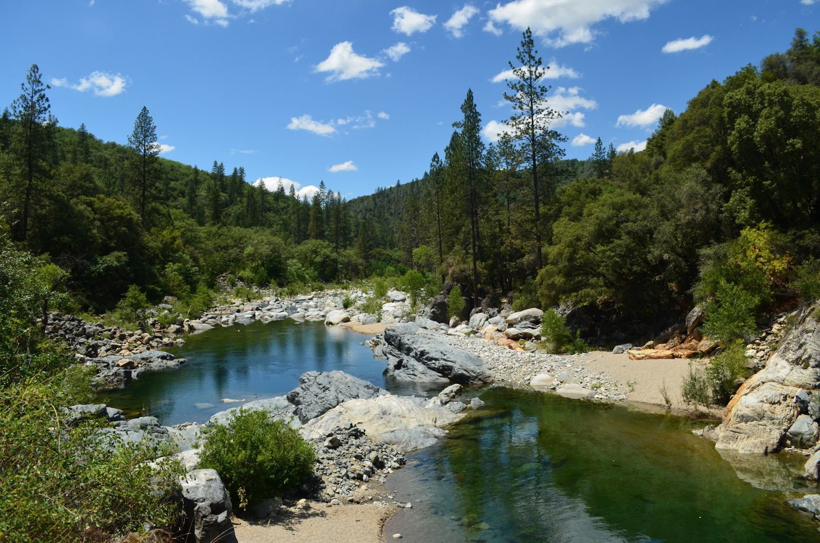
This was my first, disheartening, sight of the water.  Nearly dry this year.

The previous photo was taken from this bridge.  I suggest you cross it (although there is a wide looking trail before the bridge, it is harder to get to the swimming holes from it) then take the trail on your right that is scarcely wider than a deer path.  Trust me.

It forks so take the left option and you will find this entrance to two very large and deep, perfect, adjacent swimming holes.  Do be prepared to avoid poison oak!  All of the warnings expected such as: don't dive from rocks, kids need life vests, no glass containers, and so on apply.

There are some sandy areas and lots of giant rocks to sun on.


 If you either skip the spur mentioned or return to the main trail, you are treated to excellent resting places, all accessible.  In days gone by, restrooms were stationed along the trail with wheelchair accessibility, but they are no longer maintained and are boarded up.

Continue along the trail and flumes.  The trail is mostly divided for strollers and wheelchairs on a lower level along the old flume, and the upper more narrow strip is for hikers.  There are rustic benches along the way too, some with distant views and others are places to take time to breathe in the forest and soak in the peace.

Visitors are soon rewarded with this open view of the flume in a horseshoe shape curving around
the canyon wall. The creek is gurgling pleasantly far below. Some people get squeamish here,
so maybe avoid looking down.  It is all in good repair at this time and you can't fall unless you
climb the rails and topple over. To your left will be a wooden flume traversing the canyon wall down
 to the waterfall and creek.

Small benches to rest on and absorb the views and nature are stationed here and there.  At
the bottom you can refresh with a splash or two from the creek.  And by the way, I met hikers
with dogs, all leashed and picked up after.  It was a pleasant outing for all.

I met Georgie there, a well behaved rescue who you can read about here.

This is part of the Rush Creek Falls that normally drops in a series of cascades,
the longest being a double tier falling 50 feet under the flume bridge overhead.

After a snack, splashes, and rest, I resumed hiking the trail around the bend. 
Often the trees are too tall and thick for views but I took in this gratifying view...

and nearly stepped on....

this wildlife surprise!
I decided to turn back at this point because the trail was less maintained. 

But this lone bright lily stood out!

A small reward for having continued!

This is an out and back trail I highly recommend.

In addition, check out the
Independence Trail Herb Walks
PRE-REGISTRATION REQUIRED: $20 prepaid or $35/both walks, prepaid. $25 at walk if space, but walks limited to 16 people so usually fill. Must pre-register via email, mail or phone; mail payment to secure place. Confirmation and directions 4 days in advance (payment refundable till then). Kids free, but number limited; teens half price. Rain cancels. checks/MO to Kathi Keville at: Oak Valley Herb Farm, PO Box 2482, Nevada City, CA 95959 530-274-3140 www.ahaherb.com HERB WALKS ...a botanical adventure with herbalist and author Kathi Keville.  Her 40+ years of herbal knowledge shines through energetic discussions about their science, lore and edible, medicinal, and other uses, and how to identify, prepare and use them. (You'll receive a plant list.) Trails are short and easy with 40 herbs, and we move slowly! Kathi has been giving walks on these trails for 25 years and they are her favorites! These walks are offered only once a year at peak bloom. Picnic areas if you want to bring lunch for afterwards. Taken from Meetup.com 2014

For more hikes, visit Trails by Locations

HAPPY TRAILS!

Edit: added aprox. driving time from Sacramento 7/6/2015

July 23, 2012

Hidden Falls in Placer County, CA


*  If you click on a photo, it will enlarge each of them and let you scroll through.  At the end of the article I will post the Wikiloc link for GPS tracks, include a map, and an elevation profile.

Hidden Falls is a waterfall hike made for families!


Difficulty:  Easy-Difficult based on choices.  There is an accessible area paved, some moderate rated trail sections, and difficult sections for those who want challenges.  The link at the bottom of the page has a map of the whole trail system with numerous options.  My GPS only includes the route I took which is moderate-easy.
Distance:  The route posted is 5.7 miles. 
Elevation:  Ascent 1208  Descent 855  This trail is loop style.
Driving Directions:
  • From Highway 80 take the CA-49 exit #119B toward Grass Valley. 
  • Turn left on Atwood.  (If you reach Cottage Drive you've gone .1 miles too far.) 
  • In 1.8 miles make a slight right onto Mount Vernon Road.
  • Go to the left in .6 miles to stay on Mt. Vernon Rd. 
  • In another mile turn left to stay on Mt Vernon Rd. 
  • Turn right on Mears Dr.( but if you reach Hastings Lane you've gone .4 miles too far). 
  • Take the first right onto Mears Place. 
  • You'll see a very large parking area and there are restrooms at the TH.
Notes:  This is a beautiful hike with places for families to stop and play in the water, and finally at the falls there is a large overlook deck to safely take in the view of the waterfall.  Just beyond the overlook deck is a trail down to the creek to an open area to play in and picnic at.  
* This area is for hikers, runners, bicyclists, and equestrians although horses and bikes are limited from some areas.


Wildflowers abound in spring but can be found almost any time.

 This shot typifies the trail you'll be hiking. Fun for kids too!


I like going down to the creek for a snack and splash, especially on a hot day.

WILDFLOWERS!  


 Cross this bridge to follow the trail to go to the falls. 
(There is a trail going straight ahead but this bridge is to your right.)


When you see this fenced area, follow the steps down and follow the trail to the right. 
It takes you to the falls.

 There is a great open area of creek side below the falls just past the deck where you can go get some shade and play in the water, but the trail is narrower and less flat of a hiking surface.

 Kids may like the many lizards they can find here. They are great at camouflaging themselves
on the rocks, but are a shimmery greenish color!


 This view of Hidden Falls is taken from the viewing deck. Just a reminder of how pretty the falls are. The viewing deck has benches all around and is in full sun.


Down at the creek, beyond the falls, you can go down and then to the left
to find some shade and pretty views of the creeks joining.

Looking upstream iinto the canyon appears to be an inviting natural pool
but the "trail" is haphazard that direction. 


There is poison oak although it is generally kept off of the trail.  Use caution if you are allergic.

Elevation graph with specific data below best viewed enlarged by clicking on it:

This is a map of the route I took, but many options exist, both easier and harder ones, longer or shorter. The waterfall is on the farthest left leg of the trail at the red arrow area.


Hidden Falls GPS Wikiloc link
Hidden Falls Regional Park 
Their site has a one page synopsis of the property history and other general information; there is a map at this site of all trail sections, mileage, paved areas, and restrooms.

Peachy Hiker's Table of Contents

Related Articles:
ASRA ~ Auburn State Recreation District
BLM ~ Bureau of Land Management
Near Auburn, CA
Happy Trails!
Updated 9-2012