Trails in Northern California

Trails in Northern California

Leave No Trace!

Visit desovw.org for more information about Desolation Wilderness. Visit Recreation.gov or call 1- 877-444-6777 to make park reservations. Visit Campfire Permits to get a permit online. More about Leave No Trace principles.
Showing posts with label wildlife. Show all posts

November 08, 2012

Olmstead Knickerbocker Trails

Olmstead Loop is within a network of trails and old roads rambling through miles of rolling hills in Cool, California.

 
*At the end of this page are details including a map, elevation graph, and data information.  You can click on any photo and then view them sequentially, enlarged for more detailed viewing.

Knickerbocker Creek is a lush green, shady area,

pleasant for kids to play in, finding bullfrogs and tadpoles.

The trailhead is located south of Auburn from CA49 coming from I-80, and north of Coloma on CA49 from Highway 50, which you can see on the map at the bottom of this page.

Check out the acorns stashed in holes
in the old fence posts!
Distance: 3+ miles.  On this hike we traveled over 9 miles.
Location:  Cool, CA, CA49 near CA193.
Difficulty: Easy to difficult depending on your choices.
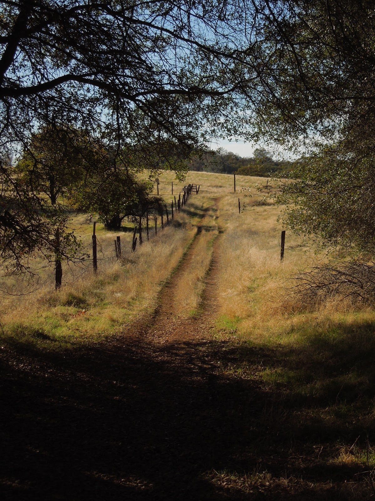
 
The trails vary from a paved road to old unused dirt roads, 
trail wide enough for several persons, down to single file.
 
 Shade is provided by several species of oak, along with some old walnut trees,
pines, and a few cottonwoods.
To my delight, we crossed paths with turkeys enjoying the shade. 

Other wildlife you may see include coyotes, skunks, raccoons, deer, hawks, ducks, geese, pheasants, bluebirds and other varieties of smaller birds. I have also met a bear back here, face to face. An acquaintance got bitten by a rattlesnake last year and had to hike out. She was hospitalized for 5 days, so keep your eyes and ears open.


Poison oak is taller than I knew existed!

Look closely at the dry, already leafless branches and stems, 
in the forefront of the pine tree ~ that's poison oak! 

Above is a closeup of a poison oak stem.  It is nubby and looks rubbery.  The trouble 

for you who are allergic: it is easy to miss while leafless.  On the bright side

 it really doesn't grow into the path on this hike, but is quite healthy alongside it.

There are two somewhat seasonal creek crossings and some wet depressions that support cattails. The ground may be soft and muddy but some short wood plank footbridges are installed to help you through.  Wear suitable shoes!


In the spring this is a popular hiking trail while wildflowers are abundant. Is this a Common Madia relative? In November we still found some very small unidentified purple flowers, yellow thistles, clarkia, larger purple thistles, and poppies.


The thistles ruled on this hike in autumn,
and displayed sparkling giant fluffs for children to wish on.  


You may come across this pond which is host to the birds
and wildlife, and has evidence of a rich history.

Beside it are old grinding rocks with deep wells,

thankfully shaded in the hot afternoons.

 
An old building still stands nestled in a grove of trees near the old walnut orchard.
 
Closer to Cool the wide trail is lined with trees
bending over it and shading hikers.

TRAIL SUMMARY    

     This set of trails is most excellent for the many options to determine the length of your journey (shown on the map below) and even how much sun or shade to spend your time in.  Heading south from the parking takes you across rolling hills brown with dried thistles and grasses.  On the west, the loop zigzags through a less generously wooded area. Then it leads you near the top of the canyon wall heavily shaded by pines and oaks, with distant views of the river and canyon far below. 
     As you descend to the Knickerbocker Creek crossing the moisture in the air is cool and luxurious on a warm day.  From there I am told the adventurous can hike down the canyon and see the Knickerbocker Falls. Otherwise, head uphill (some say it gets a little arduous) and turn northeast. The trail returns to sunny rolling hills with distant views to the south and southeast of snowy mountain caps, then runs alongside a charming old walnut grove.  Turning toward the east, you'll pass by the photogenic weathered "home" where the trail is wide and well-shaded.  The sounds of Highway 49 grow, and once there, there is a trail set off the roadside running parallel to 49 with the firehouse now in sight.
     In the winter and after storms, water pools and this trail is known (and loved by some) for becoming deep mud, most appreciated by mountain bikersEquestrians love the area, too and the parking behind the Cool Fire Station has ample room for large horse trailers. 
You can enlarge the map of area trails by clicking on it:


     There were also single file trail choices not shown on the map.  The very top of the map is where you head north and can connect with the Training Hill.  From there it is possible to go to Western States Trail from the bottom of the Training Hill and take it back uphill toward Cool, making an even longer loop. There are signs for these and other options. I have hiked everything I posted on this map, but we hiked 9.14 miles without that TH-WST section.

Here is a map of our hike as described above:


Click here for my Everytrail GPS tracks
Wikiloc has these trails posted individually by "Clipper Creek Wanderer".

Parking and Trailhead Information: 

     The official parking area is located west of Highway 49 behind the fire station, northwest of the only signalled intersection in Cool, where CA193 meets CA49.  (Some people park at the nearby market, southeast of the fire station.)
     The parking has state fees now. The Olmstead loop, if you go clockwise, heads out of the southeast side of the equestrian parking area. There is a picnic table in the sun and a vault toilet. 
 
HAPPY TRAILS!
 Updated 11-14-2012

August 11, 2012

Miners Ravine near Roseville, CA

The trail head is behind UA Theaters on Eureka! 

Updated on Nov. 9, 2012: This local dirt trail is ideal for getting the kids outdoors. There is a stream with beaver dams, indian grinding rocks, shade, and room to run.  First I am posting new photos of the dazzling autumn colors (not edited or enhanced) from my hike yesterday (Nov, 2012) then the previously written article, photos, and information I had posted here before will follow.


Often you see ducks and geese here and occasionally some other wildlife.

Autumn 2012
 
Here in our community is this wonderful trail with rolling hills, trees, wildlife, a pond, and as strenuous or easy a hike as you personally choose. 


This is one view of the pond in Miners Ravine that invites geese, ducks, and other wildlife. Its a great place for a picnic with the kids!

This is where you leave the paved bike trail and head into the woods. It will be on your left just after you cross a foot bridge.

Foothill Hikers introduced me to this area or I wouldn't have know to get off of the bike trails!

At times you will walk along the creek and often in the shade.


You'll cross under this bridge, not picturesque yet, but it gets better!


One of my favorite ways to kick this one up a notch is to jog up and down these hills.  They are steeper than they look!

Ducks, geese and other wildlife visit the Miners Ravine Pond.  There aren't tables, but a blanket would do..

Soon you'll see the beaver dam and evidence of their residency! 

There are a couple of dams in place although I guess for flood reasons, sometimes they get disturbed.  The beavers are ambitious though and they erect new ones!

A little history here in our own backyard...historic indian grinding rocks!
More of the hills I like to jog...

I couldn't resist the reflections here!
Remember to look up for wildlife too!  Birds of prey live here as well as garden variety birds.


This is the creek as you near the end of this hike.

Miners Ravine Trail Map
Distance: 5.9 miles as posted, but so many options make it totally adjustable to fit your needs.
Difficulty: This can be easy to moderate as a hike. It would make a nice trail run also.
Location: It is in the Rocklin/Roseville area but easy access for Sacramento and Loomis right off of 80 near 65. I park at the back of the UA Theaters parking lot on Eureka Road near the marked trail head . It is posted and leaves the parking lot paved as a bicycle trail, but you'll turn off and hike as shown above.
You can park on the dead end street at the other end of the loop by taking Sierra College Road east off of Highway 80. Turn right on El Don Road. Turn left on Foothill Road. At the corner you turn right and it is then Greenbrae. Follow it to the end taking the left fork as shown on the map below.
Click on this Miners Ravine Trail elevation profile and see the details clearly.

Foothill Hikers also have tracks posted on Wikiloc with a hiking variation of this same area.

Happy Trails!

updated Nov. 2012


June 24, 2011

Carr Lake under Snow!

Our goal was to hike around Carr, Feeley, and maybe Island and Penner Lakes along the Crooked Lakes Trail in the Grouse Ridge Area, toward Bowman Lake. We took 80E from Sacramento area, and got over to 20 then followed the signs to Bowman, Carr and Freeley Lakes.  The last road to the lakes is dirt and recommended for high centered vehicles although you might be able to maneuver around potholes and bumps, it would be a gamble.
Along the way we crossed South Yuba and it was roaring with swifter runoff than I have ever seen!
As it turned out, we hiked 5.85 miles, round trip, ascending from 5842 to 6703 feet at the backpackers campground, largely on snow!  We actually ascended and descended more than 1500 feet according to our GPS route.
The dirt road in was blocked with snow so we, along with others, parked alongside the road and began hiking up it.
Naturally the higher we got, the deeper and more consistent the snow.  Dog, cougar, deer, and bear tracks dotted the snow, some deep and fresh like our own, but no animal contact.  Water rushed out from under the fringes of the snow banks and made the snow unstable and potentially unsafe.
Some other hikers had their snowshoes, but we were able to hike in our regular hiking shoes.  The snow was just soft enough for our feet to sink in most of the time without slipping, or having the snow fill our shoes!  Our hiking poles came in handy for stabilizing our steps.
Good sense would indicate waterproof shoes and extra hiking socks, along with some layers for warmth.  Unexpected weather changes are not uncommon!  The weather was short-sleeve-warm and sunny, but I should mention that SAR recommends wearing long sleeves and long pants because falls can cause road rash like burns.  They also recommend carrying an ice ax to capture yourself in the event you do break through the snow.  The ground warmth melts the snow underneath and creates pockets of water and air you can't see to navigate around.  
Another recommendation is to avoid going too near trees and plants when traveling over snow because the roots create warmth that melts the snow near the ground and that you can fall through.
Once at the backpackers campground overlooking Carr Lake it was apparent we couldn't get further safely due to snow melt.  We hung around taking photos of the snow and even a few wildflowers!  The snow trek was similar to hiking in sand, and the final stretch to the lake was steeper and more work.

These are photos of Carr Lake: The first shows the lake covered in snow at the bottom of the "hill" in the background.

There was a thick layer of snow, submerged and yet interestingly visible around the edges.  From the opposite side of the lake a wind was blowing towards us, pushing the snow across the lake and chilling our bones!

We found wildflowers blooming even in this unexpected place.

The photograph below was of the gate to the parking area (used when the snow melts)!  It wasn't an "illusion" shot; the snow thickly covered the rest of the gate!


Any snow precipice could have crumbled down at any time.

Another view of the lake through the budding willows that had provided us camouflage for our golden tent last fall.
The lake was stunningly bright and beautiful! 
I am reminded of my goosebumps simply reviewing our photos!
As we hiked lower in elevation, in the afternoon heat, the more mud and water we hiked through.  Snow was melting fast!  Overall it was a fun hike, but for us, a long drive to be able to see only one of the numerous lakes in the area.
Check out Google Earth for the Grouse Ridge Area and plan some hiking and backpacking once the snow melts and it becomes accessible.  There is another blog entry here from our "Survivor" camp up there with photos of what you can expect to see after snow melt.  (In fact, the photo used as my standard headline photo was taken in that area!) The trail we primarily used was "Crooked Lakes Trail".  It is fairly well marked and by following it you can get fabulous views of distant ridges, and local finds including a variety of plant life, many small lakes and suitable swimming holes, not to mention fishing, and if you are so inclined, there is a hunting season for game as well.

Peachy Hiker's Table of Contents

Happy Trails!