Trails in Northern California

Trails in Northern California

Leave No Trace!

Visit desovw.org for more information about Desolation Wilderness. Visit Recreation.gov or call 1- 877-444-6777 to make park reservations. Visit Campfire Permits to get a permit online. More about Leave No Trace principles.
Showing posts with label maps. Show all posts

November 08, 2012

Olmstead Knickerbocker Trails

Olmstead Loop is within a network of trails and old roads rambling through miles of rolling hills in Cool, California.

 
*At the end of this page are details including a map, elevation graph, and data information.  You can click on any photo and then view them sequentially, enlarged for more detailed viewing.

Knickerbocker Creek is a lush green, shady area,

pleasant for kids to play in, finding bullfrogs and tadpoles.

The trailhead is located south of Auburn from CA49 coming from I-80, and north of Coloma on CA49 from Highway 50, which you can see on the map at the bottom of this page.

Check out the acorns stashed in holes
in the old fence posts!
Distance: 3+ miles.  On this hike we traveled over 9 miles.
Location:  Cool, CA, CA49 near CA193.
Difficulty: Easy to difficult depending on your choices.
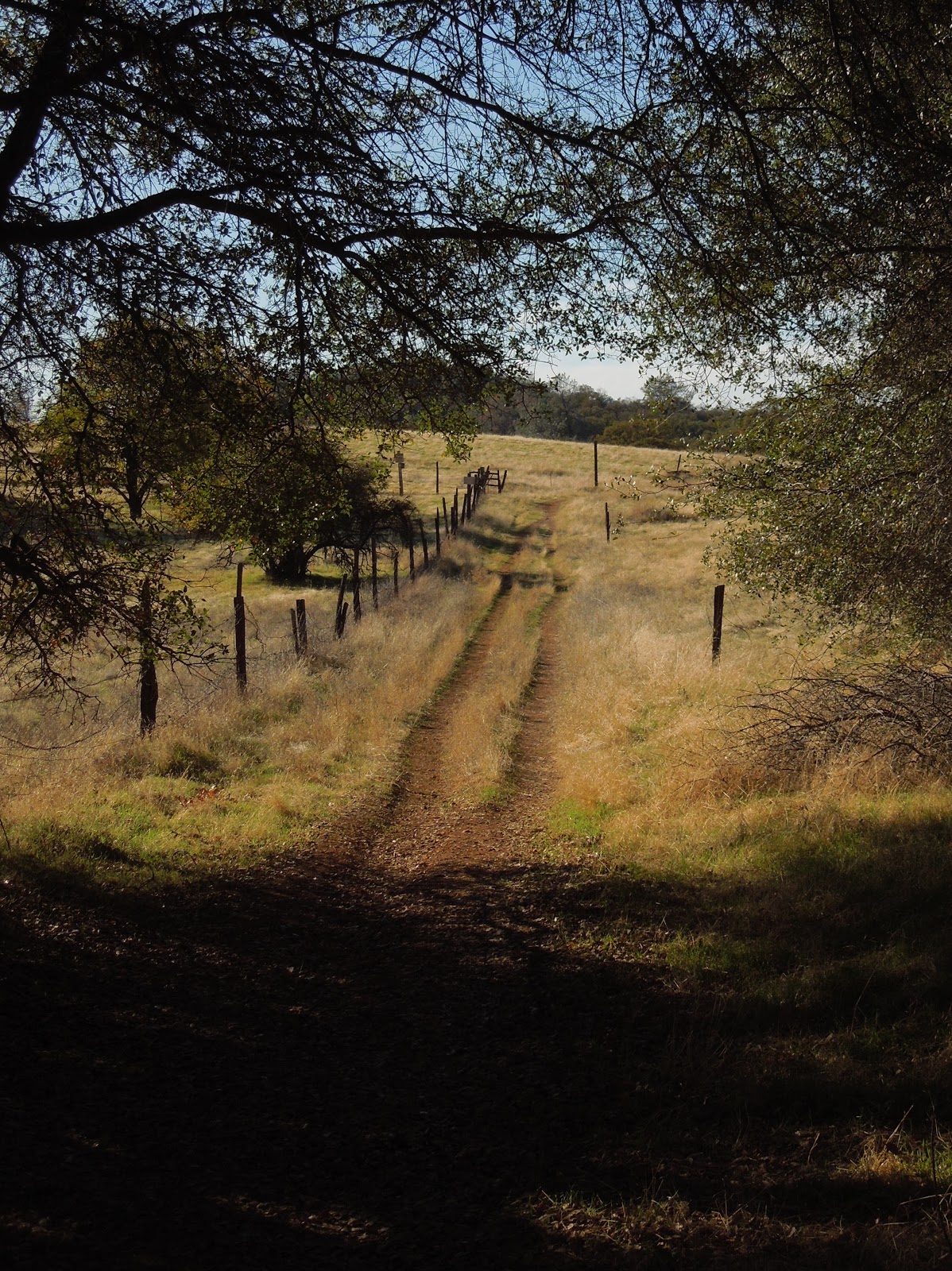
 
The trails vary from a paved road to old unused dirt roads, 
trail wide enough for several persons, down to single file.
 
 Shade is provided by several species of oak, along with some old walnut trees,
pines, and a few cottonwoods.
To my delight, we crossed paths with turkeys enjoying the shade. 

Other wildlife you may see include coyotes, skunks, raccoons, deer, hawks, ducks, geese, pheasants, bluebirds and other varieties of smaller birds. I have also met a bear back here, face to face. An acquaintance got bitten by a rattlesnake last year and had to hike out. She was hospitalized for 5 days, so keep your eyes and ears open.


Poison oak is taller than I knew existed!

Look closely at the dry, already leafless branches and stems, 
in the forefront of the pine tree ~ that's poison oak! 

Above is a closeup of a poison oak stem.  It is nubby and looks rubbery.  The trouble 

for you who are allergic: it is easy to miss while leafless.  On the bright side

 it really doesn't grow into the path on this hike, but is quite healthy alongside it.

There are two somewhat seasonal creek crossings and some wet depressions that support cattails. The ground may be soft and muddy but some short wood plank footbridges are installed to help you through.  Wear suitable shoes!


In the spring this is a popular hiking trail while wildflowers are abundant. Is this a Common Madia relative? In November we still found some very small unidentified purple flowers, yellow thistles, clarkia, larger purple thistles, and poppies.


The thistles ruled on this hike in autumn,
and displayed sparkling giant fluffs for children to wish on.  


You may come across this pond which is host to the birds
and wildlife, and has evidence of a rich history.

Beside it are old grinding rocks with deep wells,

thankfully shaded in the hot afternoons.

 
An old building still stands nestled in a grove of trees near the old walnut orchard.
 
Closer to Cool the wide trail is lined with trees
bending over it and shading hikers.

TRAIL SUMMARY    

     This set of trails is most excellent for the many options to determine the length of your journey (shown on the map below) and even how much sun or shade to spend your time in.  Heading south from the parking takes you across rolling hills brown with dried thistles and grasses.  On the west, the loop zigzags through a less generously wooded area. Then it leads you near the top of the canyon wall heavily shaded by pines and oaks, with distant views of the river and canyon far below. 
     As you descend to the Knickerbocker Creek crossing the moisture in the air is cool and luxurious on a warm day.  From there I am told the adventurous can hike down the canyon and see the Knickerbocker Falls. Otherwise, head uphill (some say it gets a little arduous) and turn northeast. The trail returns to sunny rolling hills with distant views to the south and southeast of snowy mountain caps, then runs alongside a charming old walnut grove.  Turning toward the east, you'll pass by the photogenic weathered "home" where the trail is wide and well-shaded.  The sounds of Highway 49 grow, and once there, there is a trail set off the roadside running parallel to 49 with the firehouse now in sight.
     In the winter and after storms, water pools and this trail is known (and loved by some) for becoming deep mud, most appreciated by mountain bikersEquestrians love the area, too and the parking behind the Cool Fire Station has ample room for large horse trailers. 
You can enlarge the map of area trails by clicking on it:


     There were also single file trail choices not shown on the map.  The very top of the map is where you head north and can connect with the Training Hill.  From there it is possible to go to Western States Trail from the bottom of the Training Hill and take it back uphill toward Cool, making an even longer loop. There are signs for these and other options. I have hiked everything I posted on this map, but we hiked 9.14 miles without that TH-WST section.

Here is a map of our hike as described above:


Click here for my Everytrail GPS tracks
Wikiloc has these trails posted individually by "Clipper Creek Wanderer".

Parking and Trailhead Information: 

     The official parking area is located west of Highway 49 behind the fire station, northwest of the only signalled intersection in Cool, where CA193 meets CA49.  (Some people park at the nearby market, southeast of the fire station.)
     The parking has state fees now. The Olmstead loop, if you go clockwise, heads out of the southeast side of the equestrian parking area. There is a picnic table in the sun and a vault toilet. 
 
HAPPY TRAILS!
 Updated 11-14-2012

April 08, 2010

Dutch Creek and Johntown Falls in Coloma, CA. updated 10-2012

Dutch Creek Falls and Johntown Falls feature cascades, historical features related to the Gold Rush era,

and hiking is on unmaintained trails (maps and GPS included below) with abundant spring wildflowers.  Mt. Murphy will be draped in golden poppies and the waterfalls are gorgeous with snow melt runoff.
This year I went in May 2012, then again in September and must warn of more hazardous trail conditions than ever due to erosion, and even more plentiful poison oak that was impossible to avoid contact with. Ticks are another hazard.
Distance: Plan to hike 2-5 miles.
Difficulty: Moderate to advanced skills.
Directions are written at the end of the article. Wikiloc link included.
Elevation min: 748 feet, max: 1,194 feet
Accum. height uphill:
420 feet, downhill: 456 feet

Lower Dutch Creek Falls 2010. 


 The above photos are Johntown Falls. 

This is the entry gate you'll look for.

You are greeted by the Coloma rolling hills, and at this time of year the poppies are blooming. Look for a typical locked green forestry gate on your left (complete directions below) with the ordinary signs like snake warnings, and a State Park Boundary sign.  Climb over or through the gates.  The trail is easy to see and follow at first. It winds through the grasses (sometimes quite tall) and then into woods (wearing long pants and even gaiters are good). Watch out for ticks and poison oak too.
On the right, the trail is paralleled by the creek but it's down below. You'll see the historic rock wall remnants that were built to guide the water.


Winding your way into the woods is beautiful and cool. The trail is not maintained, so any debris will remain and the trail changes over time to avoid the obstacles like fallen trees.


If you bushwhack a little, you can get down to the water and find some serene and picturesque views upstream. Beware, the rocks are very polished by the water, and slippery. One of our hikers took quite a slip and fall onto the rocks even though he was wearing good quality hiking boots! If you have trekking poles, they can come in handy.  We also saw plenty of wildflowers, mostly fairy lanterns and poppies up on the hillside, but also some lupines, vetch, and some butterflies.

There were salamanders galore this May 2012!  The ripple is from the little guy coming up for air.

To go to Lower Dutch Creek Falls you will see a trail heading down to the right that has a small boulder on either side of it. The trail winds a little to the left and after that the surface is hard and slippery with nothing to dig your boots into for traction.  It is a steep, butt-slide trail down to the falls and pool at the base.  There is shade and a great boulder overlooking the falls you can sun on, and an excellent wading pool at the base of the double falls.


Lower Dutch Creek Falls May, 2012


Once past the lower falls turn off, the trail here, and in a couple of places, goes almost straight up.  I didn't worry about going in but wondered about footing on the way out!

 The local vultures collected when they noticed we made it to the upper falls....hinting that our chances of getting out safely may be questionable!  (Chuckle, really!)

This May, 2012 photo doesn't do the trail damage justice, but you can see the erosion pattern and how narrow the trail is currently.  It is also less flat and more angled downhill.

Besides Lower Dutch Creek Falls, there are numerous small cascades along the way.

If you do continue on upstream along the narrow, steep at times, rough trail, you get to the falls below, Dutch Creek Falls and Johntown Creek Falls merging into Dutch Creek. We accomplished this pleasure in May 2010, 2011, and 2012.  We missed out in February 2010, having lost the trail! In April of 2011, we bushwhacked to a high point overlooking both falls!  The water flow was generous and the view was wonderful!

April 2011 Johntown Falls

April 2011 Dutch Creek Falls taken from the boulder 
overlooking both falls and the canyon.
Dutch Creek Falls May 2012

I love the rock structure to the right of the falls. 
We refer to her endearingly as the "Ancient Lady".


Directions: 
  • From Highway 80, take the exit for Elm Street at Auburn, CA.
  • Make a left at the stoplight.
  • At the next signal make a left.
  • The street veers to the right or has an option to go straight ahead. Veer right to go on Highway 49.
  • Go straight ahead at the next signal at Lincoln Road.  Now the road winds.
  • Take Highway 49 towards Coloma. 
  • An option is to park in the state parking and pay at the kiosk ($10?) 
  • You can park along the roadway across the bridge on the left, but you have to go to the museum and pay there. (There are pit toilets in the parking area.) 
  • Walk to Bayne road by crossing the single lane bridge across the river from Highway 49 and turn right. 
Walk up the road  then follow the trail as described above, starting at the green gate on your left.

Allow for a 2-4 mile hike and try to go early in the year for the best water flow over the falls. The later in the year it gets, the more dry the fields get and you encounter stickers galore, poison oak year around, and a less satisfying view of waterfalls. You can decide how much bushwhacking you are up to and can keep it mild-moderate or push it into a more technical-difficult hike.
Bring plenty of water, sunscreen, snacks, hiking poles if possible and shoes with deep tread.

Click on photo to enlarge.