Trails in Northern California

Trails in Northern California

Leave No Trace!

Visit desovw.org for more information about Desolation Wilderness. Visit Recreation.gov or call 1- 877-444-6777 to make park reservations. Visit Campfire Permits to get a permit online. More about Leave No Trace principles.
Showing posts with label wildflowers. Show all posts

August 16, 2018

Winnemucca, Round Top and Fourth of July Lakes Aug 2018

Fourth of July Lake as we entered the bowl.

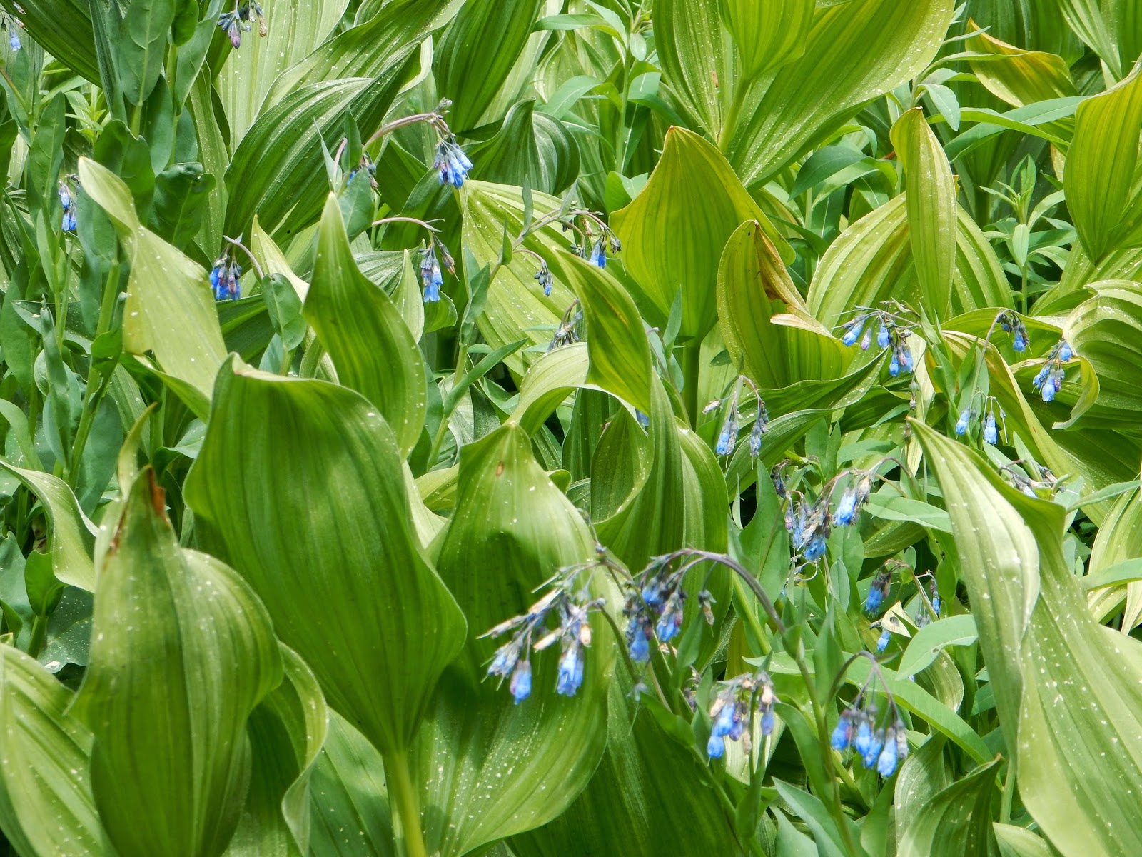
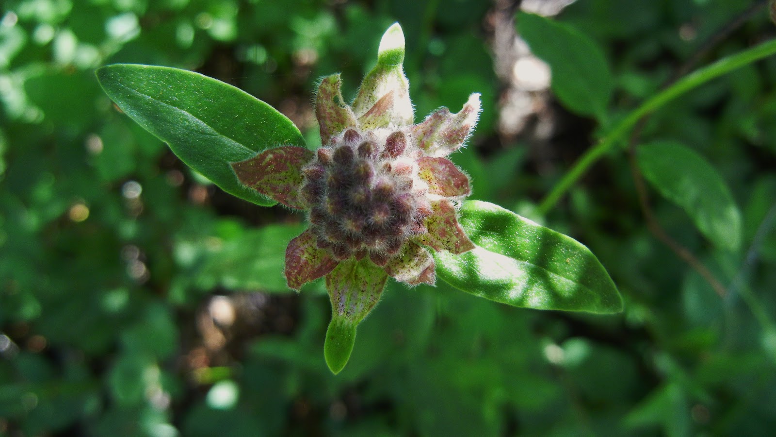
As luck had it, we hit the Winnemucca-Round Top Lakes Loop trail in July/August when wildflowers were in full bloom, making this a most colorful hike! 

Late July and early August were the wildflower extravaganza on the east hike up from Woods Lake to Winnemucca and then Round Top Lake.  
Details:  Either can be done as day hikes, although it depends on your fitness of course, and your ability to acclimate to elevation.  We started at 8200' elevation and climbed to over 9400'. Both of my hikes started at the Woods Lake Trailhead, with the short one as a loop and the longer trip as an out and back.


Distance: With some additional exploration, we hiked about 14 1/2 miles on our trip to Fourth of July Lake.  The Round Top loop was about 6 1/2 miles with a little exploration beyond Round Top Lake, toward Fourth of July Lake, to help plan my annual backpacking trip with one of my grandsons the next week. Both trips were rewarding and fun thanks to the flowers, and the snow banks here and there at the higher elevations.
Elevations: 9419 was the highest recorded on both hikes, but we estimated about + 50-75 on our boulder scrambling. 2864 ft elevation changes recorded on Fourth of July Lake trip; 1325" recorded on Round Top Lake hike.
Parking:  It costs $5 cash in an envelope per day for both day trip and per day for a full backpacking stay. We parked at Woods Lake Parking.
Advisories: 

  • There is a restroom in the parking area.  
  • The parking is adequate sized and you can park along the road if it is full.  
  • There is water available from creeks (bring your purifier) and the lakes. 
  • No poison oak.  
  • Not suitable for strollers but we saw happy kids on the loop day hike, and yes, even backpacking kids!
  • Many campsites at our 3 destination lakes do not have any close access to water, but more disappointing was the lack of any lake view.
  • These are popular trails and lakes so getting a "wilderness/solitude" experience is less likely. On the other hand we met so many generous and friendly folks!
  • No quad maps were available from the ranger cabin.  I expected to get one for my grandson to both educate him during our stay, and to keep as memorabilia of our trip.  It is important to keep aware of your location as you hike the area.  People do get lost there, so GPS, compass and map, and even your trackers like AllTrails are wise.  
  • Be prepared for unexpected rain and for winds, which are common to the area.
Our AllTrails unedited tracks from Woods Lake Trailhead to Winnemucca, Round Top, then Fourth of July Lake. 

Backpacking permits must be picked up at the Carson Pass Information Station, manned mostly by volunteers, on the first day of your trip.  I confess, this system is poor. "First come-first serve", right at the cabin, not at the destination.  They assign campsites.  Groups were divided all over each destination, rather than grouped together, and my grandchild and I had to break camp and move three times over 5 days.  No online reservations from Mokulumne Wilderness. Two groups offered us good sites for our two nights there so we accepted them with love and appreciation, as our assigned site didn't had a flat tent area.
4th of July Lake has sandy beaches!
There wasn't a fee for the camping permit on the bright side.
Day permits are not required.
Fire Permits required for use of any campstove etc.
Others have posted tracks you can use on AllTrails, but here are links to mine unedited to view the maps:
Fourth of July Lake
Winnemucca and Round Top Lakes Loop

It was smokey due to forest fires around CA, but there were rivers of color along the hike down into the Fourth of July Lake bowl that stood as tall as my preteen grandson!.
I loved the hikes.  I chose to go clockwise both times, personal preference, although most people choose counter clockwise.  We spent 5 days and 4 nights.  

July 25, 2015

Lyons and Sylvia Lakes in Desolation Wilderness July 2015

WILDFLOWERS ARE BLOOMING 

EVERYWHERE, IN EVERY COLOR, ALL AT ONCE

along the Lyons Creek Trail!  

Alpine Lilies

Leichtlin's Mariposa Lily

Fireweed

Assorted Indian Paintbrush, lupine, and other wildflowers.

Single-stemmed Groundsel

More Alpine Lilies


This is the creek just before the Lyons Lake Junction sign looking SW into the woods.

Difficulty:  At 10 miles I would rate any hike "Strenuous", and there are a couple of shallow creek crossings this year.  A plus is the elevation gain is accomplished going in, and coming out is downhill.  Not for strollers, but babypacks work!
Distance:  10+ miles round trip, upward, some loose rocky sections.
Elevation gain:   + 1875 feet up and -1875 back down.
Driving Directions:
  • Take Wrights Lake Road north off of Highway 50 near Kyburz. 
  • Follow the signs to Lyons Creek Trailhead. There is parking, but no restrooms are available. If you reach the Bloodsucker Lake parking, you have gone too far.  
Notes: Day passes are available at the trail head, seasonally. In the winter season, stop by Pacific Ranger Station at Fresh Pond, CA and pick one up.
You could stop at Fresh Pond for gas, restroom use, drinks and snacks before you get off of Highway 50. For backpacking, see the notes near the end of this page.  For even a small cooking stove, have your fire permit with you.  Also bring your fishing license with if you bring your pole.

A great website is Desolation Wilderness Volunteers.  It includes a photo gallery and a wealth of information if you plan on visiting the area.
I just returned from hiking to both lakes on the Lyons Creek Trail and the weather was, as expected, random!  Sunny and hot on my first day and then on my way out after my over-nighter and day hiking, a thunderstorm blew in. In Desolation these weather changes are not uncommon, so be prepared.  

Walk along a barely used roadway for forestry related activities.  In a short distance though it becomes trail, first leading you through an large open meadow.
Take one of the "use paths" to your left when you hear the water, and
at some of those locations you can refill your water in Lyons Creek
or maybe splash to cool off.
The following photos will take you through to Sylvia Lake.
Enter the woods on a hard packed soil trail.
I get excited when I reach this point, feeling closer to my destination.
Some hiker's goal is Pyramid Peak.  Sylvia Lake is in the bowl beneath the peak though, so you won't have to climb it unless you are prepared to do so.  Lyons Lake is a steep climb north marked with a forestry post at the trail junction.
This open area has corn lilies blooming at shoulder height right now,
along with Lupine, Paintbrush, Pennyroyal, Larkspur, Asters,
Mountain Bluebells, and many other wildflowers.
Corn Lilies and Mountain Bluebells

The creek crossings are quite shallow.  Step across the rocks and head into the woods again.
The view to the south side.  
As you get closer to the lake, the trail is composed of loose rocks.  If you are prone to twisting an ankle, mid boots will help prevent injury.
We have arrived!  Bring your fishing pole if you have one.  There were fishermen along the WNW shore of Sylvia Lake and also at Lyons Lake. 
 Please note that Sylvia Lake is a sensitive area with recent restoration work done. Please respect the restoration effort.  These signs will show you the areas to avoid:


Larkspur

Please, please, please respect fire restrictions in place.  More than ever before, Desolation Wilderness could be lost in fire due to the extreme drought, and even lasting effects from dead and dying trees that resulted from the drought.  Fires mar the surfaces and change the resources, but at the end of the day, fire hazards are very high regardless of how careful you feel you are.  Build fires in campgrounds designed with safe fire rings rather than in the wilderness. 

  •  Day use fees: none; permits available at some trail heads after Memorial Day weekend, specifically at Lyons Creek, Rockbound, and Twin Lakes Trailheads.   
To obtain passes or for assistance in trip planning:
  • You can make online reservations for Desolation Wilderness Permits for a small reservation fee at Recreation.gov
  • or visit Pacific Ranger Station Fresh Pond, 7887 Highway 50, Pollock Pines, CA or call (530) 647-5415 .  
  • If you are from the Tahoe side, check with Lake Tahoe Basin Management Unit at (530) 543-2600. 
Other regulations and restrictions can be found on the website, too.
 I highly recommend you bring water and some snacks or lunch. No campfires are permitted in the wilderness. Have your Wilderness Permit to use your stoves and lanterns. 

 Please Leave No Trace and enjoy your trip!

Happy Trails!

Related Posts
Desolation Wilderness
2015-07
10+ miles
Strenuous
2014-08
30 miles
Moderate to Strenuous/Difficult
2014-07
18 miles
Moderate-Difficult
2014-06
12+ miles
Moderate to Strenuous
2013-06
13+ miles
Moderate to Strenuous
2012-09
Umpa Lake & Enchanted Pools
8+ miles
Cross country ~ Moderate
2012-08
Horsetail Falls via Pyramid Creek TH
Aprox.  10 miles to lakes at the top of the falls
"Difficult, and potentially dangerous" miles
2012-07
10 miles
Moderate
2012-07
8 miles
Moderate-Strenuous
2012-06
Lyons Lake via Lyons Creek Trail
10+ miles
Strenuous
2012-08
9.2 miles
Moderate
2012-06
6+ miles
Strenuous
2011-07
Lyons Creek Trail with melting snow
9+ miles
Moderate
2011-02
3.8 miles
Moderate
2010-09 We hiked 12 days.
167 total
Moderate to Strenuous

See the Full Table of Contents.
Added links and updated permit information  06-2016

May 27, 2013

The Botany Song


I am making some progress in life...taking natural resources coursework!  In my California Wildflowers class, a friend of one of my classmates wrote and performed this!  Who says botanists are boring???   We saw Jamie in concert and she played this one for we flower freaks....not a better song in her set!  Get ready for a good belly laugh!
P.S. I finished the class with an "A", and having learned fun things, the pressure is off and I will just enjoy hiking again!
updated May 2013

July 23, 2012

Hidden Falls in Placer County, CA


*  If you click on a photo, it will enlarge each of them and let you scroll through.  At the end of the article I will post the Wikiloc link for GPS tracks, include a map, and an elevation profile.

Hidden Falls is a waterfall hike made for families!


Difficulty:  Easy-Difficult based on choices.  There is an accessible area paved, some moderate rated trail sections, and difficult sections for those who want challenges.  The link at the bottom of the page has a map of the whole trail system with numerous options.  My GPS only includes the route I took which is moderate-easy.
Distance:  The route posted is 5.7 miles. 
Elevation:  Ascent 1208  Descent 855  This trail is loop style.
Driving Directions:
  • From Highway 80 take the CA-49 exit #119B toward Grass Valley. 
  • Turn left on Atwood.  (If you reach Cottage Drive you've gone .1 miles too far.) 
  • In 1.8 miles make a slight right onto Mount Vernon Road.
  • Go to the left in .6 miles to stay on Mt. Vernon Rd. 
  • In another mile turn left to stay on Mt Vernon Rd. 
  • Turn right on Mears Dr.( but if you reach Hastings Lane you've gone .4 miles too far). 
  • Take the first right onto Mears Place. 
  • You'll see a very large parking area and there are restrooms at the TH.
Notes:  This is a beautiful hike with places for families to stop and play in the water, and finally at the falls there is a large overlook deck to safely take in the view of the waterfall.  Just beyond the overlook deck is a trail down to the creek to an open area to play in and picnic at.  
* This area is for hikers, runners, bicyclists, and equestrians although horses and bikes are limited from some areas.


Wildflowers abound in spring but can be found almost any time.

 This shot typifies the trail you'll be hiking. Fun for kids too!


I like going down to the creek for a snack and splash, especially on a hot day.

WILDFLOWERS!  


 Cross this bridge to follow the trail to go to the falls. 
(There is a trail going straight ahead but this bridge is to your right.)


When you see this fenced area, follow the steps down and follow the trail to the right. 
It takes you to the falls.

 There is a great open area of creek side below the falls just past the deck where you can go get some shade and play in the water, but the trail is narrower and less flat of a hiking surface.

 Kids may like the many lizards they can find here. They are great at camouflaging themselves
on the rocks, but are a shimmery greenish color!


 This view of Hidden Falls is taken from the viewing deck. Just a reminder of how pretty the falls are. The viewing deck has benches all around and is in full sun.


Down at the creek, beyond the falls, you can go down and then to the left
to find some shade and pretty views of the creeks joining.

Looking upstream iinto the canyon appears to be an inviting natural pool
but the "trail" is haphazard that direction. 


There is poison oak although it is generally kept off of the trail.  Use caution if you are allergic.

Elevation graph with specific data below best viewed enlarged by clicking on it:

This is a map of the route I took, but many options exist, both easier and harder ones, longer or shorter. The waterfall is on the farthest left leg of the trail at the red arrow area.


Hidden Falls GPS Wikiloc link
Hidden Falls Regional Park 
Their site has a one page synopsis of the property history and other general information; there is a map at this site of all trail sections, mileage, paved areas, and restrooms.

Peachy Hiker's Table of Contents

Related Articles:
ASRA ~ Auburn State Recreation District
BLM ~ Bureau of Land Management
Near Auburn, CA
Happy Trails!
Updated 9-2012

July 22, 2012

Loch Leven Lakes- Donner / Tahoe Area, CA


*  If you double click on a photo below you'll be able to view each of the photos enlarged.  At the bottom of the article will be a map, an elevation profile, and a Wikiloc link for GPS tracks.


On this beautiful hike of 7.2 miles, we passed 6 lakes and ponds, each one inviting and remote.  

Difficulty:  Moderate.  Distance is flexible but also farther than beginners usually want to tackle for a day hike.  For backpacking though you do half of that each day, then 3+ miles is an easier distance.  Be prepared for rocks and tree falls though.
Elevation changes:  Ascent 1218; Descent: 1198, no section steep as you will see on the graph below.
Driving Directions:
  • Take 160 toward Yuba Gap.  
  • In .2 mi. turn right onto Lake Valley Road.  It turns slightly left and becomes Crystal Lake Road. 
  • In .2 miles make a slight right toward Lake Valley Road.  Continue for 1 mile.  
  • Make a slight left onto Forest Route 19 and drive for 3 miles. 
  • Continue onto Power Line for .8 miles.  
  • Continue onto Forest Route 19 for .2 miles.  
  • Turn left and drive for 1 mile. 
The TH is after Huysinks.  The last 4 miles are dirt and the road conditions change, but on this trip in July 2012 I could have gotten my car there but there are some deep tire ruts and a lot of washboard or potholes. 

Notes:  If you are a backpacker, I highly recommend this popular trail and the lakes.  There is plenty of room and many campsites along the way.  Sure, there are people at the first lake but the further you go, the fewer you'll be likely to see.  For me the last lake was most beautiful and enjoyable.  The first Loch Leven Lake is large and groups were there of young people swimming.  Various backpackers were solo and had separate camps with privacy enough. 

WILDFLOWERS, for those who stop by to see what's blooming in the wilds:

This time of year is full of color and variety.  I love the macro shots like this first one.  Enlarged, you'll see the little residents and scavengers that may appear to be dirt or debris in the field!


We were also treated to a section of trail covered with these beauties.

Our hike started in the shade of brush and willows, when we suddenly stepped out into this sublime meadow.  I'm happy to report we didn't have to break out bug spray to fight off the biters that commonly stalk hikers along moist areas.

Quickly the trail reentered the woods and there were several larger fallen trees to climb over, or in the case above, through.

For the most part the trail is in good condition and easy to follow. but of course, GPS helped us along the Salmon Lake area.  We did some granite crossing and boulder scrambling in that area, all fun and nothing treacherous!

This unnamed grassy lake hid a treasure for me:  my first chance to photograph what I believe was a great blue heron.  You'll have to enlarge this to find it because I zoomed my lens as far as possible taking the photo, and still can barely see the giant bird in the tree (below).

It caught me off guard and flew down into the grasses where I thought I had missed my opportunity but at home on the laptop, there it is hiding.  Another one to enlarge or zoom in on.

So play a little "Where's Waldo?" and find the bird in the above photos.  Help me if you know for sure what type it is.  Good luck.

A bit of adventure struck us here because somehow, talking too much I guess, we lost the trail but took our time on the granite resting and snacking, taking pictures of Salmon Lake and wondering if we needed to go all the way down to the lake or not.  We opted for a bit of cross country in the compass direction of Loch Leven and with a little bushwhacking we were able to reconnect with the official trail. 


As we srolled along and greeted hikers and dogs, Loch Levens first lake presented herself in full color and beauty.  As you can see, a breeze was steady but it sure didn't slow down all the young people swimming!  They were across the lake between islands squealing, laughing, and splashing.  It did nothing to dampen my enjoyment.

 Neither did the various camps set up along the trail.  Our ambition was to get to Upper Loch Leven though so our stay was shorter here at the largest of the lakes.


My vision of what it might be like was good as gold.  No one was there but us, no splashing or tents.  We picnicked and took off our boots for a wade in the pleasantly warm shallow water.  This was a fantastic destination!

Our chosen spot was here at the southwest side of the lake where we found some boulders and a long shallow area perfect for soaking our tired dogs.  Lily had a blast splashing and digging up mud between snacking and finding sticks to be thrown.

Sunset was on our way out, but worth stopping for this shot. This was a fun moderate hike and might be a good start for a new backpacker.  Our 7.2 miles could be shortened and was a round trip total.  No bathrooms. For the day, take a water purifying means, food, sunscreen and bug spray (and your swim trunks)!


Wikiloc  for GPS.  Other tracks are available.

Related Articles:
Grouse Ridge Trails
Survivor Night on Crooked Lakes Trail
Carr Lake Under Snow

Peachy Hiker's Table of Contents
Happy Trails!