Trails in Northern California

Trails in Northern California

Leave No Trace!

Visit desovw.org for more information about Desolation Wilderness. Visit Recreation.gov or call 1- 877-444-6777 to make park reservations. Visit Campfire Permits to get a permit online. More about Leave No Trace principles.
Showing posts with label Auburn. Show all posts

July 06, 2015

Alta Sierra Biblical Garden in Grass Valley, CA

 has a waterfall, creek, gardens, outdoor chapel, and a historical 13th century prayer and meditation labyrinth.  

This walk is a privately owned daytime retreat located near Grass Valley, open sunrise to sunset daily.  The gardens are  closed in winter months.  They also have a quaint outdoor chapel for up to 150 persons and includes a PA system, and electricity available.  No reservations for a few people but if more than 5 of you are going please make reservations.

Difficulty:  Easy.  It is made to be a pleasant place to reflect and find some peace. They say allow 1 1/2 hours for a self-guided walk through the gardens. The trail is very short, but perfect to spend some time reflecting. There are uphill and downhill areas and rocks sticking out of the dirt, and some has wood chips making use by wheelchairs unavailable.
Driving Directions:  From I 80 take CA 49 east.  In approximately 17 miles turn left on Auburn Road.  The Biblical Gardens is located on your right in about .7 mile.  There is plenty of parking, even for buses for events!
Notes: I called two days ahead to say we were coming.  We were greeted sternly because people have been using their parking as a park and ride, leaving cars in the parking area for overnight even.  The woman also looked quite suspiciously at our small day packs and said we cannot take food or water on the trail.  She complained that people have been leaving trash.  We never made it to see the labyrinth, but did walk the trail.  It is indeed serene and beautiful.  Please use the picnic area to eat.  Take your water in a non-disposable container.  Please, please be considerate of the owners and of people who use this place.  Leave it cleaner than you find it.  Enjoy the view.  The restrooms are only open on week-ends due to the drought.

MapQuest

16343 Auburn Rd.
Grass Valley, CA 95949
You can call them at (530)272-1363.  

Below is their map of the gardens to give you an idea of the layout.  You walk from station to station within the garden. Benches are placed to pause and enjoy the garden, meditate, perhaps pray, reflect, or simply take it all in. On their website you can click on each number and see a photo of a spot in the garden.  Click the link below the photo.
http://biblicalgarden.org/HTMLS/mapofgarden.html
Notes of interest:  
  • A picnic area is available for reservation for bible studies, or other small group activities. A family picnic is fine too. Please take out your trash.  No BBQing is allowed.
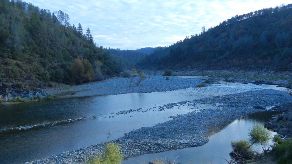
  • The prayer labyrinth is a historical replica of a 13th century as a meditation or prayer path. Please don't let children run about or disturb the rocks that line the path.  It sits near Rattlesnake Creek and the gardens.  
  • Please, no wading or splashing around in the creek.
  • No pets allowed.
  • The outdoor chapel accommodates 150 people, and is available for memorials, weddings, and baptisms.
  • While the property is privately owned, the Grace Works Community Project has designed and constructed the interfaith nondenominational labyrinth.  (Donations are welcome and are tax deductible.)
The original owners and developers of the land have moved on and since 1996, Paula and Maskey Heath have continued the traditions of Alta Sierra Biblical Garden.
To learn more about the Gardens check out all of their website pages at Alta Sierra Biblical Garden.


August 24, 2012

Codfish Creek Falls, River Access, Family Fun

This is an especially fun family day trip.  The 50 foot waterfalls tickle the kids and it is a short, mostly shady, hike.  Then for the heat of the day enjoy the swimming holes back toward the bridge with room to sun in, shade to picnic, and natural pools to swim and fish.  Near Auburn.


The 2.8 mile out and back trail heads downriver along North Fork American River, near Weimar, and ends at the beautiful year round 40-50 foot waterfall and creek. 


Parking is alongside the dirt road that is in car condition this August, 2012. 


Codfish Falls also known as Codfish Creek Falls

is reportedly 40-50 feet high. 

There are large flat boulder areas beside the falls,

great for picnicking in the shade!


The trail has some steep offshoots that take you to the river
but it's well maintained to the falls
and gets morning sun and
afternoon shade. 
Perfect! 
I have seen families with all ages of children here.

 The creek flows down to the river and adds
to the pleasant atmosphere for just hanging out.
 
There is a trail less maintained that heads uphill to
a boulder that two can comfortably sit on and view the falls,
hidden from the visitors below.

Of course, fun wildlife lives back there!

I may not recommend it, but I bushwhacked up the other side of the falls. 
The rocks are slippery and the blackberry vines get prickly!  A person
gives you some perspective on the height of the falls. 
Find Peach Hiker at the falls!

Back at the bridge,

Families can find areas near the shoreline to swim and picnic.


There is plenty of room to get comfortable and cast out some lines. 
The couple is Brandon and Jen. 

We caught a nice trout,


and well, a frog that day!
That's me, Peachy Hiker with my fishing pole enjoying the sun and company!


Get out your poles and fishing gear. 

Pack a picnic and your swimming stuff,

to have a perfect family day!

Directions:

  • From Highway 80 (east of Auburn),  exit at Weimar Cross Road.

  • Turn right onto Ponderosa Way, heading south. (Stay to the right at Cross Road. )

  • Drive south for 5.8 miles down the canyon.

  • 2.5 miles before the river the road becomes a dirt road that is suitable for most cars at this time. 

  • This is now a fee area.  They are collected by park rangers at the top at the dirt road.  You will see park personnel there and at the river. Carry your fishing license.

To go to the falls,

Start hiking downriver from the bathrooms. Just follow the trail and you'll find the falls. 

To swim and fish, there are quite a few places to get down to the river.  Across the bridge is where we fished and swam.

More hikes for you in this area:

 
ASRA ~ Auburn State Recreation District

BLM ~ Bureau of Land Management


Near Auburn, CA


OR:     Trails by Locations
Happy Trails!
edited 8-2012

August 11, 2012

Cardiac Bypass North Fork Trail

In Folsom Lake State Recreation Area ~

Distance: On this weeks Cardiac Bypass Loop I hiked 5.75 miles round trip.  Go much more or some less depending on your choices.
Difficulty:  Moderate to Strenuous also based on your choices of using the road or trails more and the speed of your gait.
Elevation Changes:  Over 2400 feet total
Driving Directions:
  • From Highway 80 East from Sacramento area, take Indian Hill Road east from the Newcastle area.
  • Turn left on Auburn Folsom Road.
  • Turn right on Maidu Drive.  Park.  If you pay, it is $10. I parked along the road for free beyond the paid parking on Maidu Drive in Auburn, CA. Photos of options are below.
Advisories:  There are restrooms at the trailhead.  Poison oak is abundant along the sides of the trails.  Some areas have rocky footing.  There are small creek crossings.
* If you click on a photo all photos can then be viewed enlarged.
UPDATED photos taken March 8, 2016
Blue Dicks along hillsides, with swallowtails fluttering about, but quite a few other wildflowers too.

The North Fork of the American River is flowing freely thanks to all this recent rain.

Poison oak is everywhere so beware.


I had not used this section before and it took us all the way back to the starting point near the paid parking.  Shady, pleasant, and good footing.


This is the paid parking.  On the right you pull in and self register.  

The side of the road where you can park for free, or go beyond the gate shown above and park alongside the road there to hike the Bypass Trail.


The original article below is based on a variation of the hike shown above.  There are a multitude of trail choices as you go.  I advise getting GPS tracks or a map of the park trails if you are not familiar with the area and not secure finding your way in new places.
____________________________________________________

COUGAR SIGHTINGS ALERT!Yesterday, March 28th, 2013 a cougar was sighted near the "Y" along the trail.  There is some dense cover for it, so just be aware, be noisy, keep your eyes and ears open!  Bears have been sighted in the area in the past, so again, just be alert.


Distance: 7.2 miles using my GPS tracks, but more or less as you choose options.
Difficulty:  Moderate to Strenuous also based on your choices of using the road or trails more and the speed of your gait.
Elevation Changes:  Over 2400 feet total
Driving Directions: 
  • From Highway 80 East from Sacramento area, take Indian Hill Road east from the Newcastle area.
  • Turn left on Auburn Folsom Road.
  • Turn right on Maidu Drive.
  • You will see China Hill paid parking on the right with a restroom, or you can park along the roadway on the right also.  Walk through the closed park gate to begin the hike using the road as shown on the map below.
Notes:  There is paid parking available, or more recently I have been using Cardiac Hill Trail that is now well marked with park signs.  I park alongside Maidu Road at the gate marked for Cardiac Hill, just before a sign posting the entry to China Bar. There are restrooms at the trailhead posted on the GPS tracks, the icon for a bathroom in a large unused dirt parking area, and another at the car icon called "road end" which refers to an unused dirt road, small parking area. The trail that will take you winding mostly through trees along the river continues from there heading south.  Cardiac Hill is a vigorous hike or jog.  Its almost as steep as Training Hill, but prettier and shadier!


 Some volunteers have placed these small signs along the way to point you in the right direction.  (2016 update:  I did not see these signs anymore, but pretty well marked park signage)

 Going down to the river to rest and eat, maybe get wet, make the hike especially enjoyable for me.


 Some areas of the trails do get quite dry and full of stickers when the hills dry.  Gaiters over your boots or shoes help.  My hiking poles propel me uphill on the steep sections which unfortunately are the return trip!


Below is a graph to show you and give you a better idea of what to expect in elevation changes.

Related Area Hike Links:
ASRA ~ Auburn State Recreation District
BLM ~ Bureau of Land Management
Near Auburn, CA

Peachy Hiker's Table of Contents                                         

Updated March 10, 2016
Updated March 29th, 2013

July 23, 2012

Hidden Falls in Placer County, CA


*  If you click on a photo, it will enlarge each of them and let you scroll through.  At the end of the article I will post the Wikiloc link for GPS tracks, include a map, and an elevation profile.

Hidden Falls is a waterfall hike made for families!


Difficulty:  Easy-Difficult based on choices.  There is an accessible area paved, some moderate rated trail sections, and difficult sections for those who want challenges.  The link at the bottom of the page has a map of the whole trail system with numerous options.  My GPS only includes the route I took which is moderate-easy.
Distance:  The route posted is 5.7 miles. 
Elevation:  Ascent 1208  Descent 855  This trail is loop style.
Driving Directions:
  • From Highway 80 take the CA-49 exit #119B toward Grass Valley. 
  • Turn left on Atwood.  (If you reach Cottage Drive you've gone .1 miles too far.) 
  • In 1.8 miles make a slight right onto Mount Vernon Road.
  • Go to the left in .6 miles to stay on Mt. Vernon Rd. 
  • In another mile turn left to stay on Mt Vernon Rd. 
  • Turn right on Mears Dr.( but if you reach Hastings Lane you've gone .4 miles too far). 
  • Take the first right onto Mears Place. 
  • You'll see a very large parking area and there are restrooms at the TH.
Notes:  This is a beautiful hike with places for families to stop and play in the water, and finally at the falls there is a large overlook deck to safely take in the view of the waterfall.  Just beyond the overlook deck is a trail down to the creek to an open area to play in and picnic at.  
* This area is for hikers, runners, bicyclists, and equestrians although horses and bikes are limited from some areas.


Wildflowers abound in spring but can be found almost any time.

 This shot typifies the trail you'll be hiking. Fun for kids too!


I like going down to the creek for a snack and splash, especially on a hot day.

WILDFLOWERS!  


 Cross this bridge to follow the trail to go to the falls. 
(There is a trail going straight ahead but this bridge is to your right.)


When you see this fenced area, follow the steps down and follow the trail to the right. 
It takes you to the falls.

 There is a great open area of creek side below the falls just past the deck where you can go get some shade and play in the water, but the trail is narrower and less flat of a hiking surface.

 Kids may like the many lizards they can find here. They are great at camouflaging themselves
on the rocks, but are a shimmery greenish color!


 This view of Hidden Falls is taken from the viewing deck. Just a reminder of how pretty the falls are. The viewing deck has benches all around and is in full sun.


Down at the creek, beyond the falls, you can go down and then to the left
to find some shade and pretty views of the creeks joining.

Looking upstream iinto the canyon appears to be an inviting natural pool
but the "trail" is haphazard that direction. 


There is poison oak although it is generally kept off of the trail.  Use caution if you are allergic.

Elevation graph with specific data below best viewed enlarged by clicking on it:

This is a map of the route I took, but many options exist, both easier and harder ones, longer or shorter. The waterfall is on the farthest left leg of the trail at the red arrow area.


Hidden Falls GPS Wikiloc link
Hidden Falls Regional Park 
Their site has a one page synopsis of the property history and other general information; there is a map at this site of all trail sections, mileage, paved areas, and restrooms.

Peachy Hiker's Table of Contents

Related Articles:
ASRA ~ Auburn State Recreation District
BLM ~ Bureau of Land Management
Near Auburn, CA
Happy Trails!
Updated 9-2012