The Tahoe Rim Trail (TRT) is 165 miles that can be hiked in dayhikes or all at once as a through hike. We backpacked the Tahoe Rim Trail in two trips.
Our first 50 miles began August 18, 2010, and then we hiked the remainder in September. After completing the first 50 miles, it became apparent I needed to write a daily diary during the second part of our trek. We started out at Echo Lake Trail Head and did not use the water taxi, but hiked along the trail that leads beside the lake and the homes that are there.
 Fun facts: Of the whole 167 miles we logged, we started at 8644 feet elevation, ended at 7385 feet; climbed a total of 35,446 feet; maxed at 10,334 feet and hiked only 68 hrs and 2 min. over 167 miles; our average moving speed was 2.5 mph.
Day 1 ~Echo Lake Trailhead to Susie Lake~

Above is Lake Aloha at an elevation of 8116'. The openness and the flat boulder islands scattered throughout the lake are surreal looking, and the trail is well maintained here. I had difficulty with footing on the irregular loose rock trail surface on the far side of the lake. You'll pass through Haypress Meadow, by Tamarack Lake, and also Heather Lake. Freel Peak comes into view standing at 10,881' elevation.


The path remained fairly rocky, and as we approached Lakes Gilmore and Susie, the wind revved up and we sought a sheltered place between two higher areas to plant our tent. Bugs came out for a feeding (us) and the wind was in its glory. DO NOT KEEP ANYTHING WHERE THE CRITTERS CAN GET INTO IT! The chipmunks were incredibly bold and persistent about digging into our gear even with us standing nearby to protect our packs. They ran around hunting for any little crumbs or bedding they could get their little furry paws on. Beware!
Day 2 ~ Susie Lake over Dick's Pass~

This was the view from Dick's Peak at 9380' elevation and shows the glacial snow still quite solid in late summer! The large lake in this photo is Dick's Lake with Fontanillas on the upper left and Middle Velma on the upper right. We also took in the views of Lake Susie and Gilmore in the distance on the other side of the pass, and closer, Half Moon Lake and Morris Lakes.

That's me taking it all in with great satisfaction!

This was the traversing climb at Dick's Peak, reaching an elevation of 9974', and from which we saw Fontanillas Lake and Middle Velma Lake, our next destination goals. It was a hearty climb and there were side trips available if one had the time, such as bagging Mount Tallac at 9735'. At the top of the moderately steep grade of the TRT, we took in views of Lake Aloha, Mount Price, Susie Lake, Half Moon Lake and Alta Morris Lake!

Taken August 19, 2010
Middle Velma Lake (Campsite 2 of our hike) breezy and cool.

Velma Lake near our campsite in the very early morning hours of stillness. The wind and breezes had died down and the lake was still, like glass. To the right it turned out there was a group of boy scouts earning a badge who had to hike 30 miles and do some trail work! May I complement the leaders and the boys. The group was quiet and barely noticeable!

Flowers were still blooming this late in the season, and were a nice pick-me-up as we trekked along in the dust and rocks!
August 20, 2010 ~Velma Lake to Tahoe City (something like 17 miles!) ~

The views were wonderful all the way through Desolation and on to Granite Chief Wilderness. The trail was easy footing for quite awhile.

We discovered frequent changes in the forests and meadows, the geology and views. It kept the hike from becoming monotonous and offered so many photo opportunities!


This sign felt like quite a landmark on our journey! We also stopped along the way at Richardson Lake, marshy, and populated with 4 wheel drivers and shooting enthusiasts. It seemed time for a short swim to relieve our sweaty dry skin and refresh ourselves for the continuing trek. The fish were nibbling at Ken's feet! As he kicked them away, it stirred the debris up, and well, this is no place for a bath! Good for cooling off.


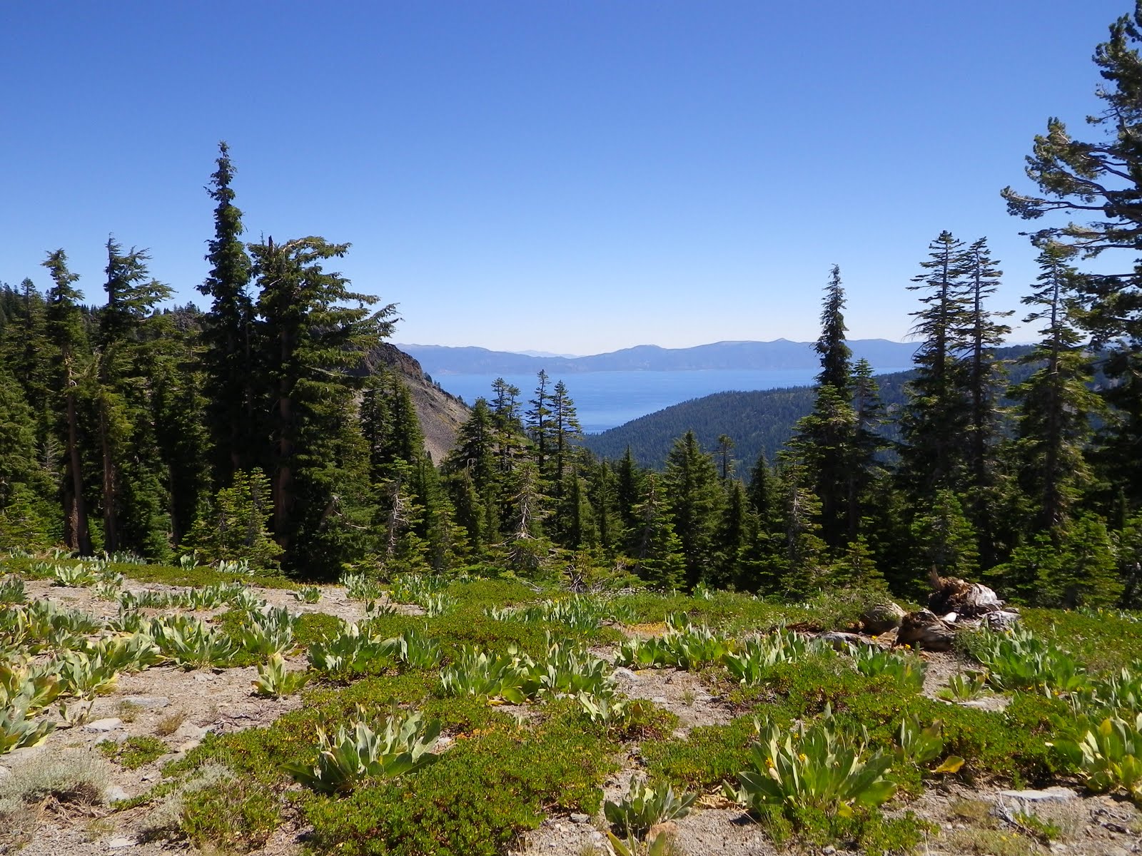
We captured countless views of Lake Tahoe along the way!

Looking up after a recent descent into this "meadow" I realized we had just come from the peak in the distance! Rather gratifying accomplishment! But now we were out of water since our research suggested streams, springs and seeps, and it was a dry year. We needed a stream to refill our bladders and get us through the day and night with enough water for cooking and cleaning up.

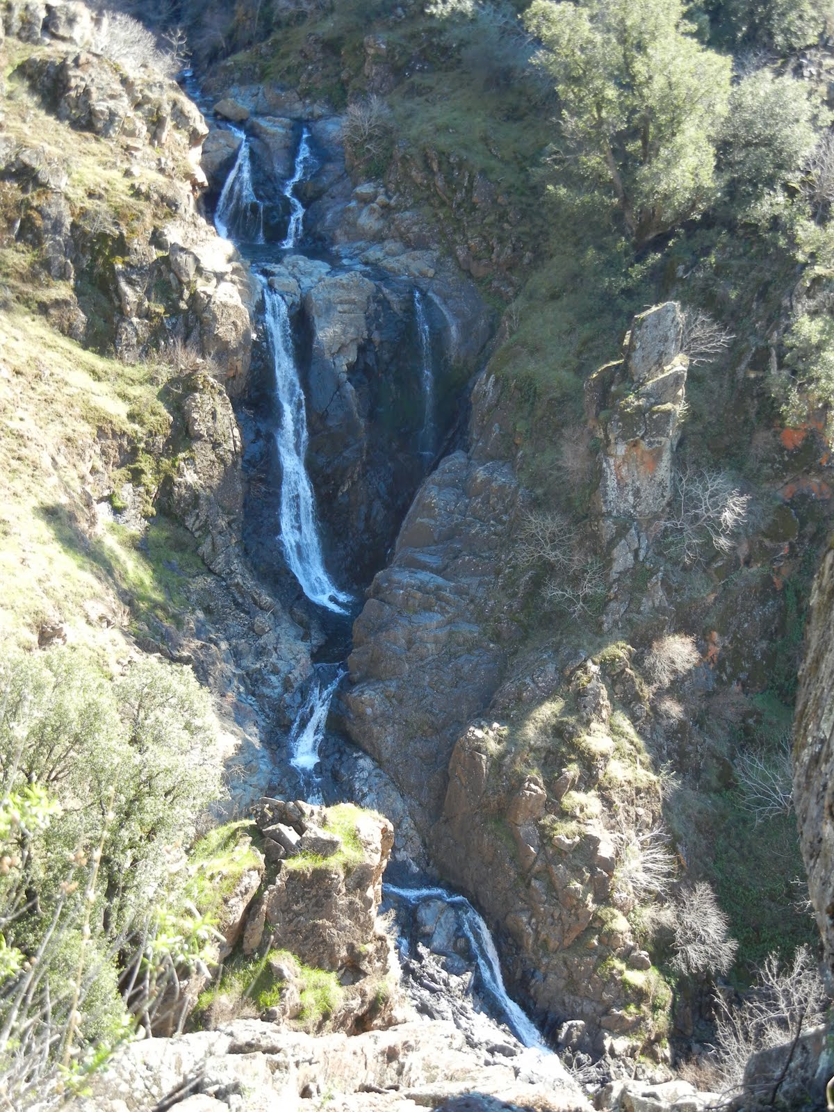
What a relief to find this waterfall. Downhill the stream was right off the trail where we rested and refilled. It was cold as expected and more refreshing than one might imagine! We took a short rest but the mosquitoes were in full force by now so we got a move on! We were heading for Barker Pass to pick up supplies we stashed there and planned to camp a little ways from the parking. Ken was too tired to cook or eat so I made lasagna. I dubbed it "Agent Orange Lasagne" not like real cheesy food, but in an unnatural orange greasy sauce that stained my camping dishes. We set up our tent on the hillside, not picturesque, and slept! There were stickers everywhere, no water available nearby, and nowhere private or flat to set up camp. We were exhausted. We got up early for a long finishing hike!

The trail surface changed fairly frequently and this is the stuff I complain about being hard on my knees and ankles. The shade was nice and the bugs were hunting!

Finally level ground and even ground to hike on! The air was cooling and the shade was a relief but invited those pesky, biting bugs to join us! When we reached Tahoe City we still had to retrieve the other vehicle from the Echo Lakes Trailhead and make it all the way back to Sacramento. Our first 50 miles took us about 3 1/2 days, and we looked forward to finishing the entire loop around the Tahoe Rim.

Starting out Phase Two of the TRT in September, 2010! 115+ miles to go!

Day Four ~13 miles~
Our trip started on Memorial Day. I got up at 6:15 A.M. ~ ouch ~ I knew if I stalled I would wake up to Ken knocking persistently at my door. I did the stereotypical stagger to the coffee pot and waited for fresh brew since we were leaving for up to twelve days of backpacking around one of the seven wonders of the world, Lake Tahoe.
I got ready, but couldn't find my knee support (many backpackers have them and it is practically a dress code item!). I got busy and distracted watering plants, doing dishes, finishing laundry, then taking a shower! Ken arrived and the knee support flew out of my mind, but the plants were watered, the car fully loaded and full of gasoline, and I had had my coffee, and breakfast.
Logisitics: We drove both vehicles to Tahoe and stashed water at Brockway, then parked one car near Ponderosa Ranch Road and returned to Tahoe City in the other car.

What can be said about a hike that is new? Up, down, rocky, hilly, mountains, valleys, meadows and forests, used by hikers, bicyclists, and equestrians. Ken typically announced switch backs, we called out "Uphill!" and "Downhill!" alerts, paused for short breaks and photos.
We took a few more pictures and ended the day at the shallow and mossy Lake Watson (13 miles in). I limped in at 7:25 P.M. We hiked carrying 31-36 pounds each just to end the day near a lake with road access, with campers whose fire smoke blew our way, a chainsaw for background music, and despite all that, we set up our own camp (with no water left). I had a blister under my left big toe again...WHY!?! and my knee needed more support. We climbed into the tent, tired, cold, and not motivated to cook (again) or even hang our bear bag.
On the other hand, I was happy and optimistic that we could finish the 165 miles on this trip; I didn't miss the city.
Day Five
We ate Thai (dehydrated food) for breakfast. I froze! We had coffee with Ken's powdered whole milk concoction that was creamy like the coffee my dad and I used to drink. Mostly milk. My nose ran like it was in a marathon.
The lake was pretty in the morning light, and the setting felt remote with no more chainsaws gnawing away at the woods, as they had last night. We cleaned and packed. It was chilly for me but I knew once we were moving I would feel better. We left camp and my knee felt okay. I resolved to baby it.
Our hike it felt like it was all uphill as we "meandered" up and around and then "descended gently", but oh my knee hated it. We had reached about 8000 feet elevation though! If I had a penny for every rock or boulder I kicked, I would be rich!

Ken, trustworthy data keeper, kept us on schedule with certain time allotments at set intervals for potty breaks, rests, book and map consultations, and the occasional breathtaking panoramic views that we photographed. Almost all seemed to require a little side trip and boulder scramble. At times we could see all of Lake Tahoe and its surrounding mountain ranges with our only regrets being that our cameras could not capture the view as we saw it. You have to be there.
We finally arrived at our water stash at Brockway where dropped our bags, collapsed to the ground, and refilled our bladders. With the leftover water we mixed a batch Emerald Balance Supplement with electrolyte tablets (lemon lime) and drank a toast to finishing that section. During the hike I threw off Ken's military time keeping with some of my antics like potty stops or freezing and needing to add layers. My knee intermittently gave me grief, but overall it was okay.
We caught glimpses of the Lake Tahoe through the trees but that were not so photo friendly, so instead we caught a few candid shots of each other. We met a young couple at the double vista we camped at ~ ranges after ranges of mountains on one side, two lakes, and Lake Tahoe on the other side, to the south.

The wind became loud and threatening------I almost wrote "fierce", but not yet. We set camp on this ridge under the trees in the only flat space visible for a tent, and thank goodness, because it became so cold. We tucked in bed tired and sore. Laugh if you will but I tucked into my 20 degree rated Cats Meow mummy bag wearing 2 layers of long sleeved shirts, my thin windbreaker type jacket, 2 layers of pant liners and a thin pair of light weight fleece pants and thin leg warmers. I had on 2 pairs of hiking socks (wool) and ear muffs and beanie in place. I put on mittens following writing in our journal!
Day Six ~ Snow Coming In ~ to Mt. Rose
We both woke up about hourly, hearing drops hit the tent which we thought could be rain or snow. In the morning, Ken began counting drops of water on the tent! (I told you, DataMan). The morning sun we were accustomed to waking up to wasn't there though. Ken's watch alarm (you know, Ken and timing on these trips) went off as set and we, as usual, procrastinated getting out of our warm sleeping bags and tent. I finally did it and wandered into the woods on a mission. The sky was thickly covered in clouds and I couldn't see much of the vistas we had marveled at the night before. I came back with a weather report and snacked on a protein bar and GORP while Ken ventured out into the cold. Clouds were breaking up so we "snacked" and made plans regarding our hike for the day, with a water source expected at least 7 miles away, if we were fortunate.
Ken announced his infamous, "Chop-chop" so we took photos of the rapidly changing views, then bundled and packed up. Our hike did offer glimpses of Tahoe through the trees.
On occasion we got views of the entire Tahoe Basin. We worked harder than usual and only seemed to be hiking uphill. A few trail segments were composed of the loose rocks we've complained about before. My knee began having those spasms but stretching helped, so they (my knees!) took me reluctantly up
Relay Peak registering at 10,388 feet elevation, the highest we have climbed. I got waves of nausea and had to slow down, but we reached the treeless top just in time for the snow to begin falling on us as we hiked along the saddle!!! We discovered the TRT turned right onto a long rough dirt road, all downhill. It continued to snow, the flakes stung as they pelted my face. The temperatures dropped. At a rusty old building we agreed to pause and layer up. Onward we hiked downhill until the trail took off of the road with a sign pointing .6 miles to Mount Rose Trail Head. The snow continued to fall.
The campground designated for through hikers was CLOSED! We went to the parking lot for the Mount Rose Trail Head and restroom (shelter) to regroup. Also stranded in the weather was a through-cyclist named Jason who was wearing shorts!!! Some time passed and Jason tried to venture out but returned to the shelter; it was too cold to cycle down to town.
 Laura, Ken, the driver, "Care Bear", and Jason as we parted ways.
As we weighed our options, a hippy-type mini motor home pulled in and as it turned out, the couple was returning from Burning Man.
Trail Angels. They brought all 3 of us back to Incline to the truck. We gave Jason and his bike a ride to a motel, then we took the time to move my car to a new site, ate dinner, then enjoyed hot showers! A wonderful laugh ended a bizarre but memorable day!
DAY 7 ~ a 14 mile day~ Tahoe Meadows to Marlett Backpackers Campground
We have hiked over a hundred miles total this trip!
We started at Tahoe Meadows and camped at Marlette Campground for backpackers. The trail was easy but we encountered lots of bicycle traffic. We took photos of Tahoe, each other, and met a few really nice people. The trail was more level with a nice sandy, gravely surface, but solid and easier on our knees and legs. The lake was gorgeous and we marveled at the peaks and ridges we could see on the other side that we had already "bagged". Grasshoppers would jump/ fly across my path, defying gravity and mocking my extraordinary labor toward achieving the next summit!
Marlett had a great bear container, table, campfire ring, at each site, and an abundant wood supply and water pump nearby! Quite novel! It also had a vault toilet and a surround shelter (to use as a changing room we guessed)! We built a small fire (yes, we had our permit on hand), unpacked, ate our dehydrated beef stew and M & Ms, then set up our tent.
My camera batteries were all fading despite my efforts to bring a collection of freshly charged camera batteries and to keep them warm and dry.
Our hearts were full of fun and victory over the successes we have achieved so far!
Day 8 ~also 14+ miles~Marlett to The Bench
Ken got us up early, trying to be a good role-model, calling out "Chop-chop" in a sing-song voice. A large bowl of oatmeal and nuts with Ken's creamy whole dried milk concoction and of course, Ken's famous cowboy coffee awaited me. We got around after a little campfire time and began the day's challenges.
Ken trekked along reviewing all of our mileage, what we have done, can do, might do, could do, and all the numbers related to that (provided by our GPS). Really, we do like to review.
Bicycles were our only grief, especially the one who almost hit Ken head-on because he was traveling at dangerous speeds downhill, around a curve, and did not even offer a small apology! Most cyclists were cordial, a few friendly. We walked and walked and complained about seeing only the Carson side. We missed the pines Tahoe is so well known for.
We had water stashed at Spooner Trail Head and found an odd selection of vault toilets, beautiful picnic table areas, friendly chipmunks, and NO garbage cans or water sources. Weather had befriended us today and on that section we nicknamed some rock outcroppings "Flintstones" or "Dinosaur Poop". Next we passed the already dry Twin Lake after a short picnic of our green powdered concoction meant to provide us with all the things our diet was missing.

Ken mentioned his thighs were sore after this upward 9 mile hike that night. He took Motrin and we ate and hung our bear bags. It was a pleasure to take in all the evening views of Lake Tahoe at sunset, and we kept reviewing how little was left of our 165 mile journey. The hike was long, not so eventful. We were actually a little disappointed at the top of this section after all of the glowing reviews we read describing it as the most "popular" and "spectacular". It was pleasant, but we enjoyed other sections more. We had to camp too far away to take in the sunset from camp and the wind was awfully cold.

That area was more rocky and scrub-brushy than we expected, but off the rim and into the trees our camp was cozy. We looked forward to a hot bath, a massage, regular fresh foods, and "The 165 mile Patch". The day's section of trail was pretty easy for us even though we read it was rated as moderately difficult.
 This was the well known "Bench" reputed to have the most amazing views of the entire Lake Basin. It is a work of art and and excellent place to rest once you have climbed so far.
Day 9 ~7 miles ~ The Bench to Heavenly

Against all of the rules, we ate in the tent. Outside was bitter cold and gloomy! Yes, we had bagged and hung all of our bear-inviting stuff, but once retrieved, the tent made a nice bistro! We went back to the "bench" so I could send a photo to the kids. I also had some blister first aid to take care of, then we packed and set out on our way. I suddenly had an epiphany! I was intensely aware of how empty my hands were and looked ahead to see Ken's were empty too! We had left the trekking poles at camp propped against a tree. We returned and were only thankful we hadn't gone far.

I got tired of eating Ken's dust so I asked to lead for awhile. We picked up the pace and Ken's strategy for avoiding dust was to stay on my heels. We met some day-hikers and cyclists along the way but spared conversation and made GREAT time! We averaged 3 miles an hour all the way! At the end, the glory was seeing the truck (now affectionately known as "The Holy Grail")!
Day 10~ about 9 miles~ Heavenly to Star Lake
We started this hike at Heavenly Ski Resort after we moved our cars and resupplied our backpacks. It began as a fairly steep, sandy, unpleasant, overly civilized trail. Our elevation there was between 7200 and 7300 feet. The day's destination was Star Lake near Freel and Job's Sister peaks. I had an unusually hard time getting a comfortable pace and catching my breath. Ken took some excellent photos including some panoramic collections. The miles were mostly all uphill and included some of those rock or boulder stairs which contributed to my difficulty setting a rhythm; my feet felt as if they were in cement! The trail itself became a nice track with firm forest soil. I could see a "bowl" at the top of the ridges far ahead, and held the secret dread that they surrounded our destination lake...and well, they did. But once we arrived, it was amazing~!
This is my favorite place of all now. It was so far removed from any easy way to get there that no persons were there, but us, when we arrived. Eventually two more backpackers with dogs showed up but were friendly and set camp far enough away for everyone's privacy. (There weren't good "restroom" sites ladies).
We had a campfire ring, and a great flat area for the tent. Fish began jumping early and I am not sure they ever stopped. The view of this lake was serene and yet a windy, stormy atmosphere was moving in. All night the winds buffeted our tent. The water lapped noisily nearby and sometimes I couldn't tell if I heard animals puddling about in the water, or just wind, or what. The temperature quickly and definitely dropped. Our bear bag was carefully hung away from camp, and yes, we followed all of the good sense rules! This was a most memorable and perfect wilderness experience. Only about 35 more miles to go to finish the whole hike! Unbelievable! We had both gotten blisters. By this time, we were anticipating the finish!
 Star Lake
 in the early morning hours

Star Lake before I was even awake!

Day 11 ~14 miles ~ Star Lake to car camp
At times we had far reaching views of summits and ranges on the Nevada side and found much prettier views of the Carson Valley. We climbed into the 9700 foot elevation levels. As we crossed Armstrong we met a friendly group of day hikers, one of whom had completed the TRT, but in day hike sections. Personally I am glad we did the backpacking and camping part of the experience. Again, we got more photos of Lake Tahoe and "meandered" while Ken sang things like the theme from Twilight Zone, and I kept being reminded of the movie "the Groundhog Day" where a reporter got stuck reliving the same day over and over again, though only he was aware of it. The trail turned downhill eventually and my knees were not happy with that change! I had to go slower and we took small breaks too. We crossed 4 or 5 small creeks and a large one. Some came from around rocks and others disappeared into the ground. The day was nice, and perfect for going from sun to shade throughout the day. We passed numerous and interesting changes in terrain and views. There were many large meadows with different vegetation and flowers even in September! One stretch was composed of mainly quartz and we could easily see interesting bits of clear quartz as we walked.
My knees were complaining bitterly but we went off on a side trail to the "backpackers' camp". Unfortunately, unexpectedly, it was
open to cars and was quite full. We found ourselves a campsite, and we had vault toilets,
but not water, as was written on the literature about the camp. It may have changed our decision to hike the extra mileage off the TRT to stop there.
There was an icy creek nearby where we purified our water and froze Ken's hands. After all those miles and my knees causing me to limp, we were exhausted. The benefits were that we had a campfire ring and wood. Our next decision was whether to hike 8+ miles the next day and 8+ miles again the following day or just complete the last 17 in one day. Even with the blisters, and boy I had plenty, this trip has made fond memories and reinforced my love for the back country.

Last Day! Day 12 ~over 17 miles~ to Echo Lake
This hike was rewarding as we encountered many new kinds of environments, including these rock formations I called the "castle rocks". A giant meadow before that was to be enjoyed as it was fairly level and sunny. There were two old buildings off trail, postcard picturesque. Along the way we met several more hikers, and one solo backpacker. There were still glaciers a bit higher than we were and were too far off to visit. One of the meadows was full of wildflowers. Then we hiked around giant outcroppings of boulders, into the trees and got lots of shade. Ken's singing kept me going despite my grumbling knees. We began to have a sense of accomplishment but too, at every downhill, we expected to see the parking lot at the Echo Lake Summit Trail Head, and all we got was more descending or climbing those wonderful carved rock stairs! The guide book was unclear, and every turn was a disappointment since no sign of civilization hinted at completion. Our "Holy Grail", my little car this time, called out to our tired, dirty backpackers' souls to find it! To sit in a cushioned seat! To head home for showers and hot meals and to review our photos and to rest in our own beds. And yes, the moment we saw the parking lot after numerous false alarms, we sang "Looks like we made it" at the tops of our lungs, and took a few photos, including one of us together to compare to our first day (and yes, what a distinct difference).
We are proud to be members of the Tahoe Rim Association and to be members of the 165 Miler Club! It's officially completed and was one of the best hikes I have ever done!
My advice, start reading up, planning and packing and get to it!
with mileage and difficulty ratings, and
these Desolation Wilderness Trails:
|
|
|
|
|
6.8+
|
Strenuous
|
|
|
165
|
|
|
|
9.2
|
Strenuous
|
|
|
10+
|
Strenuous
|
|
|
7.95
|
Strenuous
|
|
|
9.2
|
Strenuous
|
|
|
6+
|
Strenuous
|
|
|
3.8
|
Moderate
|
|
|
3-11
|
Easy to Strenuous and Difficult
|
|
|
10-18+ RT
|
Moderate- Strenuous
|
|
|
10
|
|
Peachy Hiker's Table of Contents


 Look, no hands! Another hint. Watch and listen for rattlesnakes.