Trails in Northern California

Trails in Northern California

Leave No Trace!

Visit desovw.org for more information about Desolation Wilderness. Visit Recreation.gov or call 1- 877-444-6777 to make park reservations. Visit Campfire Permits to get a permit online. More about Leave No Trace principles.

July 08, 2012

Rockbound Trail to Maude Lake in Desolation Wilderness

Maude Lake, a hike up and across granite,
 for a swim, sun, and a fair amount of privacy.


 Maude Lake is the destination for this hike but not necessarily the prettiest view.  You'll find more solitude here with plenty of room for other hikers and picnickers.

For a more current article for this trail, see Rockbound Trail to Maud, Doris, and Lois Lakes.

Distance: 10.1 miles round trip.  You could shave a bit of that off since I went to the opposite side of the lake.
Difficulty:  Moderate, basically due to miles, some elevation gained partly by those stairs of granite!
Elevation range:  6739-7685  feet, up going in and down coming out.
Driving directions:  Take Highway 50 to Wrights (Lake) Road north from the Kyburz area.  The Wrights Lake Road will be between tract 36 and tract 39 along Highway 50.  Follow the signs to Wrights Lake Recreational area.  When you get to the Wrights Lake Welcome Cabin and parking lot on your left, go straight ahead following signs to Rockbound Trailhead.  There is ample parking and a restroom there.  (The trailhead is near the restroom.)
Notes: For day hiking, just fill out a free day use permit at the trailhead.  For backpacking you can get permits online or at a Tahoe or El Dorado National Forest Ranger Station, for a fee.  There are no campfires allowed inside the wilderness boundaries and if you fish, be sure to have your regular fishing license with you.

 
The trail heads into the forest, nice and shady with generous doses of mosquito action you've come to expect!  The trail passes by some pretty and inviting lake views, through some aspens, quite a bit of shady forest, and finally out on less sheltered granite.

 But notice the trees, they are always close enough.


 I find plenty of shady spots for rests and snacks, but even on the granite shade allures the skeeters!

 In July there are plenty of wildflowers cheering the hiker onward and soon to be upward.


There are intermittent forested areas with views of distant peaks that I enjoy using as landmarks of my progress.

I only cross this stream which was shallow on this trip, and easy enough to rock hop across, although water volume can always change, so be prepared.

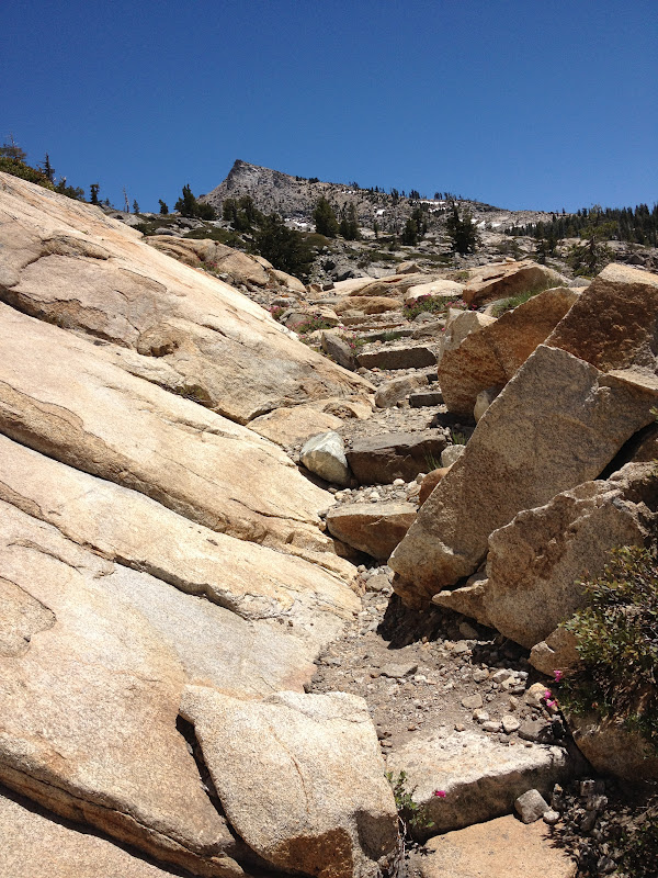
As you can see, the Rockbound Trail across the giant slabs is defined by a row of larger rocks on each side.

Refreshing as it appears, this section through the aspens delights those of us who seek out wildflowers; it also camouflages the ravenous vermin with wings- out to get you, (the dreaded mosquitoes).

 The granite stairs I mentioned will look like this.  Some traverse to make a steeper climb easier.

*** Please avoid using cairns (also known as ducks) as guides for safety reasons.  People have followed them thinking they were placed for guidance but they've often led hikers to random places other than their destination.  If you use cairn building as a guide, you may end up lost because they will be moved or gone when you return.  Look for landscape and use your map, GPS, compass, and landmarks to find your way.

At this point you are entering the higher views with more foliage and realize you must almost be there.  Climb some short traversing "stairs" and amble through low growing shrubs. The rocky trail may seem obscure for a moment or two, but look carefully around and you'll find the stairs and rocks guiding you upward.

Maude Lake!  You have arrived!  There is some land mostly surrounded by water that has nice large rocky areas to sit and picnic on, plenty of shade and sun, and on this day, not so many bugs.  The water is nice rather than snowy cold.  If you follow the trail around the northern side of the lake, there's a large watershed where the trail is built to help hikers stay out of mud using some well designed rock features. 
Local views all around are relaxing and its a secluded, quiet area.  It can be breezy, though refreshingly so.  I would backpack here.  There are some fish, but their dinner time ripples look small.
On my way back I saw this little user trail and needed water for the return hike.  I found this welcome mini-waterfall.  Resupplied, it was time to return rather than risk night hiking.
The views looking back are some little rewards for me, reminders of my hikes up and how close I am to the "holy grail", as my car is affectionately known, at the end of long hiking and trail work days.  My pleasure is an ice chest in my car with food and cold drinks for the ride home (hours for me).

Beauty Lake whispers that I'm almost back, and a little regret of sorts always goes along with my anticipation of completing a destination goal.

Nearing the end,  I'm surprised by a hen gathering her chicks!   


Related Posts
Desolation Wilderness
2015-07
10+ miles
Strenuous
2014-08
30 miles
Moderate to Strenuous/Difficult
2014-07
18 miles
Moderate-Difficult
2014-06
12+ miles
Moderate to Strenuous
2013-06
13+ miles
Moderate to Strenuous
2012-09
Umpa Lake & Enchanted Pools
8+ miles
Cross country ~ Moderate
2012-08
Horsetail Falls via Pyramid Creek TH
Aprox.  10 miles to lakes at the top of the falls
"Difficult, and potentially dangerous" miles
2012-07
10 miles
Moderate
2012-07
8 miles
Moderate-Strenuous
2012-06
Lyons Lake via Lyons Creek Trail
10+ miles
Strenuous
2012-08
9.2 miles
Moderate
2012-06
6+ miles
Strenuous
2011-07
Lyons Creek Trail with melting snow
9+ miles
Moderate
2011-02
3.8 miles
Moderate
2010-09 We hiked 12 days.
167 total
Moderate to Strenuous
Happy Trails!  Thanks for dropping by!

Update links and facts 06-2016

July 03, 2012

University Falls, Quintette, CA

The not so  "fine print" posted AUGUST 14, 2014:  I am editing this post due to controversy regarding use of this area..  
BEFORE ATTEMPTING TO VISIT THIS PLACE: VISIT THIS LINK: All Trails, because there is current, important information. 

 Leave No Trace!

 Check out this Nature's Unbelievable Wonderland Water Slide Park!

RESPECT PRIVATE PROPERTY, OBSERVE LEAVE NO TRACE PRINCIPLES, AND TAKE 

RESPECTFUL AND RESPONSIBLE BEHAVIOR WITH YOU WHEREVER YOU GO.

The photo above is from above the falls in February, 2013.  Since the snow and water level, along with the hour of the day, made photos from below looking up achievable, it was the only decent view I could get.
Part of this trail crosses private property you must gain permission to cross.  At this time the area is closed by forestry research and access is discouraged, if not denied.  
There are some great YouTube videos of these falls and the fun people have there.

As you hike down, you'll see this truck remnant and know you are on the right path.  A good part of the hike is shady enough to help keep your cool.

 As you descend the unbelievably slippery granite to get to the bottom pool, the rope is there to hang on to for added security.

 There is a wooded area after you've crossed the creek that runs above the falls.  Handy "changing room".

 Each slide brings you to land in a pool below it that you swim across to the next natural slide.  CAUTION!  These rocks are genuinely dangerous due to the slippery surface.  People have been seriously injured or killed not taking the hazards here seriously.  It is a very difficult place to get rescued from in the event of injury, so have fun but use good sense!  Avoid the 4th slide.  More accidents happen there and it is harder to get up the hill safely too.

We have arrived to find topless sunbathers so be aware of the possibility!

 I loved this pool for its depth and yet short distance across!  The water is so cold sometimes, and the first time in, I belted out my very first horror-movie-worthy, blood-curdling scream!  It hurt so good! 

Oh ya...for real.

 Our first time here we chose the bottom pool to hang out, sun ourselves, and yes, take a little swim!

 We went with a group on this trip and joined some adventurous kids, soaking and sliding all day.  Lots of types of people were there with families, and kids from around 12 and up taking the slides, even leaping off into the pool below them.

 On a hot day the rocks are the perfect balance to the cold water.

You can hang out in shallow areas and go down a very short slide if you are less than Braveheart!
This is a memorable, fantastic hike with an unusual payoff.  Whenever snow runoff is high the falls will reflect it.  Your tolerance for cold will reach all new lows, and I can't imagine anyone not just LOVING it.

If you get the chance to visit some natural water slides, go for it.  We obviously
 have had some memorable exciting times at these falls.  

For more hikes:
Trails By Locations
Peachy Hiker's Table of Contents

HAPPY TRAILS!

Again, University Falls is a natural wonderland, and the photos reflect how much fun the wilderness has to offer.  There are notes on the internet circulating that the community and the private property owners have had enough abuse of this amazing place. Someone named Ron York contacted me through Google+, whose credibility I could not verify, requesting the page be removed.  I am leaving the article posted for your enjoyment, however I am afraid the days of public fun here may be at an end.  Before trying to visit the falls, check with local authority, forest service, and relevant private property owners.  


Twin Lakes Trail to Island Lake, Desolation Wilderness 2013


There are some amazingly rugged waterfalls and cascades along the creeks,

with especially inviting pools on the way to Island Lake.


Fall colors are vivid contrasts to the granite along the Twin Lakes Trail. 

Taken in Sept. 2012
Miles: Our round trip was 7.95 miles with stops at ponds, lakes, creeks and waterfalls.
Elevation range:  7,000 - 8,120 feet  (3,197 total per Basecamp, Garmin 62s)
Difficulty:   Moderate~Strenuous.  It is uphill, rocky, and around 8 miles.  Some skill is needed to look for and keep on the trail.  Avoid following cairns.  They are often down on your return trip and unreliable.  You never know who placed them or why, or if their destination was the same as yours.  Same idea if you set them up. They could very well be gone on your return trip.  Use the terrain, lakes and creeks as guides to stay found, and GPS, map, and a compass if you can.
Driving Directions:  From Highway 50 near Kyburz, CA turn north onto Wrights Lake Road.  Note that the sign I saw only said "Wrights Road".  Follow the signs passing Lyons Creek Parking, and Bloodsucker Lake parking, on to Twin Lakes Trailhead parking.

To the Trailhead:  From the north side of the parking lot you'll see a closed metal gate.  Go around it and follow the pavement a short distance until you see a sign for the Twin Lakes Trail and Grouse-Hemlock Trail that points to your right.  Follow that and there is a big sign at the trailhead where you need to fill out a day permit, no fees, for entering Desolation Wilderness.  The hike is pretty strenuous up to the fork toward Twin Lakes and Island Lake.  It is rocky and has carved boulder stairs off and on.  It winds through the trees alongside a creek, in and out of the sun.  Once you head north again toward the lakes you'll spend a lot of time on the granite in the sun.

Notes:   Sunscreen and sunglasses are a must.  I suggest packing along a parka or hoodie in case of weather changes.  It tends to be more windy up top too.  Take plenty of water and snacks.  Hiking poles are a fantastic help!  To backpack, you'll need to contact a ranger station or go online to Desolation Wilderness website and get a permit there.  There are minimal fees.  Other regulations or restrictions can be found on that link also.  Fishing there is very popular; be sure to have your license with you.

WILDFLOWERS IN JUNE:  I am no expert but try to name them for the curious. 

Along with wildflowers come moths and butterflies like this beauty, a Field Crescent Butterfly, and this one was camera friendly!

Buckwheat

Lily, the dog is playing in the water behind the Camas Lilies.

Crimson Columbine

Meadow Larkspur

Pink Indian Paintbrush

Monkey Flowers

Small Larkspur


Along the way the views behind you are startlingly clear and distant.
Lily found every pond and creek to play in!
We were looking up along the way to the uppermost lake, Island Lake.
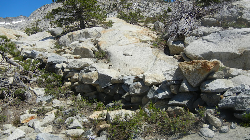
We found the trail fairly easy to follow by looking for landmarks like these rock walls.
Other places were rocky but had a well groomed path leading into sections like this one of well placed rocks, obviously not built by nature, but unobtrusively leading the way.  Desolation Volunteer and his dog hiking to Island Lake.  Volunteers are out on the trails to help visitors, so feel free to approach them.
There were stunted trees along the mostly granite hike on Twin Lakes Trail that 
offered us some shady respites
from the glaring sun.  Wear sunglasses.


The trail over large areas of flat granite slabs were lined with large stones that made it clear enough to follow without doubt.
This is one of several inviting brilliant pools along the way.  They
stood out vividly from the grey acres of granite.
Not so inviting, but very helpful stones placed in the path so hikers
didn't have to slug through the muddy area.
Peachy Hiker (take by me) at Twin Lakes on the west side. My tripod was almost useless
due to the winds up there, but the weather was perfect for this hike.

Boomerang Lake
And finally we reached Island Lake!  The wind up there was pretty cold and swimming wasn't a big option.  It can be though and backpackers have plenty of room to camp at this lake and others along the way.
This was the south side of Island Lake, still snowy in September!
Another lake along the way.
The last part of your return hike will take you back through the woods and shade, and yes, the dreaded carnivorous biting black beasts some kindly call mosquitoes.  Repellent didn't seem to phase them!

Nearing the end of a long day, sunset makes the trailhead picturesque. The parking and restroom will be to your left after you stroll through the cabin area.
This map courtesy of Every Trail shows my GPS tracks and our speed.
GPS tracks of my hike can be found at
Every Trail:
Island Lake in Desolation Wilderness has elevation profile graph too!  But ignore the stated speed.  We were doing trail work along the way.
Island Lake in Desolation Wilderness at Wikiloc.

Related Posts
Desolation Wilderness
2015-07
10+ miles
Strenuous
2014-08
30 miles
Moderate to Strenuous/Difficult
2014-07
18 miles
Moderate-Difficult
2014-06
12+ miles
Moderate to Strenuous
2013-06
13+ miles
Moderate to Strenuous
2012-09
Umpa Lake & Enchanted Pools
8+ miles
Cross country ~ Moderate
2012-08
Horsetail Falls via Pyramid Creek TH
Aprox.  10 miles to lakes at the top of the falls
"Difficult, and potentially dangerous" miles
2012-07
10 miles
Moderate
2012-07
8 miles
Moderate-Strenuous
2012-06
Lyons Lake via Lyons Creek Trail
10+ miles
Strenuous
2012-08
9.2 miles
Moderate
2012-06
6+ miles
Strenuous
2011-07
Lyons Creek Trail with melting snow
9+ miles
Moderate
2011-02
3.8 miles
Moderate
2010-09 We hiked 12 days.
167 total
Moderate to Strenuous
Happy Trails!  Thanks for dropping by!

Updated links and facts, corrected spelling 06-2016


HAPPY TRAILS!
Updated Oct. 2013