Trails in Northern California

Trails in Northern California

Leave No Trace!

Visit desovw.org for more information about Desolation Wilderness. Visit Recreation.gov or call 1- 877-444-6777 to make park reservations. Visit Campfire Permits to get a permit online. More about Leave No Trace principles.
Showing posts with label South Yuba Trails. Show all posts

July 12, 2013

Historic Independence Trail, CA ~ Wheelchair Accessible

Take a hike! Independence Trail near Nevada City is a dirt wheelchair and stroller accessible trail. Then, a waterfall!


DIRECTIONS:  Take Highway 49 north of Nevada City, CA to the parking shown below.  (Estimates are 5-8 miles out of Nevada City.)  South Yuba River State Park manages this area and provides a map online.  From Sacramento allow about 1 1/2 hours each way.
Difficulty:  Easy to moderate based on whether you stay on the main trail or head down to the swimming holes.
The trail is well marked so no GPS tracks are necessary, although sites do have several peoples' tracks loaded.

There are handicapped parking spots marked.

At the trail head, there are wheelchair accessible vault toilets.  Turn to the right for this hike to the waterfalls and swimming holes described in this post.  It will lead you under the highway through a tunnel that is too short to stand upright in. 

I chose to go down this Jones Bar spur on the right to see the creek, river, and swimming holes I have read about.  It is not stroller or wheelchair friendly, but is a great short, although steep hike if you came to picnic and swim.

You might endure a brief hot, sunny, section but most of it is shady on your way down, less than one mile, to the water.

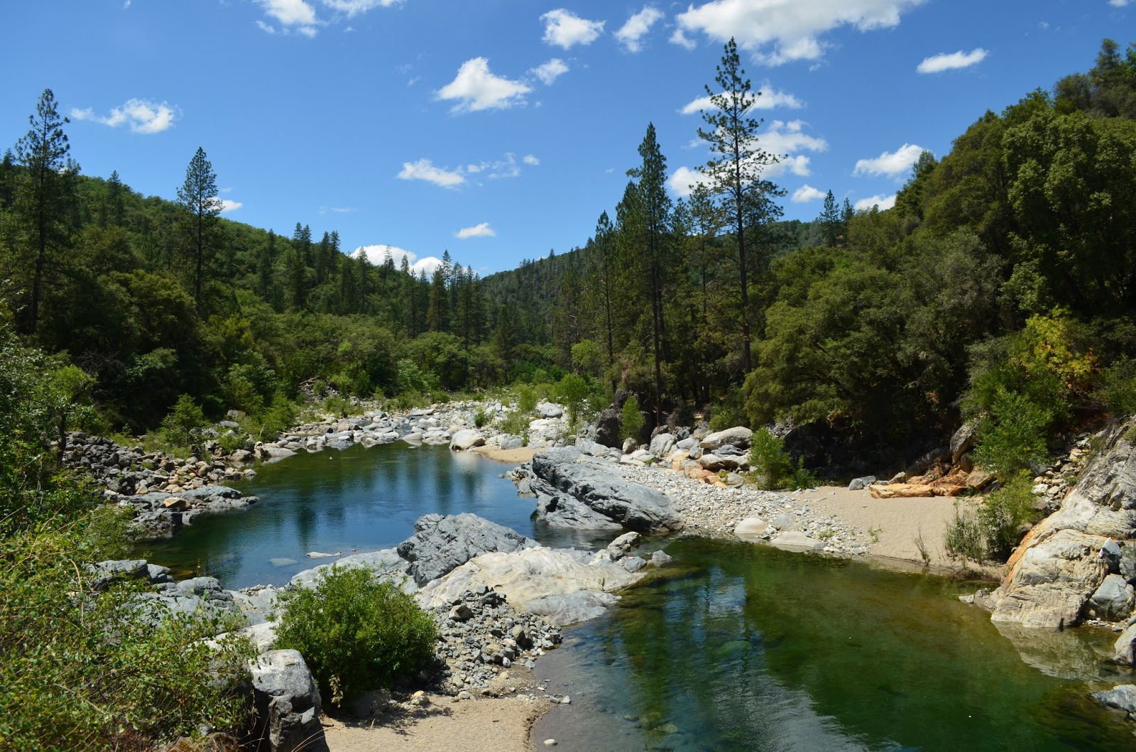
This was my first, disheartening, sight of the water.  Nearly dry this year.

The previous photo was taken from this bridge.  I suggest you cross it (although there is a wide looking trail before the bridge, it is harder to get to the swimming holes from it) then take the trail on your right that is scarcely wider than a deer path.  Trust me.

It forks so take the left option and you will find this entrance to two very large and deep, perfect, adjacent swimming holes.  Do be prepared to avoid poison oak!  All of the warnings expected such as: don't dive from rocks, kids need life vests, no glass containers, and so on apply.

There are some sandy areas and lots of giant rocks to sun on.


 If you either skip the spur mentioned or return to the main trail, you are treated to excellent resting places, all accessible.  In days gone by, restrooms were stationed along the trail with wheelchair accessibility, but they are no longer maintained and are boarded up.

Continue along the trail and flumes.  The trail is mostly divided for strollers and wheelchairs on a lower level along the old flume, and the upper more narrow strip is for hikers.  There are rustic benches along the way too, some with distant views and others are places to take time to breathe in the forest and soak in the peace.

Visitors are soon rewarded with this open view of the flume in a horseshoe shape curving around
the canyon wall. The creek is gurgling pleasantly far below. Some people get squeamish here,
so maybe avoid looking down.  It is all in good repair at this time and you can't fall unless you
climb the rails and topple over. To your left will be a wooden flume traversing the canyon wall down
 to the waterfall and creek.

Small benches to rest on and absorb the views and nature are stationed here and there.  At
the bottom you can refresh with a splash or two from the creek.  And by the way, I met hikers
with dogs, all leashed and picked up after.  It was a pleasant outing for all.

I met Georgie there, a well behaved rescue who you can read about here.

This is part of the Rush Creek Falls that normally drops in a series of cascades,
the longest being a double tier falling 50 feet under the flume bridge overhead.

After a snack, splashes, and rest, I resumed hiking the trail around the bend. 
Often the trees are too tall and thick for views but I took in this gratifying view...

and nearly stepped on....

this wildlife surprise!
I decided to turn back at this point because the trail was less maintained. 

But this lone bright lily stood out!

A small reward for having continued!

This is an out and back trail I highly recommend.

In addition, check out the
Independence Trail Herb Walks
PRE-REGISTRATION REQUIRED: $20 prepaid or $35/both walks, prepaid. $25 at walk if space, but walks limited to 16 people so usually fill. Must pre-register via email, mail or phone; mail payment to secure place. Confirmation and directions 4 days in advance (payment refundable till then). Kids free, but number limited; teens half price. Rain cancels. checks/MO to Kathi Keville at: Oak Valley Herb Farm, PO Box 2482, Nevada City, CA 95959 530-274-3140 www.ahaherb.com HERB WALKS ...a botanical adventure with herbalist and author Kathi Keville.  Her 40+ years of herbal knowledge shines through energetic discussions about their science, lore and edible, medicinal, and other uses, and how to identify, prepare and use them. (You'll receive a plant list.) Trails are short and easy with 40 herbs, and we move slowly! Kathi has been giving walks on these trails for 25 years and they are her favorites! These walks are offered only once a year at peak bloom. Picnic areas if you want to bring lunch for afterwards. Taken from Meetup.com 2014

For more hikes, visit Trails by Locations

HAPPY TRAILS!

Edit: added aprox. driving time from Sacramento 7/6/2015

May 27, 2010

South Yuba Trail, CA


 Our intentions for this hike were to find a trail where we could test ourselves and our equipment, and encounter as little poison oak as possible. We looked for a place not too far away from the Sacramento Valley, and preferably find a loop trail rather than an out and back hike. As we discovered on our Quarry/Western States Trail hike, we like an immediate reward, and something tangible as a destination; for that we are more motivated!
Distance: This trail is estimated to be up to 25 miles each way, and described as strenuous.   I wanted to make it to the Humbug Creek where there are supposed to be several waterfalls upstream. It seemed a reasonable distance, and there would be a primitive campground, so to speak, near there.
My hiking companion had said, "Surprise me!" so I previewed the drive and the beginning of the trail the week before we went.
Difficulty: Strenuous according to internet sources.
Directions: Drive through Nevada City, up Highway 20, turn left on Washington, then drive down the canyon.  Funny but obey the speed limit of 15 miles per hour through the town of Washington. It is barely a wide spot in the road with a few businesses and motel. Beyond town, there is a Y in the road, take the left fork, following the sign to the South Yuba Trail Head. It becomes a rutted, deeply potholed dirt road and again, there is a Y in the road.  Follow the steeper branch downward to the left. At the end is the parking and a bathroom (no plumbing!).


The trail began alongside the river and we, set out going south, full of energy, enthusiasm, and anticipation. We could see up the river canyon and look down on the water. The trail was sometimes only wide enough to plant one foot due to erosion. It climbed to 100-200 feet above the water, and the canyon walls then rose steeply on the right and fell as steeply on the left. I was disappointed that it was too steep to bushwhack downward for cooling rests by the river, and worse yet, if we needed a "potty" break, we were out of luck unless we were prepared to rappel down and climb up using the rope. It was too steep to go off trail safely for any reason.


The river was tantalizingly clear, blue and cool! Once we got to the trees, the noise of the rapids was humming along, but our views were obscured by the trees and brush. I couldn't post enough photos to give the true feel for the place, but there were wildflowers, little runoff mini-waterfalls, and mossy rocks. There was also a thick carpet of quite dry leaves, and with their depth, footing was as bad as a slip 'n slide at at times!


The day was warm and sunny as we passed several small groups of people heading back to the trail head. The trail wound inland some, and the trees and foliage grew thicker, shading the trail, and we were plagued by a fog of little black flying insects. If we breathed with our mouths opened, they could fly in, and one did, in fact, find a nostril to fly into! Gross.


To our disappointment, the trail seemed to continue farther inland away from the river. The rush of the rapids faded as we followed the switchbacks up and down the canyon.


The pleasant surprises were the cool run off creeks and waterfalls with thick foliage that weren't mentioned in the trail descriptions I had read. The temperature felt like it dropped significantly in these areas, not to mention how much we enjoyed the rest stops and photo opportunities!


We caught glimpses of the river, usually through the trees, but every so often we were treated to a long, wide open canyon view.


Most of the way, our breaks were taken at switchbacks. We had to believe we were putting on miles in terms of elevation changes as the trail led up and down, and up and down, and we swore more up than down the canyon walls. We understood where the trail got its designation as "strenuous".


A most definite and joyful discovery was that many creeks crossed the path, and had sturdy bridges for easy crossing at heights we could use to rest our backpacks on.


This was a blooming section of trail, fairly overgrown, but lush and without stickers, nor was poison oak evident.


There weren't many, but wild irises bloomed out of the rock and debris!


After climbing and descending too many switchbacks to have counted, we made our way back to the trail which again ran parallel to the river, but still with steep canyon walls on either side of the trail. We got to a primitive campsite at around 9 miles in. It was getting later in the day, and we decided it was too risky to try to reach Humbug Creek. It seemed necessary to stop, get some food, set up camp, and rest our weary feet, not to mention make time for a soulful, peaceful evening watching the sun go down behind the ridge. We backtracked a mile or so to a sand bank we had seen, and found a place we thought could be access down to the water. Hahha. We ended up sliding on our seats, unintentionally, but made it safely down.  On this tiny beach too close to the water, we set up camp.
My partner woke up during the still of night and found the sand covered with bugs!  No climbing out of the safety of our tent for a midnight stroll!  Eww.


This was our upstream view, and created some nice background sounds!

Below is in the direction of the hillside. Rocky and had dense, bushy poison oak.


As we retraced our steps back toward the car, we didn't encounter another person! The trail was all our own, and more pleasant than the day before. The sounds were all of birds celebrating a Sunday, the constant roaring of the rapids, and of backpackers' footfalls and sometimes heavy breathing!!!


Along the way, these giant ferns overtook the trail fed by a tiny runoff stream; a river of them flowed downward, following the stream. Nowhere else along the trail were there any signs of these giants.


Suddenly, we re-emerged into the sun where things dried up and heated up considerably! We came back to the places where the trail has eroded and was only wide enough for one foot to be planted. Some narrow loose, rocky areas could be hazards also. Watching our steps was a must, because if we fell, it was a long way down, and we were bound to get hurt!
Overall, it was a hike I would do again, more enjoyable than expected, and I would continue on for the Humbug Falls area at least. The poison oak was a deterrent for some, and my hiking partner did get a few patches of it, we guessed from the slide!

I hope you enjoyed our photos and please enjoy your hike!


Peachy Hiker's Table of Contents

Happy Trails!