


The park has seasonal camping and picnic areas on only a first come first serve basis, and along with trails for hikers, a museum for history buffs. As a regional Indian museum, the collection at Chaw'se includes Northern, Central and Southern Miwok, Maidu, Konkow, Monache, Nisenan, Tubatulabal, Washo, and Foothill Yokuts. Examples of tools, basketry, featherwork, arrowheads and more. It is located at 14881 Pine Grove-Volcano Road, Pine Grove, CA.
Showing posts with label hiking. Show all posts
Showing posts with label hiking. Show all posts
June 06, 2013
April 08, 2013
Grizzly Island Wildlife Area
We saw numerous small groups of tule elk, beaver, otter, and signs of coyote, raccoon, and other wildlife, including a variety of birds.
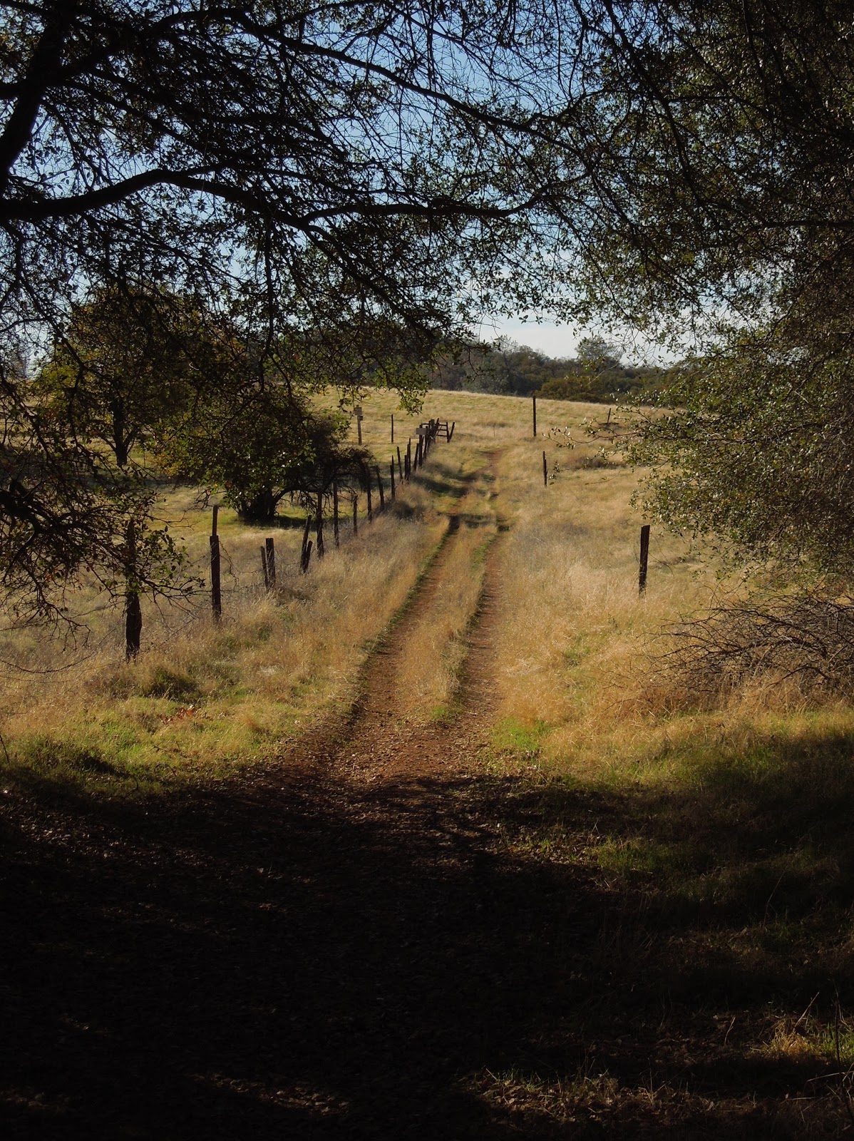
This reserve is not too far from Fairfield. A map is provided to help you manage driving directions.
 |
This reserve has hunting seasons for waterfowl, pheasant, Jr pheasant hunts, rabbit, tule elk, doves and falconry. |
 |
| Cormorants, when they swim you only see their head and neck. Their bodies are submerged! |
 |
| Tule Elk tracks |
 |
| Courtesy of Google Maps |
 |
The acreage is full of endemic species that can only live here. Many are endangeredand protected.The pickle weed is the habitat element the harvest mousecannot live without. It nests there and the plants have adapted to salty marsh by pulling in lots of water, then sending the salt to the tips of their leaves. In the fall they turn reddish colored and drop off, taking the salty residue with them. |

Wild things!

 |
| Otters like this type of area and left tracks and scat (poop). |
 |
| In the distance you see the huge windmills. |

Taking a trail guide book to help you and the kids determine what left the tracks makes a fun discovery adventure. The tracks are often fresh, so it is likely you'll have the joy of viewing critters.
 |
| Animal Tracks |
 |
| Animal Tracks |
 |
| You can park and walk back into these areas along gated dirt roads. Watch out for ticks though! |
 |
| Animal Tracks |
 |
| Animal Tracks |
 |
| People like to fish in this area. Bring the kids and the poles! |
 |
Probably raccoon tracks. We also found rabbit, beaver, coyote, bobcat, otter and elk prints. |
 |
| Using binoculars, going for drives and taking short hikes feel like you have gone back in time. The views are beautiful. Kids will love all of the tracks they can find, and if you don't see wildlife, go slower! The weather is cooler than the Sacramento Valley, and warmer than the beach. |

Happy Trails and Come Again! For more to do, check:
November 08, 2012
Olmstead Knickerbocker Trails
Olmstead Loop is within a network of trails and old roads rambling through miles of rolling hills in Cool, California.
*At the end of this page are details including a map, elevation graph, and data information. You can click on any photo and then view them sequentially, enlarged for more detailed viewing.
Knickerbocker Creek is a lush green, shady area,
pleasant for kids to play in, finding bullfrogs and tadpoles.
The trailhead is located south of Auburn from CA49 coming from I-80, and north of Coloma on CA49 from Highway 50, which you can see on the map at the bottom of this page.
 |
| Check out the acorns stashed in holes in the old fence posts! |
Distance: 3+ miles. On this hike we traveled over 9 miles.
Location: Cool, CA, CA49 near CA193.
Difficulty: Easy to difficult depending on your choices.
 |
| The trails vary from a paved road to old unused dirt roads, trail wide enough for several persons, down to single file. |
 |
| Shade is provided by several species of oak, along with some old walnut trees, pines, and a few cottonwoods. |
 |
| To my delight, we crossed paths with turkeys enjoying the shade. |
 |
Other wildlife you may see include coyotes, skunks, raccoons, deer, hawks, ducks, geese, pheasants, bluebirds and other varieties of smaller birds. I have also met a bear back here, face to face. An acquaintance got bitten by a rattlesnake last year and had to hike out. She was hospitalized for 5 days, so keep your eyes and ears open. |
 |
Poison oak is taller than I knew existed!Look closely at the dry, already leafless branches and stems,in the forefront of the pine tree ~ that's poison oak! |
Above is a closeup of a poison oak stem. It is nubby and looks rubbery. The troublefor you who are allergic: it is easy to miss while leafless. On the bright sideit really doesn't grow into the path on this hike, but is quite healthy alongside it. |

 |
| There are two somewhat seasonal creek crossings and some wet depressions that support cattails. The ground may be soft and muddy but some short wood plank footbridges are installed to help you through. Wear suitable shoes! |
 |
| In the spring this is a popular hiking trail while wildflowers are abundant. Is this a Common Madia relative? In November we still found some very small unidentified purple flowers, yellow thistles, clarkia, larger purple thistles, and poppies. |
 |
| The thistles ruled on this hike in autumn, and displayed sparkling giant fluffs for children to wish on.
|
 |
| You may come across this pond which is host to the birds and wildlife, and has evidence of a rich history. |
 | ||
Beside it are old grinding rocks with deep wells,thankfully shaded in the hot afternoons.
|

 |
| Closer to Cool the wide trail is lined with trees bending over it and shading hikers. |
 |
TRAIL SUMMARY
This set of trails is most excellent for the many options to determine the length of your journey (shown on the map below) and even how much sun or shade to spend your time in. Heading south from the parking takes you across rolling hills brown with dried thistles and grasses. On the west, the loop zigzags through a less generously wooded area. Then it leads you near the top of the canyon wall heavily shaded by pines and oaks, with distant views of the river and canyon far below.
As you descend to the Knickerbocker Creek crossing the moisture in the air is cool and luxurious on a warm day. From there I am told the adventurous can hike down the canyon and see the Knickerbocker Falls. Otherwise, head uphill (some say it gets a little arduous) and turn northeast. The trail returns to sunny rolling hills with distant views to the south and southeast of snowy mountain caps, then runs alongside a charming old walnut grove. Turning toward the east, you'll pass by the photogenic weathered "home" where the trail is wide and well-shaded. The sounds of Highway 49 grow, and once there, there is a trail set off the roadside running parallel to 49 with the firehouse now in sight.
In the winter and after storms, water pools and this trail is known (and loved by some) for becoming deep mud, most appreciated by mountain bikers! Equestrians love the area, too and the parking behind the Cool Fire Station has ample room for large horse trailers.
You can enlarge the map of area trails by clicking on it:

There were also single file trail choices not shown on the map. The very top of the map is where you head north and can connect with the Training Hill. From there it is possible to go to Western States Trail from the bottom of the Training Hill and take it back uphill toward Cool, making an even longer loop. There are signs for these and other options. I have hiked everything I posted on this map, but we hiked 9.14 miles without that TH-WST section.
Here is a map of our hike as described above:


 Click here for my Everytrail GPS tracks
Wikiloc has these trails posted individually by "Clipper Creek Wanderer".
Here is a map of our hike as described above:


Wikiloc has these trails posted individually by "Clipper Creek Wanderer".
Parking and Trailhead Information:
The official parking area is located west of Highway 49 behind the fire station, northwest of the only signalled intersection in Cool, where CA193 meets CA49. (Some people park at the nearby market, southeast of the fire station.)
The parking has state fees now. The Olmstead loop, if you go clockwise, heads out of the southeast side of the equestrian parking area. There is a picnic table in the sun and a vault toilet.
***Check out my Tables of Contents by Titles and Trails by Locations for other trails, topics of interest, and wildflower photos.
HAPPY TRAILS!
Updated 11-14-2012
July 19, 2012
July 2018 updates Grouse Ridge, Donner Area
*If you double click on a photo you can view all of the photos enlarged. At the bottom of this article I am including a map, an elevation profile from my Garmin GPS and a Wikiloc link. Some of my hike to the lakes and ponds shown is off trail.

Sunset my first night there.
Distance: can be as little as one mile (to Milk Lake) and can go for many miles over many days.
Difficulty: Easy to difficult, according to your choice. I would be comfortable taking an outdoorsy child who can hike at least 1/2 mile in and then out. They would enjoy the lakes. It really is not too steep for any length of time. There were some tree falls to climb over and strollers are out of the question.
Driving Directions: Get onto Highway 20 West from Highway 80 west of Donner. Turn right onto Bowman Lake Road, cross the South Fork Yuba River and keep going until you see the sign for Grouse Ridge. Turn right on the forest road that turns to a dirt and gravel road immediately The road had some work done on it so should be in good condition for a dirt road, accessible by car. 6 miles but worth it! July 2018 the road was in good condition, and I drove in my sedan.
You'll arrive at a fork that points to the right for camping with a well kept vault toilet in an actual structure or the fork to the left that leads to a parking area for the trailhead. No running water is available. You can hike a half mile to Downey or Milk Lake or just bring bottled water for camping.
Notes: The area is being renovated so by the time you read this and get there the road will be in better condition. The campground has picnic tables, fire pits, and some nice flat tent areas. Check on hunting season dates before you go. (Deer hunting in the fall).
Weather: forecast here

Amusing. Not much better than the road. July 2018 the trailhead sign is repaired.


The following photos were taken along the path heading east along Glacier Lake Trail. Within a short distance there are lakes, ponds, meadows, pine forest, willows, and granite bowls and outcroppings. I enjoyed plenty of shade and the trail is in good condition. Off trail you bushwhack but get to see a variety of landscapes and enjoy a true wilderness experience.

 |
| The size of a pencil eraser, one of countless flowers in bloom right now. |

 |
| The cattle eyed me suspiciously and began calling to each other and clanging their bells! |


Not sure of possible bacteria, I did purify water from these sources.


GPS link, click here.
 |
| You can print the map and it is a handy pocket size to keep with you on the trail. |
Carr Feeley Trailhead and Backpackers Camp will give you more information about the area and another map of trails northwest of the Grouse Ridge. From there you use the Twin Lakes Trail or Round Lake Trail.
Crooked Lakes Trail Survivor Night describes an unexpected storm, hiking hazards and solutions. A true account with a happy ending.
Peachy Hiker's Table of Contents
Thank you for stopping by and Happy Trails!
Road conditions updated 5-13-2014
Updated July 018: map note, trailhead sign, removal of truck, added weather link,and current road conditions.
Updated July 018: map note, trailhead sign, removal of truck, added weather link,and current road conditions.
Subscribe to:
Posts (Atom)