Trails in Northern California

Trails in Northern California

Leave No Trace!

Visit desovw.org for more information about Desolation Wilderness. Visit Recreation.gov or call 1- 877-444-6777 to make park reservations. Visit Campfire Permits to get a permit online. More about Leave No Trace principles.
Showing posts with label Island Lake. Show all posts

July 03, 2014

2018 Crooked Lakes Trail at Grouse Ridge CA

This was my grandson's second backpacking trip to this area.

Crooked Lakes Trail offers trail use for hikers, backpackers, equestrians, mountain cyclists, fishermen, seasonal hunters, and has excellent opportunities for outdoors activities for youngsters.


July 2018 update:  The weather was variable, warm, cold and windy, and rained most of one day.  Check for weather forecasts and go there prepared for unexpected changes that are common in this area.  On this trip there were no pesky flies at any of the many lakes we visited as were noted below.  Mosquitoes were there but not a high number. There were no more of the biting orange beetles mentioned in the article either, thank goodness. The trail to Milk Lake is more adequately marked than on our last trip, and for my 9 year old grandson's first backpacking trip, we camped there. Expect to see some kids as I do on every hike there, making a great family destination.
The forestry link is here.  
Distance: can be as little as one mile and can go for many miles over many days.
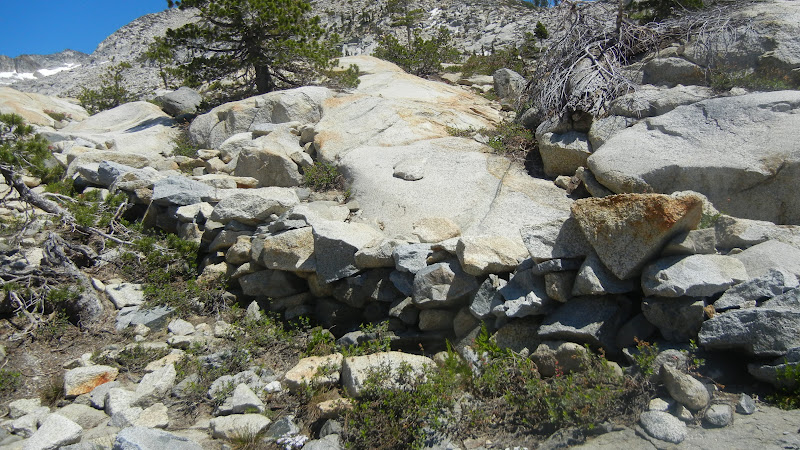
Difficulty:  Easy to difficult, according to your choice.  I would be comfortable taking an outdoorsy child who can hike at least 1/2 mile in and then out. They would enjoy the lakes. It really is not too steep for any length of time.  There were some tree falls to climb over or go around, and strollers are out of the question. We always meet people with kids here and it is an excellent place for backpacking with youngsters.
Weather: For forecasts click here.
Driving Directions:  Get onto Highway 20 West from Highway 80 west of Donner.  Turn right onto Bowman Lake Road, cross the South Fork Yuba River and keep going until you see the sign for Grouse Ridge.  Turn right on the forest road NF-17 which turns to a dirt and gravel road immediately.  When there are offshoots, just follow the road to the right.  It gets quite tricky just before you reach the parking.  There is a parking circle carved out on your right just before the original shaded parking area at the trailheads that will just extend your hike a little bit.  I drove my car successfully in.  The top parking is nice and shady.  
Note:  There are fees to pay at the trail head for using the backpackers campground facilities, but not if you backpack beyond it and camp near other lakes.  There are a countless number of sites throughout the area, but no restrooms beyond Carr-Feeley.  Fire permits are required, although there are currently fire restrictions, so check the Tahoe National Forest link provided at the end of this article before your trip.  Get your permit here: Fire permits
For a pocket map of the area, Right click on the image, Save image as....name it, and choose the location to keep it on your device.  Now you can print it as an 8 1/2" by 11" guide to take along. With all the lakes and trails at this location, it can come in handy.
This time, we arrived during a small heat wave! There were many day hikers and a few backpackers. Our camp site was along the west shore of Island Lake with good water access.  We didn't use our tent's rainfly, and sleeping bags weren't really necessary since the nights were very warm.
We discovered numerous sites along all but a few small unnamed lakes.
This campsite on the north side of the unnamed lake west of Island Lake has some nice flat tent sites nearby, is far enough from the lake, but clearly has a hazardous fire ring setup.  We chose a sunny site thinking it would be nice not to wait for morning dew to dry before packing up camp, but in this hot weather, shade like this might have been best.
There are trout and catfish in Island Lake and some surrounding lakes, although we didn't see anything large.  Only a few fish were observed feeding at sunset.
The local views of the lakes were satisfying at the end of our active days.  
There were some orange beetles (not ladybugs) voraciously biting our lower legs and feet, leaving itchy red bumps to remain for days.  Mosquitoes stayed until breezes kicked in, but the worst offenders were large black flies buzzing around our heads tapping our hair frequently, and I mean persistently.  Hikers we met reported them at other lakes they visited on this journey.  Breezes affected only the mosquito activities.
Our trip was enjoyable with weather perfect for swimming, fishing, and bonuses of viewing two eagles doing their own fishing.

FIRE RESTRICTIONS ARE IN EFFECT for Tahoe National Forest.  Get your permit here: Fire permits to use backpacker stoves and check any new restrictions.

For more tidbits of helpful information from previous trips in various weather conditions check out these posts:

Carr Feeley Trailhead and Backpackers Camp will give you more information about the area and another map of trails northwest of the Grouse Ridge. From there you use the Twin Lakes Trail or Round Lake Trail.
Crooked Lakes Trail Survivor Night describes an unexpected storm, hiking hazards and solutions. A true account with a happy ending.

Happy Trails!
July 2014

July 03, 2012

Twin Lakes Trail to Island Lake, Desolation Wilderness 2013


There are some amazingly rugged waterfalls and cascades along the creeks,

with especially inviting pools on the way to Island Lake.


Fall colors are vivid contrasts to the granite along the Twin Lakes Trail. 

Taken in Sept. 2012
Miles: Our round trip was 7.95 miles with stops at ponds, lakes, creeks and waterfalls.
Elevation range:  7,000 - 8,120 feet  (3,197 total per Basecamp, Garmin 62s)
Difficulty:   Moderate~Strenuous.  It is uphill, rocky, and around 8 miles.  Some skill is needed to look for and keep on the trail.  Avoid following cairns.  They are often down on your return trip and unreliable.  You never know who placed them or why, or if their destination was the same as yours.  Same idea if you set them up. They could very well be gone on your return trip.  Use the terrain, lakes and creeks as guides to stay found, and GPS, map, and a compass if you can.
Driving Directions:  From Highway 50 near Kyburz, CA turn north onto Wrights Lake Road.  Note that the sign I saw only said "Wrights Road".  Follow the signs passing Lyons Creek Parking, and Bloodsucker Lake parking, on to Twin Lakes Trailhead parking.

To the Trailhead:  From the north side of the parking lot you'll see a closed metal gate.  Go around it and follow the pavement a short distance until you see a sign for the Twin Lakes Trail and Grouse-Hemlock Trail that points to your right.  Follow that and there is a big sign at the trailhead where you need to fill out a day permit, no fees, for entering Desolation Wilderness.  The hike is pretty strenuous up to the fork toward Twin Lakes and Island Lake.  It is rocky and has carved boulder stairs off and on.  It winds through the trees alongside a creek, in and out of the sun.  Once you head north again toward the lakes you'll spend a lot of time on the granite in the sun.

Notes:   Sunscreen and sunglasses are a must.  I suggest packing along a parka or hoodie in case of weather changes.  It tends to be more windy up top too.  Take plenty of water and snacks.  Hiking poles are a fantastic help!  To backpack, you'll need to contact a ranger station or go online to Desolation Wilderness website and get a permit there.  There are minimal fees.  Other regulations or restrictions can be found on that link also.  Fishing there is very popular; be sure to have your license with you.

WILDFLOWERS IN JUNE:  I am no expert but try to name them for the curious. 

Along with wildflowers come moths and butterflies like this beauty, a Field Crescent Butterfly, and this one was camera friendly!

Buckwheat

Lily, the dog is playing in the water behind the Camas Lilies.

Crimson Columbine

Meadow Larkspur

Pink Indian Paintbrush

Monkey Flowers

Small Larkspur


Along the way the views behind you are startlingly clear and distant.
Lily found every pond and creek to play in!
We were looking up along the way to the uppermost lake, Island Lake.
We found the trail fairly easy to follow by looking for landmarks like these rock walls.
Other places were rocky but had a well groomed path leading into sections like this one of well placed rocks, obviously not built by nature, but unobtrusively leading the way.  Desolation Volunteer and his dog hiking to Island Lake.  Volunteers are out on the trails to help visitors, so feel free to approach them.
There were stunted trees along the mostly granite hike on Twin Lakes Trail that 
offered us some shady respites
from the glaring sun.  Wear sunglasses.


The trail over large areas of flat granite slabs were lined with large stones that made it clear enough to follow without doubt.
This is one of several inviting brilliant pools along the way.  They
stood out vividly from the grey acres of granite.
Not so inviting, but very helpful stones placed in the path so hikers
didn't have to slug through the muddy area.
Peachy Hiker (take by me) at Twin Lakes on the west side. My tripod was almost useless
due to the winds up there, but the weather was perfect for this hike.

Boomerang Lake
And finally we reached Island Lake!  The wind up there was pretty cold and swimming wasn't a big option.  It can be though and backpackers have plenty of room to camp at this lake and others along the way.
This was the south side of Island Lake, still snowy in September!
Another lake along the way.
The last part of your return hike will take you back through the woods and shade, and yes, the dreaded carnivorous biting black beasts some kindly call mosquitoes.  Repellent didn't seem to phase them!

Nearing the end of a long day, sunset makes the trailhead picturesque. The parking and restroom will be to your left after you stroll through the cabin area.
This map courtesy of Every Trail shows my GPS tracks and our speed.
GPS tracks of my hike can be found at
Every Trail:
Island Lake in Desolation Wilderness has elevation profile graph too!  But ignore the stated speed.  We were doing trail work along the way.
Island Lake in Desolation Wilderness at Wikiloc.

Related Posts
Desolation Wilderness
2015-07
10+ miles
Strenuous
2014-08
30 miles
Moderate to Strenuous/Difficult
2014-07
18 miles
Moderate-Difficult
2014-06
12+ miles
Moderate to Strenuous
2013-06
13+ miles
Moderate to Strenuous
2012-09
Umpa Lake & Enchanted Pools
8+ miles
Cross country ~ Moderate
2012-08
Horsetail Falls via Pyramid Creek TH
Aprox.  10 miles to lakes at the top of the falls
"Difficult, and potentially dangerous" miles
2012-07
10 miles
Moderate
2012-07
8 miles
Moderate-Strenuous
2012-06
Lyons Lake via Lyons Creek Trail
10+ miles
Strenuous
2012-08
9.2 miles
Moderate
2012-06
6+ miles
Strenuous
2011-07
Lyons Creek Trail with melting snow
9+ miles
Moderate
2011-02
3.8 miles
Moderate
2010-09 We hiked 12 days.
167 total
Moderate to Strenuous
Happy Trails!  Thanks for dropping by!

Updated links and facts, corrected spelling 06-2016


HAPPY TRAILS!
Updated Oct. 2013