Trails in Northern California

Trails in Northern California

Leave No Trace!

Visit desovw.org for more information about Desolation Wilderness. Visit Recreation.gov or call 1- 877-444-6777 to make park reservations. Visit Campfire Permits to get a permit online. More about Leave No Trace principles.
Showing posts with label El Dorado National Forest hikes. Show all posts

June 02, 2016

Rock Creek Falls and One Eye Creek Trail 2016

Rock Creek Falls is reported to be 100 feet across at times
Rock Creek Falls in May 2016

MILES: 6-7 miles
DIFFICULTY:  Moderate
ADVISORIES:  Poison Oak is everywhere!  The trail is steep, sometimes wet and slippery.

This marks the place you will either park or turn right and park at a junction of three roads.
 DIRECTIONS: 


1.      Take Highway 193 from Highway 49 toward Georgetown, California.

2.      If you are coming from Highway 50, turn right on Traverse Creek Road, or from Highway 80, turn left on Traverse Creek Road.

3.      Take Bear Creek Road to the right and pass Bear Creek Picnic area on the right (although this is a good place to stop and use restrooms since there aren't any at the trailhead).

4.      Continue for 0.7 miles to Forest Service Road 12N81 on the right, visible due to park signs posted.

5.      In winter park in the wide area on your left, and walk straight down the Forest Service Road until you come to the junction of three roads. In months the road is open you can drive back and park along here.

6.      Walk straight ahead and you will see a small post on your slight right at the One Eye Creek trailhead. Follow this trail all the way to the falls.

 At the beginning of the trail, there was scrub brush on either side, but the trail itself was clear and wouldn't be confused with animal trails. At one point it opened out into a small sunny meadow, but most of the area had manzanita and other brush.

Early on One Eye Creek Trail, these stickery bushes and vines had grown over the trail and caught on our backs and backpacks which made them a nuisance. The terrain is hilly and not too steep for any length of time until you descend to the creek and waterfalls. There was less poison oak in that area, except where the sun had more access to the trail. In May wildflowers were blooming.

A nice shady section is a tunnel.
And next is the most wild of all, the seeming meadow that when you look closely, you discover it is mostly poison oak!

About a mile into the trail you come to the "mine" shown below which is actually only a few feet deep, but a trail hazard that is fenced in with a small trail down the hill for hikers to see in.

The rolling trail finally opened up into this beautiful, cooler forest area that goes until you traverse downward to the creek.  Keep in mind it is deceiving because you are heading downward and on your return you will be heading upward, though slightly, you feel it.
.
After hiking all the way in, we had to bushwhack a little, but this time wasn't too bad.

 Going in we hiked the steady downhill and fairly easy trail. From about a mile away from the creek, we began to hear the waterfalls! As we made our way closer, the trail got steeper, and the pine needles were thickly layered and are sometimes slippery. Hiking poles and good shoes helped me navigate this section more safely.


 This section of trail could be dangerous due to steep slippery hills.  It makes having inexperienced hikers, inadequate equipment, or having children present inadvisable.  Lat/Long:38.82396, -120.759

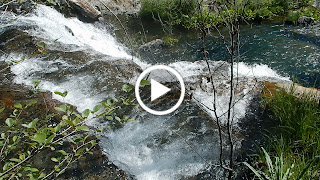
It has been reported that the falls have been as much as 100 feet wide in flood stage. Here, there was a powerful current and as you can see, a large stretch of the 100 feet was, in fact, covered. The falls have also been estimated to be only a 25 foot drop, but with the current rushing almost violently, they were quite impressive!  To get to the bottom you had to creek cross and then climb down.  Others were there so we stayed up top beside the creek.

Our picnic spot along Bear Creek.
On our way out, we had to travel upward, and it felt steep and challenging in the wet, and especially with the weight of a backpack. Hiking poles really helped me there, too!


 Another alert: If you sat anywhere along the trail, it was on the damp ground with pine needles or poison oak! We also noted ticks, so check yourselves when you get out and wash all of your gear.

For fun here are some photos of wildflowers that were blooming:


This was a very worthwhile hike! On this trail, I have never met other hikers until this trip, when only two guys passed us, suggesting it gets little traffic, but the trail was in overall adequate condition. The views were memorable, and the trail was well marked. It isn't for the casual city hiker, due to the length and the difficulty near the falls. The elevation changes also required fitness, and being accustomed to ups and downs. Take some food, wear good hiking shoes with deep tread, and maybe take something dry to sit on in case it’s wet. Again, my hiking poles were helpful, especially on the climb out of the creek canyon. I wouldn't advise taking kids due to length, safety and difficulty level, until you have done the hike yourself and can make your own judgment about their abilities. Don't forget the camera!

The closest hikes you may also be interested in:
2010-06
3 miles
Difficult
2014-06
Stifle Claim Trail (Traverse Botanical Special Interest Area)
0+ miles
Easy +
2010-04
7 miles with closed road, 6 when it is opened
Moderate

or see the Table of Contents.

August 24, 2014

McConnell Lake Loop ~ Primitive Trail ~ in Desolation Wilderness

Unmaintained, "PRIMITIVE",
marked only with cairns*,
the McConnell Lake Trail helps you find
 numerous lakes hidden in the 
depths of Desolation Wilderness.  


We walked 15 miles hiking to (and searching for) the
rugged McConnell Lake Trail and visited 9 lakes.

This link has an interactive topo map of the lakes you will travel by on this reportedly 8 1/2 mile loop. The trail it shows appears to be hand drawn and is not an exact representation of the trail. We hiked about 15 miles following cairns* across granite, across streams, through woods, and hiking through vegetation with a barely visible, or invisible, trail. If you go now, I do not recommend you follow ANY cairns! According to information taken from my Tom Harrison topo map the trail is closer to 10.5 miles. This is a snapshot of the online interactive map, but please use the link to use the interactive version of this map.


Location:  Desolation Wilderness near Wrights Lake Recreation Area, CA, USA.
Distance:  It can be done in less than 30 miles round trip including the hike from the TH and back.  It is recommended backpackers first hike in to Lois or Schmidell Lake, via Rockbound Trail, then get a fresh start the next day. Schmidell Lake is 8.5 miles, depending on your rest stops and side trips along the way.  From there it will be no less than 8.5 miles to do the loop, conservatively since every hiker we met reported having trouble keeping on the trail and spent extra time and miles finding it.  Cross country side trips are available over to Zitella and Highland Lakes (which we didn't opt for).  We recommend allowing at least two or three days, and to backpack the loop rather than day hiking it unless you are traveling with someone who is familiar with the trail.
Difficulty:  Strenuous and difficult.  It requires fitness, skills in using maps, confidence in back country hiking, having exceptional trail finding skills, being comfortable doing cross country hiking, and being prepared for rapidly changing weather conditions common to this area. The terrain varies from loose rocks, giant slabs of steep granite, thick vegetation, creek crossings, (one easy log crossing) through forest, through mountain meadows, and steep "rock stairs" down into Leland Lakes (or up if you do the loop counter clockwise).  It is also recommended you be prepared for a workout at elevation where the air is thinner, and more tiring.
Driving directions will be posted at the bottom of this post.


View of Schmidell Lake from the trail to Leland lakes.


Leaving the Schmidell Lake basin to Lois Lake.


View of inclement weather that set in when we were at Doris Lakes.


Warning that the trail is difficult, and stock are not able to travel it.

McConnell Lake itself is small and grassy.

We paused here searching for the trail down to the junction with Blakely Trail to get back to Schmidell Lake.


Granite slopes between Horseshoe Lake and the 4-Q Lakes.  I wish you could see the
granite in 3-D for a better understanding of the steep hike down it.

Areas with vegetation are not maintained so they are overgrown and look like deer paths. 


Another view of the steep granite we had to negotiate to get down to 4 Q Lakes.

A 4-Q Lake

A 4 Q Lake, nice swimming hole, the first going clockwise around the loop.


Horseshoe Lake was grassy and we opted not to even filter water here.


In Nov. 2015 I came across this discussion: "... I'm one of the USFS Desolation Wilderness managers and recently hiked the McConnell Loop this summer and removed every cairn that I came across on the trail. Wilderness for most visitors is about discovering and exploring, not only the challenges and beauty our wild land has to offer, but about how we as visitors travel in it. Seeing sign of other people's passing is not enjoyable or acceptable. We as Wilderness rangers enforce the code of federal regulations and there is a CFR for removing or disturbing any natural feature in a federaly protected Wildernes area. Placing rock cairns along system trails is unnecessary and a blight on the land and against the CFR's .
Our trails are maintained to their designated standard as detailed in our Wilderness plan. The McDonnell loop is a remote trail that is in one of the more isolated areas of the Wilderness and is maintained accordingly to preserve it's Wilderness character.
Rock cairns are finding their way into camping and vista areas in the Wilderness and are becoming an increasing problem.
The stacking and placing of these rocks can become a safety issue when they are used to create shortcuts off of our trails.
Take the time when hiking and look ahead of you, there are subtle signs of where the trail is.
Enjoy your hike!

Jon Erickson
Desation Wilderness Manager
USFS"

With cairns this trail was a challenge and took us hours to follow.  Your map finding skills ARE ESSENTIAL!  This edit was made in November of 2015.  Happy Trails!

  • Early in the season (May- June, please check out road conditions before you go.  In June 2016 there are snow drifts crossing the road before the intersection with Ice House Road.)

Driving directions:  Take Highway 50 to Wrights (Lake) Road north from the Kyburz area. The Wrights Lake Road will be between Tract 36  and Tract 39 along Highway 50.  Follow the signs to Wrights Lake Recreational area.  When you get to the Wrights Lake Welcome Cabin and parking lot on your left, go straight ahead following signs to Rockbound Trailhead.  There is ample parking and a restroom there.  (The trailhead is near the restroom.)
Notes: For backpacking you can get permits online or at a Tahoe or El Dorado National Forest Ranger Station, for a fee.  There are no campfires allowed inside the wilderness boundaries and if you fish, be sure to have your regular fishing license with you.  Fire permits are still required to use camp stoves.

Happy Trails!

Related Posts you might be interested in for nearby trails:

Desolation Wilderness
2015-07
10+ miles
Strenuous
2014-08
30 miles
Moderate to Strenuous/Difficult
2014-07
18 miles
Moderate-Difficult
2014-06
12+ miles
Moderate to Strenuous
2013-06
13+ miles
Moderate to Strenuous
2012-09
Umpa Lake & Enchanted Pools
8+ miles
Cross country ~ Moderate
2012-08
Horsetail Falls via Pyramid Creek TH
Aprox.  10 miles to lakes at the top of the falls
"Difficult, and potentially dangerous" miles
2012-07
10 miles
Moderate
2012-07
8 miles
Moderate-Strenuous
2012-06
Lyons Lake via Lyons Creek Trail
10+ miles
Strenuous
2012-08
9.2 miles
Moderate
2012-06
6+ miles
Strenuous
2011-07
Lyons Creek Trail with melting snow
9+ miles
Moderate
2011-02
3.8 miles
Moderate
2010-09 We hiked 12 days.
167 total
Moderate to Strenuous

See the Full Table of Contents.
Added updated links and Table of Contents 06-2016

August 11, 2013

Silver Lake, Hidden Lake, Granite Lake, & Amy Lake

We backpacked this moderate loop but spent our first night in the Silver Lake Campground.  It cost over $20/night.  The hosts were friendly, warm, and helpful.  There are vault toilets, firewood for sale, and each site had flat tent areas and well positioned fire rings.  There are short trails from the campground over to various lake areas.

One of Silver Lake's islands; have you been anyplace more idyllic?  I imagined meeting Tom Sawyer wading out to the boat.

Pastures a few miles from Silver Lake.  Horses grazed as lazily as the clouds that floated overhead.

 The jagged cliffs overlooking the Silver Lake basin.  As the sun rose and fell the cliffs took on dramatic shadows and depths. 
 
 Silver Lake in the evening.  The area is a mixture of mountain meadows, granite slabs to cross, and pine forests to meander through.  You'll find a variety of geological features.
 
 The brown in the skies was from a recent fire in San Joaquin.
 
 Another beautiful island that you can swim or paddle to near the campground.
 

 Granite Lake is large and a better place camp than other lakes we passed.  The water was less grassy and it is deeper so a swim is possible.
 
This is my least favorite.  It is surrounded by old cattle droppings and moss grows on the water.  More later.

 There are rental horseback riding stables, and a camping area that is set up for visitors with horses.
 
 Silver Lake came into view.
 
 The bugs were thick on the entire Amy Lake.  It is shallow and muddy, unsuitable for swimming.  There are fire rings around the lake, but it really looked unappealing to me since the water might be difficult to purify and filter, too.
 
 Amy Lake, okay, this one view of it is pretty.
 
 Wildflowers were at eye level and in full bloom!
 
 This trail is mostly well maintained and other than distance, if you do our loop, it is fairly easy.  On the flip side, there are numerous trails that break away from Hidden Lake Trail and head to Silver Lake for a swim, and maybe a shorter hike.  There are more fire ring sites to be found, too.
 
 We apparently took a turn that got us off-trail so we crossed the fallen tree (over a stream) to return to the correct trail.
 
 As you can see, there are plenty of hiking options, and Plasse Resort would also be a good starting point.  Note that if you enter Mokelumne Wilderness, you need to have obtained permits ahead of your hike.
 
 This was taken from Plasse parking.  There is a nearby boat ramp for Silver Lake. There are water faucets and picnic tables near the creek and "Shanty Town".  It is a trailer type park and next to it are campsites with small horse enclosures for the equestrian crowd.
 
Silver Lake at sunrise. 
We camped near Treasure Island without a campfire ring, off the trail.  Bears are common so we did hang our supplies in nearby trees.  The campgrounds have nice large metal "bear proof" storages in each site.  For reserving sites, I liked the ones along the creek which have a pleasant sound, and I avoided pond-side sites.  Mosquitoes like those sites!  There are sites for two vehicles parked side by side, for an extra fee.
 
To Plasse
 
East of CA88 is the campground we enjoyed.  We camped on the side closer to 88.  To get to the trailhead we drove along Kit Carson Road to the dirt parking.  (There is a fork in the road, go left.)


Driving Directions:
From Sacramento,
Take Highway 50E towards Lake Tahoe.
Take the Sly Park Exit.
Turn left on NF-5 Northern Emigrant Trail. Drive 24.6 miles.
Turn left on CA88.
Follow the signs to either Plasse Resort or to Silver Lake Campground for a great basecamp.  We chose the campground to the north of the lake, but there is another one across CA88 also.
This takes about 2 hours from Sacramento.

Silver Lake Campground
We drove through the cabin "neighborhood" along the west side of the lake to the road's end where there was ample free parking at the trailhead.  We started our hike by passing the green gate (locked) and following the old road for a short distance where we broke away from the road then walked through the old girls camp.

ASAP I will post our map and GPS tracks for you.

Happy Trails, and if you feel like finding more trails, check out Trails By Locations.