Trails in Northern California

Trails in Northern California

Leave No Trace!

Visit desovw.org for more information about Desolation Wilderness. Visit Recreation.gov or call 1- 877-444-6777 to make park reservations. Visit Campfire Permits to get a permit online. More about Leave No Trace principles.
Showing posts with label backpacking trail. Show all posts

June 29, 2014

Lyons Creek Trail to Lake Sylvia-June 2014

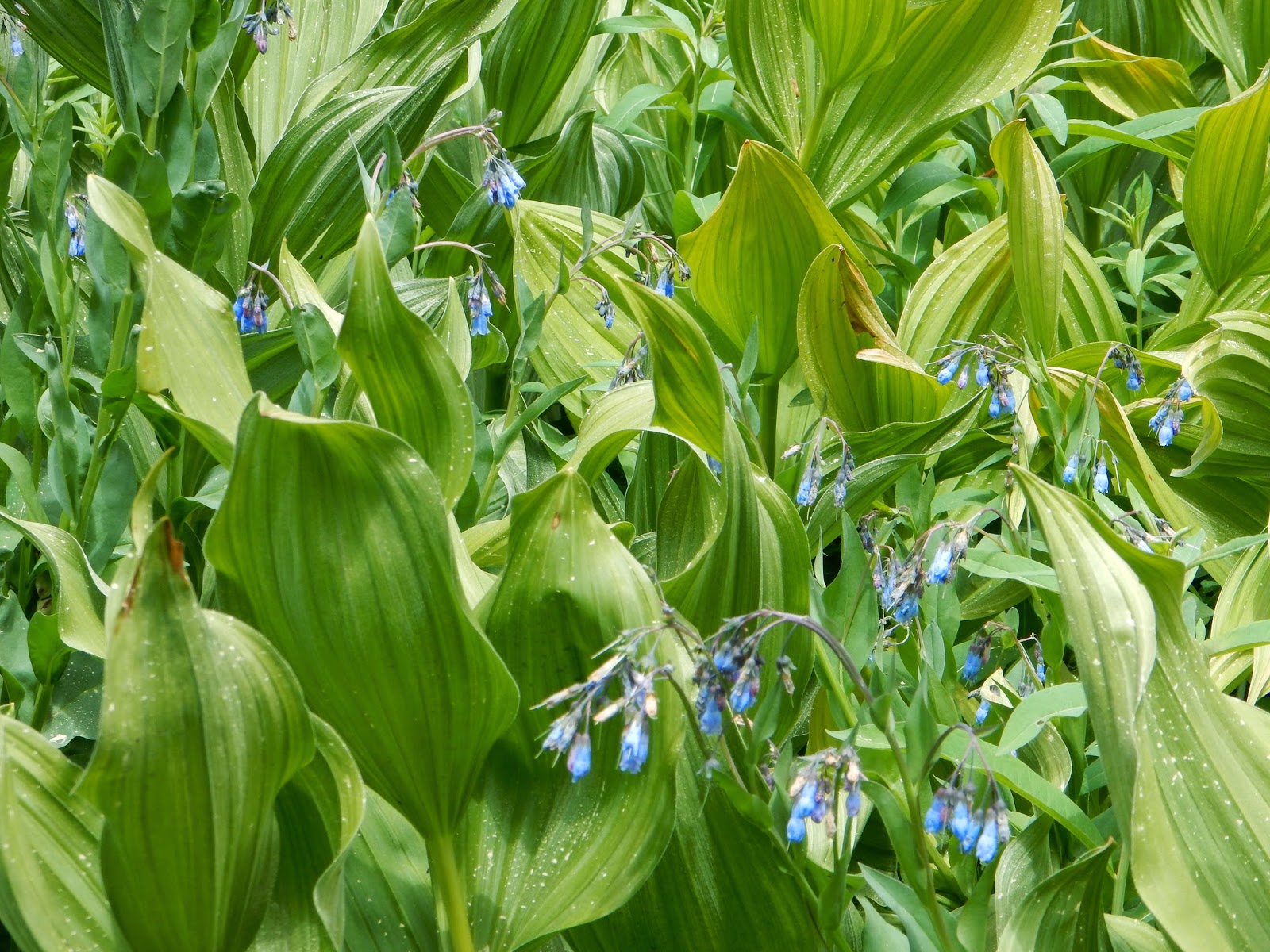
WILDFLOWERS ARE BLOOMING 

more profusely than I have ever seen along Lyons Creek!

EVERYWHERE, IN EVERY COLOR, ALL AT ONCE!  

Lake Sylvia, Desolation Wilderness, June 2014
Distance:  12+ miles round trip, upward, some loose rocky sections.
Difficulty:  At 12 miles I would rate any hike difficult, but aside from length, there are several creek crossings (one could be ankle deep).  A plus is the elevation gain is accomplished going in, and coming out is downhill!
Elevation gain:   + 1875 feet up and -1875 back down.
Notes: Day passes are available at the trail head. There is parking, but no restrooms are available. You could drive up to the Bloodsucker Lake parking, or stop before you get off of Highway 50. For backpacking, see the notes near the end of this page.  More notes at the end of the article.

Photos of the trail and views  are arranged chronologically.  Click on one and you can see them enlarged.  Another great website, with photos posted by me and others, is Desolation Wilderness Volunteers.  It also includes a wealth of information if you plan on visiting.

Walk along a barely used roadway for  forestry related activities.  In a short distance though it becomes trail, first leading you through an large open meadow.
Take one of the use paths to your left when you hear the water, and at some of those locations you can refill your water or maybe splash to cool off.
The following photos will take you through to the lake.
Enter the woods on a hard packed soil trail.
I get excited when I reach this point, feeling closer to my destination.  Pyramid Peak is 
some hikers' goal.  The lake is in the bowl beneath the peak though, so you 
won't have to climb it unless you are prepared to do so.  That is another story.
This open area has corn lilies about hip high, not yet in bloom, intermingled with wildflowers.


The creek crossings are usually shallow.  Step across the rocks and head into the woods again.
The view to the south side.  
As you get closer to the lake, the trail is composed of loose rocks.  If you are prone to twisting an ankle, mid boots will help prevent injury.  I have seen people hiking out here in flip flops!
Although this is not the crossing, it is the last creek you will cross to get to Lake Sylvia.  I included this shot so you can get an idea of the creek depth at this time.
We have arrived!  Bring your fishing pole if you have one.  There were a handful  of fishermen along the west shore and I could see fish swimming along the south side where I had lunch.  Please note that this lake is a sensitive area with recent restoration work done.  Please respect the effort.  These signs will show you the areas to avoid:

Vicariously, enjoy blooms in Desolation this June and July

without driving up and hiking by viewing the photos below:


and more can be found at  Desolation Wilderness Volunteers website under the media heading.
Driving Directions:
  • Take Wrights Lake Road north off of Highway 50 at Kyburz. 
  • Follow the signs to Lyons Creek Trailhead. (No restroom here) If you reach the Bloodsucker Lake parking, you have gone too far.  
Fees:  
  •  Day use fees: none; permits available at trailheads seasonally.   
  • Backpacking: $5.00 for the first night, and $10.00 for 2-12 nights.  Children 12 and younger are free.  
To obtain passes or for assistance in trip planning:
  • or visit Pacific Ranger Station Fresh Pond, 7887 Highway 50, Pollock Pines, CA or call (530) 647-5415 .  
  • If you are from the Tahoe side, check with Lake Tahoe Basin Management Unit at (530) 543-2600. 
Other regulations and restrictions can be found on the website, too.
 I highly recommend you bring water and some snacks or lunch. No fires are permitted in the wilderness. Have your fire permit to use your stoves and lanterns. 
Get your permit here: Fire permits
 Please Leave No Trace and enjoy your trip!

Happy Trails!

Related Posts you might be interested in for nearby trails:

Desolation Wilderness
2015-07
10+ miles
Strenuous
2014-08
30 miles
Moderate to Strenuous/Difficult
2014-07
18 miles
Moderate-Difficult
2014-06
12+ miles
Moderate to Strenuous
2013-06
13+ miles
Moderate to Strenuous
2012-09
Umpa Lake & Enchanted Pools
8+ miles
Cross country ~ Moderate
2012-08
Horsetail Falls via Pyramid Creek TH
Aprox.  10 miles to lakes at the top of the falls
"Difficult, and potentially dangerous" miles
2012-07
10 miles
Moderate
2012-07
8 miles
Moderate-Strenuous
2012-06
Lyons Lake via Lyons Creek Trail
10+ miles
Strenuous
2012-08
9.2 miles
Moderate
2012-06
6+ miles
Strenuous
2011-07
Lyons Creek Trail with melting snow
9+ miles
Moderate
2011-02
3.8 miles
Moderate
2010-09 We hiked 12 days.
167 total
Moderate to Strenuous

See the Full Table of Contents.
Added updated links and Table of Contents 06-2016

December 02, 2012

Donner PCT TH to Flora Lake ~ Snowshoeing in 2012 with 2016 photo update

See Donner from the Flora Lake hike. Visit snow covered, iced over ponds and lakes. This is a memorable snowshoe experience!

The Sno Park is a great family fun place! Toboggan, build snowmen, make snow angels, and have a snowball toss (with close parking and restrooms)! 

Peachy Hiker on the lake, very well iced over in  September 2015.
 Azalea Lake, a frozen beauty queen!

And it is right off I-80 at the Boreal exit!

Snowing so hard over I-80 we couldn't even see tail lights in 2012.

Quite a few of my photos are not showing any longer.  Not sure why so I am editing those out today (Aug 28, 2015).  I will go for replacements this winter assuming we get snow!  For now and ease in updating, I am leaving the captions.  Sorry for the difficulty!  This link still has all of the photos:  GPS tracks 

Along your way are creeks to cross, views to take in,
and photographs waiting to be taken.  Great backpacking destination!
  • Distance:  Posted is out and back totaling about 3.5 miles
  • Difficulty:  Easy+ at this time.  Nothing steep.  Conditions can change quickly so check forestry sources if you are concerned. 

Now let's get you going!

Advisories:

  • Carry food, and plenty of layers. Be prepared for all weather. We encountered rain, snow and sleet. It got windy and colder late in the afternoon.
*** Find GPS links and a map at the end of this article!

(Missing image)   In the snow, Everything had a mystical aura.


The Sno Park is likely to be full of families playing in the snow and building snowmen.
This creek offers a bridge, but there may be creek crossings ahead!
Gaiters helped me stay dry.

 It appears that there is a seasonal Interpretive Loop.


(Missing image)   The first large icy pond beside the trail.

 Looking back at our snowshoeing path!
 The photos, despite all looking quite grey, are really in color!
 Haha...We headed toward PCT and Donner.  Sometimes I got ahead of myself and
landed on my knees by clipping the back of one snowshoe with the other. 
Take your time...

(Missing image) 
If you stay on the PCT you will see markers on trees. This route breaks off of 
the PCT to get to the lakes, so this is the only one you should see on this trek.

Good insulation kept me warm, but I did
have to change layers on our way back. 
I carried my usual safety supplies and first aid kit
but was so engrossed in the trip and
achieving our goals, I forgot I had a rain poncho
It could have been used over my daypack in the heavy moisture!
We were snowshoeing in a storm.

(Missing image) Flora Lake, inviting and picturesque.

(Missing image) We could see Donner Lake from here but it feels like a "Where's Waldo?" view!
(It is near the center in the "v" between the dark hill and the snowy one.)


We each had our poles broken on this trip...wow.  My new set is ordered, but what a
strange problem.  From reading, the aluminum poles are stronger (slightly heavier) but
what good is it to carry out the weight of broken carbon poles and do without any benefit?  My
new set has my coveted cork material handgrips, soft wrist straps and a locking mechanism.

(Missing image)  The storm wasn't taking breaks at high elevation.

 This creek usually has water, but creeklets were pouring under the snow.  It took some
searching to find places to cross.  Use caution.

(Missing image)  Donner Lake is in the "V" behind the tallest sparse tree.

 Approaching one of the unnamed lakes and ponds that are all iced over.
Iced over pond.  I wouldn't recommend
 stepping on any of it.

(Missing image)  Bridge to civilization and a weather break.
 Almost back to the car!  Photographed from the bridge.  The blur is snow.
I highly recommend this trail for snowshoeing!!!

The trail in red is what I posted for GPS tracks from this snowshoeing trip. Our side trips
are edited out. GPS tracks supplied are accurate regarding areas where we had to detour
due to trail conditions, and may diverge from what a forestry map shows, or maybe from
conditions when you arrive.
The pink trail is one I hike from the Old Donner highway (the brown line) during dry seasons, but is included for your frame of reference. (Posted on Wikiloc)  I would still like to snowshoe
all of that from Old Donner Highway to I-80.
On January 5th, my daughter in law, Kristin, and I went up and below is our map of tracks.  We followed snowshoers tracks mostly, but blazed our own tracks east and just beyond Flora Lake to our Donner view lunch spot, perfect for a great view on a sunny day!

Reviews of other trails in Northern California: Trails By Locations
Or: By Titles
    Thank you for dropping by!  Happy Trails!
If you like this article, please share it by clicking on the buttons for social media below for your convenience! 
Thanks again!

updated 12-14-2012
updated 8-28-2015
updated by adding the standing on lake photo and rearranging the Advisories text 1-4-2016

June 24, 2012

Lyons Lake, Desolation Wilderness, CA

Upon arriving at Lyons Lake, I discovered completely idyllic, serene views, and wilderness solitude.  (Visited only by a photogenic marmot, that is!)  Lyons Lake offers the classic wilderness experience Desolation strives to provide.


*  For a newer article visit Lyons and Sylvia Lakes 2015  I suggest scrolling through the photos here though!
If you click on a photo you can scroll through the photos, enlarged for easier viewing.  At the bottom of this article I have posted Wikiloc's link for GPS tracks, a topo map of the trail, and an elevation profile.

Sunset at Lyons Lake in June 2012.


Difficulty:  Strenuous. Climbing rocky terrain, several creek crossings.  Take extra socks or waterproof boots.

Length:  10+ miles RT per my GPS.

Elevation:  range from 6707 to 8401 feet.

Directions:  Take Wrights Lake Road north off of Highway 50, out of Kyburz, CA.  Follow the signs to Lyons Creek Trailhead.  The Wrights Lake Road will be between tract 36 and tract 39 along Highway 50.
Other advisories: There is free parking; no restroom.  At the trailhead there are day passes available that you will need to cross into the Desolation Wilderness.  If you are planning to backpack in, obtain a permit from  Recreation.gov  , a Tahoe Basin Ranger Station or from Pacific Ranger Station off of Highway 50 at Fresh Pond..  There are minimal fees.  No campfires allowed inside the wilderness boundaries.  Fishing is popular and you need your fishing license. Check for Desolation's current regulations.

Wildflowers abound while the area is still moist with runoff from snow melt.  They line the trail and there is no need to bushwhack around to have the pleasure of the colors.


Alongside Lyons Creek Trail this creek flows invitingly, and offers picturesque, idyllic wading and resting areas, not to mention more photo opportunities!


As you approach Desolation, it is getting drier and rockier, but as you climb in elevation (gradually until the fork up to Lyons Lake) you'll wind your way through some more shady areas, but the threat is the mosquitoes are there waiting for you!!! They seem to love Deet.

 This trail is not only inviting to us, but those flying biting ravenous bugs.  The trail gains elevation slowly at first and is as the photo depicts, pleasant and easy.  But it's deceptive!


 It gradually gets steeper and definitively rockier!

Then the junction for Lyons or Sylvia Lakes is clearly marked with a forestry post, and both are wonderful destinations. It's only .1 mile farther to Lyons though quite a bit steeper climb.

 On a warm day you tend to look for some shady rest as the trail has wandered away from the creek. A hat is nice protection and sunscreen is worth the trouble.
The next thing you know you'll cross Lyons Creek, preferably by going from rock to rock, but plan on getting wet.

    
The trail up to Lyons Lake winds upward through the rocks and boulders, and is pretty easy to follow. 

This creek flowing from Lyons is slightly off trail, actually easy to get to for a rest.


You have arrived!  There is an outlet from Lyons that has a small dam on its north side that you can cross to get to this small clearing beside the lake that is shaded.


This little marmot will probably visit you. He was happy to let me wander around taking photos but he didn't get into my things, as some will do without apology. There are several campsites around the lake.  I chose the flat granite east of the outlet.

This photo is of the west side of Lyons Lake later in the day.

 Fewer wildflowers are to be found up here, but these were bright accents to the drier scenery.
The evening sky from southeast of the Lyons Lake outlet.

 As I descended the next day, this was my view from Lyons Lake.

Wikiloc GPS tracks:  Lyons Lake in Desolation Wilderness 


Related Posts
Desolation Wilderness
2015-07
10+ miles
Strenuous
2014-08
30 miles
Moderate to Strenuous/Difficult
2014-07
18 miles
Moderate-Difficult
2014-06
12+ miles
Moderate to Strenuous
2013-06
13+ miles
Moderate to Strenuous
2012-09
Umpa Lake & Enchanted Pools
8+ miles
Cross country ~ Moderate
2012-08
Horsetail Falls via Pyramid Creek TH
Aprox.  10 miles to lakes at the top of the falls
"Difficult, and potentially dangerous" miles
2012-07
10 miles
Moderate
2012-07
8 miles
Moderate-Strenuous
2012-06
Lyons Lake via Lyons Creek Trail
10+ miles
Strenuous
2012-08
9.2 miles
Moderate
2012-06
6+ miles
Strenuous
2011-07
Lyons Creek Trail with melting snow
9+ miles
Moderate
2011-02
3.8 miles
Moderate
2010-09 We hiked 12 days.
167 total
Moderate to Strenuous
Happy Trails!  Thanks for dropping by!

Updated links and facts 06-2016
Happy Trails!

updated 8-2012
Updated with a link to a new post about this hike and a new link for reservations.