Trails in Northern California

Trails in Northern California

Leave No Trace!

Visit desovw.org for more information about Desolation Wilderness. Visit Recreation.gov or call 1- 877-444-6777 to make park reservations. Visit Campfire Permits to get a permit online. More about Leave No Trace principles.
Showing posts with label Coloma. Show all posts

October 01, 2012

Coloma Waterfalls In September 2012 vs Spring

A glimpse of the top of waterless Johntown Falls in September 2012.

Update: October 2012: Conditions are hot, dry, stickery, and trail conditions are extremely poor. I would not take children back toward the falls. Not only is it hazardous, full of invisible poison oak, but also any more pools normally worth getting to have dried up to wet spots. The sitting water is mossy and brown. Worst downside of all, no waterfalls!!!! Dry as a bone.


Upper Dutch Falls on September 30, 2012.

The affectionately named "Ancient Lady"west of the Upper Dutch Falls September, 2012.

Ancient Lady in May 2012 with a glimpse of Upper Dutch Falls to the left.


Upper Dutch Creek Falls in late April, 2010


Johntown Falls in Coloma, CA Taken in April, 2010


Take water with you as there is none very appealing to try to purify!

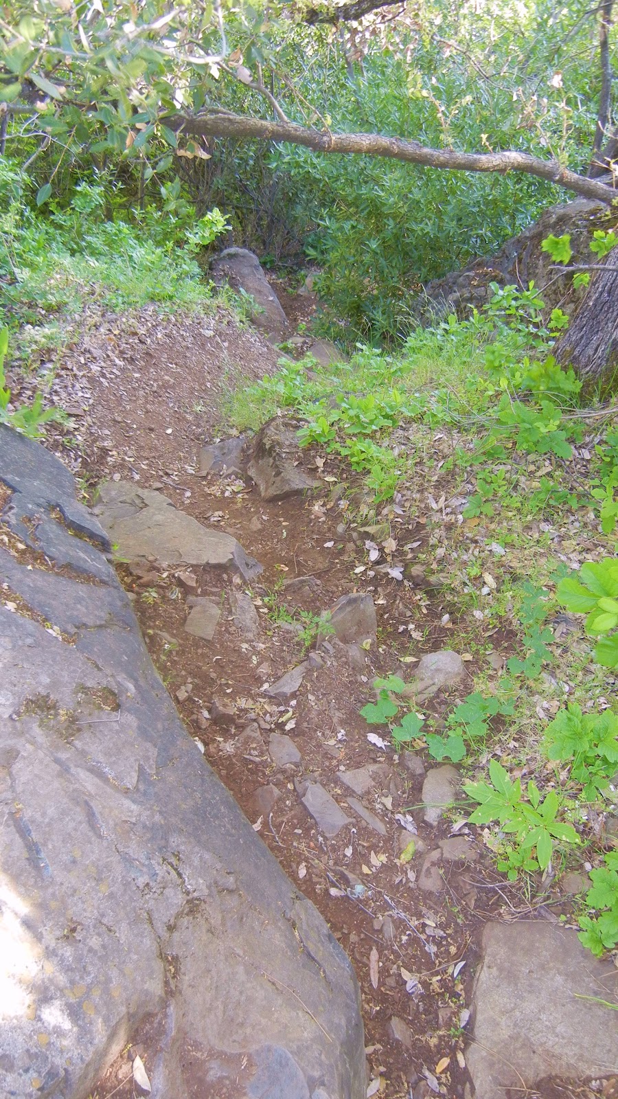
There is no foothold here and quite a stretch from "level" ground to grabbing the biggest rock and hoping you don't fall.  It is slippery and steep.  You can grab the tree branches to pull yourself up, but it is risky!  Going down is another vertical episode.  AT YOUR OWN RISK FOR SURE!

Dutch Creek Trail needs serious maintenance work to become safe, and beware of the poison oak you can barely see now. It is everywhere, but leafless or with little white balls, but bare branches. It is no less toxic to the allergic.


This was a suffocatingly hot difficult day!  I vote for staying by the river to play until we get some rain. But in case you are so determined:
Coloma is between I-80 and Highway 50 on Highway 49. 
  • Go to Coloma, pay for parking at the parking lot kiosk.
  • Walk over the one lane bridge. (You can't miss it as the town is VERY small.)
  • Turn right on Bayne and follow the paved road to the locked green gate on the left across from the house downhill by the river. It is also identifiable by small signs like rattlesnake warnings, says State Park, and is a regular locked forestry green gate you climb over or through.
  • The trail is single file, but visible. Dry brown knee height stickers crowd the trail.


Advisories to hike to the creek and waterfalls:
The trail is single file all the way. It leads through the dry, weedy, stickery fields, into the trees, and then has some steep ups and downs, but they are short. There is some brush, a couple of tree falls you have to climb over, under, or around. The trail is hard dirt mostly and has a blanket of very dry slippery leaves I swept away for safer footing.  Hiking pole(s) are handy balancing tools, but cumbersome when you have to hang on to something to get around something else! If I can give any advice, it is wear GOOD hiking shoes; take water and snacks. Follow the trail to the falls! Have an adventurous and happy day!
Latitude: 38-47'57'' N    
Longitude: 120-52'54'' W
 
Thank you for checking in! There is another review of this hike on this blog dated April of 2010, and has some other information, and beautiful photos showing the differences you can come across.

Other hikes near this area that you may be interested in:

BLM ~ Bureau of Land Management
Near Coloma, CA

Peachy Hiker's Table of Contents
or
CA State Parks
ASRA ~ Auburn State Recreation District
October, 2012
 Happy Trails!

August 08, 2012

Dave Moore Nature Area ~ Gold Country

*  If you click on a photo it enlarges and you can scroll through all of the photos at once.

Hiking, swimming, picnicking, fishing and enjoying nature and history are all welcome activities!


Hike Length:  1 mile loop
Difficulty:  Easy
Driving Directions:  Highway 49 ~ 2 miles west of Coloma, or 3 miles south of Pilot Hill.
Notes:  No horses.  Starting at the restroom TH, this is a wheelchair  and stroller accessible trail to the river and back.  The whole loop is not.  There is plenty of dirt parking, no fees, and a vault toilet at the trail head.  There are garbage cans.  Dogs are welcome. 


A little history of the area is posted at the trailhead.


My first exploration of this hike was this August 2012, so you might guess it is plagued by stickers and dry grasses.  The trail is covered in a carpet of slippery, crispy leaves too.

Wildflowers are blooming despite this dry year and add color to the shady lane to the river.

Even on this hot day, there is enough shade to keep my cool.

I would love to know the history of this rock "formation".  There are two of these on the trail and I assume they have some connection to the rich mining history of the area.

There are several picnic tables in shady areas along the way to have a meal, or just take a rest.

The second of the strange rocks.

A peek through the green to the inviting river where you may find rapids fit for the pros or shallow rocky river good for wading in.  It changes depending on the day and time of day according to water releases. 

There are sandy or rocky areas but all with a fair amount of shade to lounge in by going a bit up or downriver.

More color!


As you can see, it is a pretty peaceful place when the water is low.  If you find high water, you will find rafters having great times.


The second part of the loop is shaded and beautiful with occasional boulders blocking wheeled transportation.

But they are not ones to scramble over.  Just walk around them.

Before you know it the parking lot is nearby.  I enjoyed this for a simple get away. 

I would take the kids, the dog, lunch and maybe a fishing pole! 

BLM Dave Moore Website
Happy Trails!
Trails by Locations
or
Related articles:
ASRA ~ Auburn State Recreation District

April 08, 2010

Dutch Creek and Johntown Falls in Coloma, CA. updated 10-2012

Dutch Creek Falls and Johntown Falls feature cascades, historical features related to the Gold Rush era,

and hiking is on unmaintained trails (maps and GPS included below) with abundant spring wildflowers.  Mt. Murphy will be draped in golden poppies and the waterfalls are gorgeous with snow melt runoff.
This year I went in May 2012, then again in September and must warn of more hazardous trail conditions than ever due to erosion, and even more plentiful poison oak that was impossible to avoid contact with. Ticks are another hazard.
Distance: Plan to hike 2-5 miles.
Difficulty: Moderate to advanced skills.
Directions are written at the end of the article. Wikiloc link included.
Elevation min: 748 feet, max: 1,194 feet
Accum. height uphill:
420 feet, downhill: 456 feet

Lower Dutch Creek Falls 2010. 


 The above photos are Johntown Falls. 

This is the entry gate you'll look for.

You are greeted by the Coloma rolling hills, and at this time of year the poppies are blooming. Look for a typical locked green forestry gate on your left (complete directions below) with the ordinary signs like snake warnings, and a State Park Boundary sign.  Climb over or through the gates.  The trail is easy to see and follow at first. It winds through the grasses (sometimes quite tall) and then into woods (wearing long pants and even gaiters are good). Watch out for ticks and poison oak too.
On the right, the trail is paralleled by the creek but it's down below. You'll see the historic rock wall remnants that were built to guide the water.


Winding your way into the woods is beautiful and cool. The trail is not maintained, so any debris will remain and the trail changes over time to avoid the obstacles like fallen trees.


If you bushwhack a little, you can get down to the water and find some serene and picturesque views upstream. Beware, the rocks are very polished by the water, and slippery. One of our hikers took quite a slip and fall onto the rocks even though he was wearing good quality hiking boots! If you have trekking poles, they can come in handy.  We also saw plenty of wildflowers, mostly fairy lanterns and poppies up on the hillside, but also some lupines, vetch, and some butterflies.

There were salamanders galore this May 2012!  The ripple is from the little guy coming up for air.

To go to Lower Dutch Creek Falls you will see a trail heading down to the right that has a small boulder on either side of it. The trail winds a little to the left and after that the surface is hard and slippery with nothing to dig your boots into for traction.  It is a steep, butt-slide trail down to the falls and pool at the base.  There is shade and a great boulder overlooking the falls you can sun on, and an excellent wading pool at the base of the double falls.


Lower Dutch Creek Falls May, 2012


Once past the lower falls turn off, the trail here, and in a couple of places, goes almost straight up.  I didn't worry about going in but wondered about footing on the way out!

 The local vultures collected when they noticed we made it to the upper falls....hinting that our chances of getting out safely may be questionable!  (Chuckle, really!)

This May, 2012 photo doesn't do the trail damage justice, but you can see the erosion pattern and how narrow the trail is currently.  It is also less flat and more angled downhill.

Besides Lower Dutch Creek Falls, there are numerous small cascades along the way.

If you do continue on upstream along the narrow, steep at times, rough trail, you get to the falls below, Dutch Creek Falls and Johntown Creek Falls merging into Dutch Creek. We accomplished this pleasure in May 2010, 2011, and 2012.  We missed out in February 2010, having lost the trail! In April of 2011, we bushwhacked to a high point overlooking both falls!  The water flow was generous and the view was wonderful!

April 2011 Johntown Falls

April 2011 Dutch Creek Falls taken from the boulder 
overlooking both falls and the canyon.
Dutch Creek Falls May 2012

I love the rock structure to the right of the falls. 
We refer to her endearingly as the "Ancient Lady".


Directions: 
  • From Highway 80, take the exit for Elm Street at Auburn, CA.
  • Make a left at the stoplight.
  • At the next signal make a left.
  • The street veers to the right or has an option to go straight ahead. Veer right to go on Highway 49.
  • Go straight ahead at the next signal at Lincoln Road.  Now the road winds.
  • Take Highway 49 towards Coloma. 
  • An option is to park in the state parking and pay at the kiosk ($10?) 
  • You can park along the roadway across the bridge on the left, but you have to go to the museum and pay there. (There are pit toilets in the parking area.) 
  • Walk to Bayne road by crossing the single lane bridge across the river from Highway 49 and turn right. 
Walk up the road  then follow the trail as described above, starting at the green gate on your left.

Allow for a 2-4 mile hike and try to go early in the year for the best water flow over the falls. The later in the year it gets, the more dry the fields get and you encounter stickers galore, poison oak year around, and a less satisfying view of waterfalls. You can decide how much bushwhacking you are up to and can keep it mild-moderate or push it into a more technical-difficult hike.
Bring plenty of water, sunscreen, snacks, hiking poles if possible and shoes with deep tread.

Click on photo to enlarge.