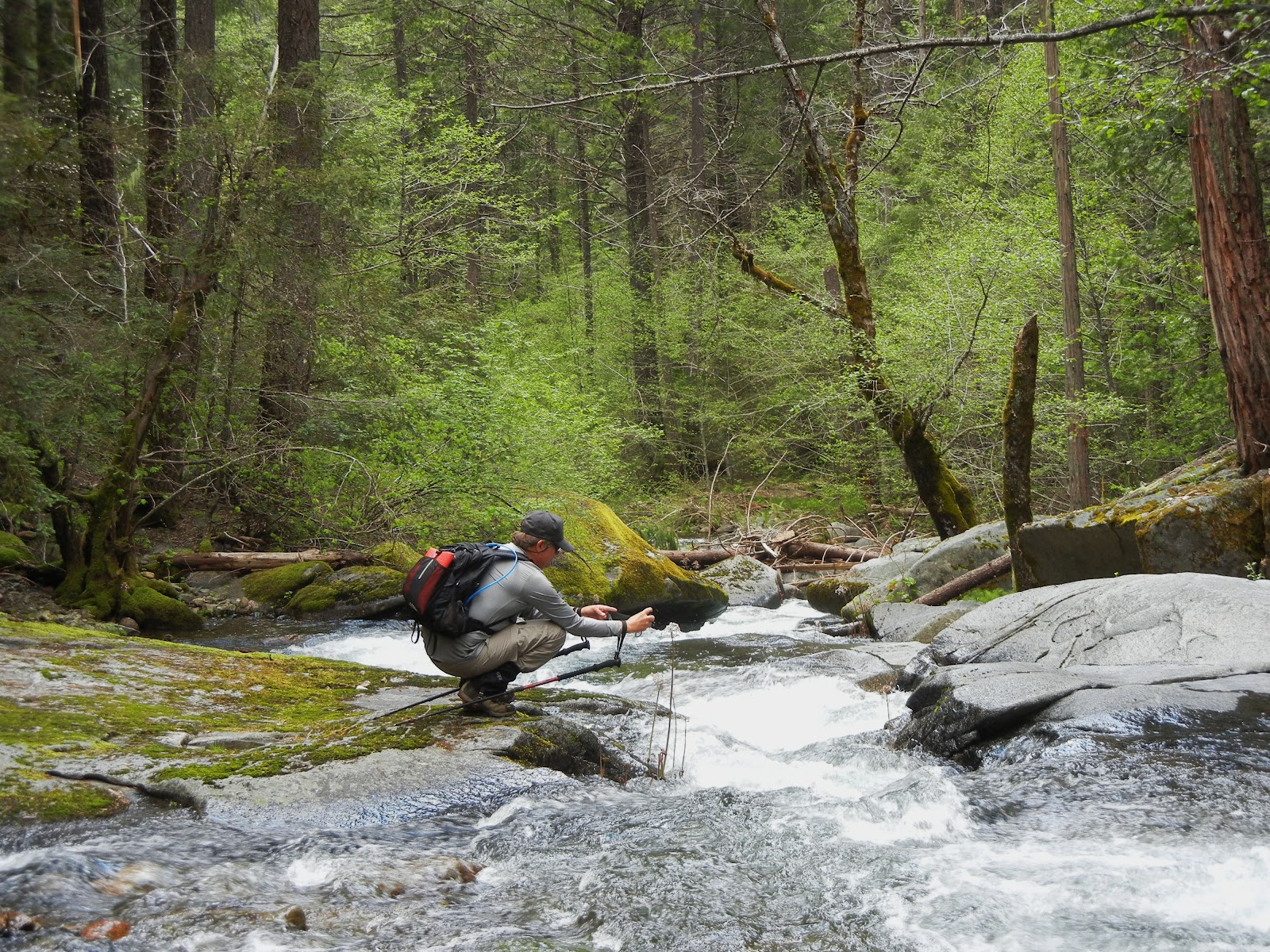
This is a MUST DO HIKE near Georgetown, CA.
Distance: about 3 miles out and back.
Elevation: 1634-2246 feet
Difficulty: Short hike, but I would rate it
difficult due to the steep areas and the ropes and metal cable used for descending and climbing. Gloves on a hot day help your grip on the cable.
Driving Directions: Take Traverse Creek Road east off of Highway 193, between Porter Ranch Road and Red Berry Hill Lane, southeast of Georgetown. Follow Traverse Creek Road staying to the left at Spanish Flat Road. The creek will run along the east side of the road. When you see the small creek bridge ahead of you, there's a small confluence of two creeks. Park by the side of the road. The trail will head south east of the road and seems to go away from the creek. There is a photo of the map at the bottom of this article.
Advisories: This hike is fun but is steep in a couple of places, again, requiring rope or cable for safety. The ground is often dry hard packed dirt with little if anything to grip your feet onto. The other note is if you are sensitive to poison oak, this is not the hike for you. It is every bit as lush and beautiful as could be and pretty toxic for the allergic. You don't have to creek cross if you are choosing to play at the bottom of the falls. The pool is absolutely wonderful for swimming. I cannot imagine taking children here.
The trail was utterly and completely deceiving at the beginning. We
parked on the side of the road and the trail lead near the creek through
a small field and then through some brush. We even felt idyllic
walking through eye level yellow blossoms toward a woods, envisioning a
wonderful waterfall with a cool deep inviting pool at its base.
Quickly, the trail took on rocky, wet crossings and many undulations
with steeper qualities. It was enjoyable going through the woods, fully
surrounded by poison oak, glossy, full, thick and beautiful foliage!
We found the changes pleasant, then arrived at the first anchored rope
to assist a steep, slippery descent toward the creek, but it had been
pulled far over to the side (out of the way?!?).
At the bottom of that,
another rope was anchored for a steeper section but it had some better
footholds. I used the knotted rope to descend to the creek.
We followed alongside the creek, downstream, not really by way of a
trail, but over rocks and boulders. It was pleasant and without
challenge.
A couple of larger boulders and rocks presented minor work
but at the top, we found ourselves looking over the falls, estimated to be a 40 foot drop!
Next we were confronted with the cable descent, the only way to get to the base of the falls. A butt slide if ever there was one!
Once we arrived at the pool safely we browsed around, took photos and began our exploration downstream. More mossy rocks, some wildflowers, and challenges.
Finally we came to an impasse and were forced to discover a
fairly safe creek crossing. A bent log was partway across with a few
boulders so all we had to do was get there. The first two of us, one at
a time, stepped, climbed, balanced and waded our way to the other side.
Our third bushwhacker wasn't so game and height was a disadvantage
If you choose to go downstream, gators are handy as well as hiking poles.


We came across several fat banana slugs, thanks to the cool moist environment.

We made our way across the rocks and boulders on our attempt for Bear Creek Falls. Runoff was high which hampered our progress significantly.We felt like pioneer trailblazers, set some rope in dangerous areas, and continued our trek. Surprisingly, as difficult as it was, we continued to pick up litter of old cans, rope pieces, and broken glass. Stopping points were sometimes mesmerizing because they felt so far removed from human imprints.
Wildflowers also got in our way, punishable by photographs being taken.
We eventually resigned ourselves to that and crossed back to return to the falls for food, rest, and reflections about a better way to achieve success in reaching Bear Creek Falls. Maybe more research, GPS research, and study some topo maps for alternate routes.
Me? I had the most fantastic wonderful time bonding with fellow bushwhackers! The falls and pool were a huge plus. I'm sure weekdays are best. By the amounts and types of trash, it appears to appeal to weekend partiers. Also, you might take ropes if you travel downstream. They were a great help to us on slippery slopes! Wear clothes suitable for creek crossings, boulder scrambling, gloves for rope and cable grip, and maybe use those preparations that supposedly help protect you from poison oak. One of us got it despite hat, gloves, long pants, long sleeves and boots!!! You'll enjoy a camera for the falls and creek are great for frame-able photos!
I would post you my GPS tracks but we wandered around so much they are cluttered with ups and downs and back and forths, impossible to edit! I left enough showing in the map so you have the general idea. The falls are easy to find.
Peachy Hiker's Table of Contents
Happy Trails!