Trails in Northern California

Trails in Northern California

Leave No Trace!

Visit desovw.org for more information about Desolation Wilderness. Visit Recreation.gov or call 1- 877-444-6777 to make park reservations. Visit Campfire Permits to get a permit online. More about Leave No Trace principles.
Showing posts with label CA waterfalls. Show all posts

November 13, 2012

Canyon Creek Falls near Georgetown, CA

Hike along forest roads, going gently downhill to find this 83 foot waterfall!  The kids can do this if they can walk 5 miles round trip. 


     I read about this waterfall on a blog last year but when I searched for more information, even the World Waterfall Data Base didn't show it. My book of California waterfalls didn't list it either.  I have tried before and this hike was another attempt. I headed out without specific information other than where to begin the hike, the name of the creek, and that you follow old logging and forestry roads; no other helpful directions. 


     My victorious hike surprised me a little with snow left on the ground from fairly recent stormy weather, but I had my jacket and gloves, gaiters, waterproof boots, and enthusiasm.  Plus gas is expensive and I wasn't about to turn back now!

    
     Holy Surprises!  I found three mounds of fresh bear scat in a short distance so I talked loudly to the bears while hiking down the muddy and snowy road. The sounds of snapping branches behind my camera-bug pauses kept me alert.


     My day was chilly enough to wear my jacket and gloves, but the sky was blue with floating clouds and the tree tops didn't even hint at the snow carpeting the forest floor!

    
     Down the road, as my elevation declined, the snowy floor dried and the trees thinned.

    
     I heard the rushing sounds and at last I made it to Canyon Creek, giddy with hope that I had time to scout out the creek from here and find the falls.  I had no idea how far or which direction they may be so I headed east, upstream.  It's a beautiful season, but the leaves were thickly blanketing the "trail" and being so wet, were a bit slippery.  The creek was a symphony for me, and I hoped it was a waterfall creating the commotion.

SUCCESS! As you can see from the photo, serendipity and intuition led me there!


     I saw the top first, and with water levels being what they are right now, crossing back and forth trying to find a perfect place to photograph the falls was nothing like the challenge I had expected!  My foot sank a little deep and the boot can only do so much to keep me dry!  There is an active mining claim here and the trail was decent, although buried in wet leaves.


     This is looking back downstream from the waterfall.  There is snow still in this heavily shaded area, and the temperature reflected it.


 The woods are colorful now rather than all green.


     I stopped here for photos and heard breaking branches in the gully behind me so I gave the bears a yell, looked around, took another snapshot, and returned to the car.  I was elated to have found this prize waterfall hike and am happy to share it with you!


Forks in the road are marked with waypoints and arrows or notes.

Directions: 

Clock your mileage from the intersection in Georgetown where you turn onto Wentworth Springs Road (like any old town "Main Street") and go 10.5 miles.  Turn right at the sign for the Bald Mountain Staging Area, but pull in on the right at the first dirt road and find an out of the way place to park.  You will hike down that road.  It is gated and crosses private lumber property for a mile or so.  There are not "No Trespassing" signs, and it is marked with a small company sign. 

I hiked further but the trail above is 4.9 miles out and back, after I took out my other detours. 


Difficulty: Moderate due to elevation and to the creek side trail being almost a bushwhacking. Plus you cross the creek at least once to see the falls, really twice for a nice view.


This is a summary of my hike.  I certainly took my time, stopped to eat and photograph.
This area has OHV areas closed for the winter, but available post snowy season.  There is ample parking for horse trailers too and equestrain traffic is welcome.


I caution you to use your discretion about hiking in across private property.  And above all, please be responsible. 

There are no restrictions about hiking on a mining claim, but don't pan for gold! 

For more trails, click here 

Thanks for stopping by and HAPPY TRAILS!

August 02, 2012

Horsetail Falls, Desolation Wilderness

A rewarding intermediate to advanced day hike to the top of the Horsetail Falls in Desolation Wilderness.

* If you click on a photo the photos will be enlarged for better detail. At the bottom of the page you will find driving directions, and other information. No tracks will be posted this time, but a topo map of the area is included.


Horsetail Falls, Desolation Wilderness


Directions: This spectacular waterfall can be seen from Highway 50. There is a paved parking lot called Pyramid Creek with a small day use fee. It is 6 3/4 miles west of Echo Lake Summit or 1 2/3+ miles northeast of Strawberry.
Distance: One Way: 1.5 miles to the base of the falls and to Avalanche Lake is listed as 1.8 miles according to Desolation Wilderness' website. Other estimates from the base of the hike to the top of the falls are 5.5+ miles one way; go more or less as you like.
"Difficult, and potentially dangerous" miles, even though it is a short distance if you go to the top, but tame along the creek. I love this day hike or backpacking trip, but strongly recommend friends, a plan, and supplies.
At the trail head are flushing toilets and permits for day use into Desolation Wilderness (that means into the steep areas).   For backpacking you will need to make arrangements with Pacific Ranger Station at Fresh Pond or online for a permitCampfire, hunting, fishing, and firearms restrictions and regulations are available at that site, too.


The trail along Pyramid Creek begins winding through forest and small bushes
but a clear trail emerges along the creek.
You will hike beside the creek for awhile, through the trees and across some granite with a fairly level trail to follow.  Many hikers come to sit near it and cool off, take some photos and just enjoy the views they can capture of the upper falls cascading down the canyon.

Keep your eyes open in this shady area! There may be a rattlesnake along resting in the shade of fallen logs, 

and I very nearly stepped on this guy! He is a huge grand daddy of a snake and apparently had eaten recently. Lucky for me.


I find this hike is rewarding because along the way the creek is cooling, soothing, energizing, and beautiful! There are some fantastic views of Horsetail Falls with many pretty photo opps like this of the water splashing its way through narrow spaces creating that wonderful rushing sound!


Here is one of our glimpses up the mountainside of one section of the famous waterfall!  If you are going to the summit, you will hike inland for awhile away from the falls, through some tall manzanita, then up some smaller loose rocks and granite tables.  If you are there with the kids, there is a viewing area that isn't hazardous and is fun.


We hike into a short section where we follow a crevice filled with loose rocks and then head right at a huge boulder that can't be missed.  Follow the granite upward keeping your eyes peeled for the widow maker. 
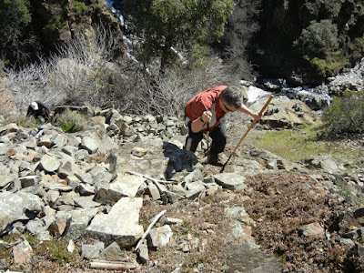
My pet name for this section of the hike is the "Boulder Mine Field".  If you have knee problems, this is the hardest part of the hike.  It feels like an eternity of climbing and even though I do enjoy boulder scrambles, this one is long!  Best wear your knee supports or braces! 

This is that widow maker I mentioned, an excellent landmark.

I keep thinking I am closer and the next view of the falls is still distant!  But keep going for the vistas and the supreme rewards!  It is the most rewarding day hike I have been on.

Another benefit of this hike is the views of the Sierras once you have climbed high enough. 

For me it keeps me climbing for more.  Some years you can see those covered in snow (notice the ski run remnants to the left?) and even find yourself cutting through some snow on your hike.  I've had some fun snowball fights up there!

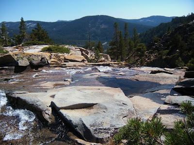
From this part of the hike you are over the falls, looking down towards them.  Just some granite rocks to descend back to being about level with the water.

That's me, Peachy Hiker, climbing westward away from Horsetail Falls.


At the top you reach the lakes, Avalanche Lake first. Water all around is inviting on a hot day. Pick a boulder and have some lunch. For a day hike you can just turn around and head down after some photos, lunch, and rest. 


Near the top of the falls on our backpacking trip this is a powerful place and sight.

For a backpacking trip, you can find a campsites available near the lakes that are far enough away from the water and not too close to your neighbors.  Be bear-safe with your food and other items.  We bear bagged and had a food canister and no issues.

A little further in is this paradise. Beyond this area are some great granite flat spaces for camps, and beautiful views. The bugs come out so be prepared!


A final parting view of and from the top of Horsetail Falls before veering upward and away from the falls to go back down to the trail head.

 Advisories:

     There is not an officially recognized or maintained trail beyond the base of the falls, and isn't for everyone, so no GPS tracks are posted.  Sometimes there is some spray paint, and some people have put up cairns, but those are not reliable sources for directions.  If you are experienced at bushwhacking and cross country hiking you can navigate this "trail", and if you lose sight of it you can find it a little ways ahead.  Having seen our photos will hopefully help you keep track of the "trail" as you go up the left (west) side of the creek.
    We saw one young lady who had climbed up much too far for her comfort, equipment, and expertise.  She was inching down the granite on her seat, looking quite frightened.  She didn't have anything like a day pack, water, rope, or other assistance and had gotten separated from her group. She declined assistance. Those are people who may fall to their injury or death. 
     Have shoes good for granite and boulder scrambling.  Take first aid and a rope.  I also carry a flashlight and headlamp, a mirror, first aid kit, and rain gear.  Take some snacks if not lunch.  Go together, not alone, especially if this is a new hike for you.  Don't leave your partner assuming they will make it to the top.  Patiently assist them and guide them so they are sure where to go.  Some areas you can use to get up but not down! 

Topo map of Horsetail Falls and Pyramid Creek

Desolation Wilderness Permits
Pacific Ranger District
7887 Highway 50
Pollock Pines, CA 95726-9602
530-644-2349
TTY 530-647-5407
*** Use caution if you climb beyond the official waterfall viewing area.  The granite gets steep and can be slippery.  Also use caution regarding following cairns (rocks stacked) for guidance as they may misdirect you, or be torn down when you return.  People do get injured or lost and is a very difficult place to do a rescue, so I prefer it not be you!!!
Feel free to add any helpful notes for hikers!

Desolation Wilderness
2015-07
10+ miles
Strenuous
2014-08
30 miles
Moderate to Strenuous/Difficult
2014-07
18 miles
Moderate-Difficult
2014-06
12+ miles
Moderate to Strenuous
2013-06
13+ miles
Moderate to Strenuous
2012-09
Umpa Lake & Enchanted Pools
8+ miles
Cross country ~ Moderate
2012-08
Horsetail Falls via Pyramid Creek TH
Aprox.  10 miles to lakes at the top of the falls
"Difficult, and potentially dangerous" miles
2012-07
10 miles
Moderate
2012-07
8 miles
Moderate-Strenuous
2012-06
Lyons Lake via Lyons Creek Trail
10+ miles
Strenuous
2012-08
9.2 miles
Moderate
2012-06
6+ miles
Strenuous
2011-07
Lyons Creek Trail with melting snow
9+ miles
Moderate
2011-02
3.8 miles
Moderate
2010-09 We hiked 12 days.
167 total
Moderate to Strenuous


Happy Trails Again!
Added updated links 06-2016
updated 6-6-2013

May 11, 2012

Feather Falls 2017 Alert!

 Feather Falls Trail


Location: Feather Falls is north east of Lake Oroville, CA. and is part of Plumas National Forest. 
Distance: Plan to hike as much as 10 miles because you will have to use the upper (harder) trail both ways, but it is well maintained and even has built bridges for accessibility.  (Thank you Chris for the distance update!)
Difficulty: Consider it a moderate-strenuous hike, due to added length and some fairly steep uphill.  
Elevation gain: 1670+ feet.  
Notes:  Dogs are allowed.  July 2017 reports are that it is best to go the same trail in and out, the longer route due to a combination of trail washout and very tall and thick poison oak.
 There are vault toilets, only at the trailhead as I recall.

 The pleasurable points of this hike are the shady areas and the water cascades.

 The forestry has built and maintained the trail and there are bridges for crossing creeks.

 
When you need a rest, there are some old and less than new benches or rocks along the way.  I have seen families with strollers and baby packs using the trail.  Have snacks, lunch, plenty of water, and plenty of bug spray.

 This was my favorite water cascade view from a shady bridge, 
making resting here a must!

There will be a turnoff to the right that is off the loop trail, taking you single file out to the platform deck for a better view of the falls. You will need to leave or carry the stroller but you'll have a good rest and view on the large wood deck.  Rainbows are a sure thing!

The waterfall is estimated to be over 400 feet tall! 
This is the bottom of the falls, creating a thick mist and perfect rainbows.
 Even the locals had to get the best views!

 This is the view of the canyon the water follows to the lake.  Apparently boaters and fishermen use the area.

Allow enough time to get back before dusk for even though it is cooler, the bugs come out in blankets of carnivorous feeders!

I don't have tracks and couldn't find it on Wikiloc.  The trail is well traveled and marked.

Peachy Hiker's Table of Contents

February 10, 2011

Dutch Creek, Coloma, Waterfalls September 2012

For Johntown and Dutch Creek Waterfalls GPS, maps, and more thorough information, click here.

Upper Dutch Falls on Sept 30, 2012.

The affectionately named "Ancient Lady" southwest of the Upper Dutch Falls 9-2012.


The top of Johntown Falls 9-2012

Take water with you as there is none very appealing to try to purify!

Dutch Creek Trail needs serious maintenance work to become safe, and beware of the poison oak.  It is everywhere.  It is no less toxic to the allergic. 

In spring, here is what you may have to look forward to if we can get some volunteers to work on the trail:
The photo below is Johntown Falls at Coloma, CA. photographed by this blogger who lead this hiking day with a Meetup.com. hiking club.  The falls were glorious and the hikers equally enjoyable! Weather was warm and mild, the water flow was gorgeous, and the company exquisite!


The next one is a shot of the trail as it enters the woods. Looks pretty docile, huh?


A walk in the park, so to speak.


This is one of our feisty hikers...none too intimidated as the trail
becomes more rugged and less park-like.


These are more of our fantastic group with high spirits for the day, waiting to see what is in store.


     Some took this side trail down to see the Lower Dutch Creek Falls that sometimes forms two separate falls, side by side, that are dropping around, guessing here, 10 feet. At about this time, one of our hikers got hurt, and that makes this a good time to advise good hiking shoes, and for hikers to beware of the short steeper sections of this trail. It is not maintained in any way, and you'll find yourself having to go over or around obstacles like rock outcroppings or tree falls. I might as well mention there is poison oak around here too. At some times of the year it is leafless, so be careful what you grab. Stay on "the trail" and I don't recommend shorts or short sleeves if you are allergic.


When we reached Dutch Creek Falls and Johntown Creek Falls some members took a nice break, while the group I affectionately call the "Bushwhacking Maniacs" climbed higher and closer to the falls and then on up to overlook both falls from as high as we could get.


The trail to the falls is narrow, occasionally steep, but good solid tread, and do-able.  For people thrown off by viewing a steep hillside from a narrow path, this might just be too scary.


These are Bushwhackers getting closer to the falls.


Following a few minutes photographing and enjoying the falls' spray, we headed UP through loose rock, through dry weeds and stickers, over boulders, to the top!

Look, no hands!  Another hint.  Watch and listen for rattlesnakes.


This is the top of Johntown Creek Falls; the first photograph on this entry is the same falls.


From the top, we had excellent views of the entire Dutch Creek Falls.
It was worth every sticker I brought home!


Here is the view downstream of both falls. Can you find all the poison oak
Again, take precautions because it IS there!


Here are your blog writer and photographer with a fellow bushwhacker who wore, note, motorcycle pants on this adventure!
Some photos included were courtesy of our hiking club members.
This was a most excellent day!

Directions:

  • Go to Coloma on CA 49 between I-80 and Highway 50; pay for parking at the parking lot kiosk.  
  • Walk over the one lane bridge. (You can't miss it as the town is VERY small.) 
  • Turn right on Bayne and follow the paved road to the locked green gate on the left across from the house downhill by the river. It is also identifiable by small signs like rattlesnake warnings, says "State Park", and is a regular locked forestry green gate you climb over or through.
  • The trail is single file, but usually visible. It is not suitable for beginners or less fit hikers.
It leads through the grassy meadow, into the trees, and then has some steep ups and downs, but they are short. There is some brush, a couple of tree falls you have to climb over, under, or around.  The trail is hard wet soil mostly.  Hiking pole(s) are handy balancing tools. If I can give any advice, it is wear GOOD hiking shoes. Follow the trail to the falls! Have an adventurous and happy day!
Latitude: 38-47'57'' N

Longitude: 120-52'54'' W
Thank you for checking in! There is another review of this hike on this blog dated April of 2010, and has some other information, and beautiful photos showing the differences you can come across.

Peachy Hiker's Table of Contents

updated 10-2012 with photos and cautions!
Updated with spelling correction, and poison oak information.