Trails in Northern California

Trails in Northern California

Leave No Trace!

Visit desovw.org for more information about Desolation Wilderness. Visit Recreation.gov or call 1- 877-444-6777 to make park reservations. Visit Campfire Permits to get a permit online. More about Leave No Trace principles.

June 03, 2013

Coloma's Dutch Creek in June 2013

Coloma is sizzling hot!

Poison oak abounds!
Kayakers are in season! 
 Coloma has a variety of activities besides the approximately 3+ mile hike described below.  It offers picnic areas, historical mining structures including the old jail, a museum, a country store, a small coffee shop, old time photos, living history days, and the river.  This is a great place for family picnics.
 
To get to the trail along Dutch Creek, walk from the parking toward this historic
Sutter Mill, along the street side.  Cross the one lane bridge and turn right on Bayne Street.
 
Poppies are still in bloom,
and adorn the vineyard hillside along the roadway.

 
 This is the gate to the trail.  As you walk up Bayne it could easily be missed.  The tree sort of blocks it and this view is looking straight at it after passing the tree.  It is legal to climb over or through the gate to hike here, and it is publicly owned property.  The trail is not very suitable for bicycles, only hikers.
 
After you cross through the green forestry gate, Mount Murphy is your focal point. You will be hiking at the base of it along the south side.  Thistles abound and the grasses are dry.  I wore gaiters to keep them out of my shoes and socks.
These beauties are called gum plants and the blooms open into large yellow flowers.  I found them scattered along the trail before I reached the shade.
When you enter the woody area, the trail is pleasantly cooler. 
At this point I found a nice cutoff marked by boulders that leads you to the creek.  I was so hot I had no choice to but to take it down.  It is a little rough, so be aware that there is some erosion and a short steep section.


This tiny waterfall makes an enticing rushing sound you can hear up on the trail.  Here is a pond deep enough to immerse yourself in but be careful.  The rocks are super slippery.  I opted to climb over to the falls and just soak my head and shirt!  What a relief!
 
Although things are dry, these Purdy's Brodiaea bloom April through June are still brighten the path.
 
This has a nice deep spot and plenty of shade.  It is a great picnic spot, and you can take another dip in this small pool.
Unless, of course, swimming with fish bothers you!  Plenty of these were swimming around and uninhibited by my presence!  Again, make your way back up to the trail and head east, upstream.  To this point the trail has been in overall good condition.

This waterfall was my biggest reward on this hike.  The trail is eroded and hiking
solo seemed too risky for me to continue to Dutch Creek Falls and
Johntown Falls.  This is a pretty area, less suitable for a dip.  There is
heavy moss growing in the water.  Downstream just a bit is a gravel bar,
 nice normally for hanging out, but pretty uninviting at this time. 

The creek is pretty downstream beyond the gravel bar.  From this stop I turned back, hoping to return and hike above the trail on a cooler day to see the biggest waterfalls.

On my way back, I watched the kayakers from the bridge before calling it a day.

 Driving Directions:
  • Go to Coloma on CA 49 between I-80 and Highway 50; pay $8.00 for parking at the parking lot kiosk in the second state parking provided on the river side of the highway.  Bathrooms are provided and roomy for changing clothes.
  • Walk south from the parking, then over the one lane bridge. (You can't miss it as the town is VERY small.) 
  • Turn right on Bayne and follow the paved road to the locked green gate on the left across from the house downhill by the river. It is also identifiable by small signs like rattlesnake warnings, says "State Park", and is a regular locked forestry green gate you climb over or through. If you get to a fork n the road, you went too far.
  • The trail is single file, but visible despite the weeds.
It leads through the grassy meadow, into the trees, and then has some steep ups and downs, but they are short. There is some brush, a couple of tree falls you have to climb over, under, or around.  The trail is hard dry soil mostly, some seems to have been loosened for better footing going down to the creek.   Hiking pole(s) are handy balancing tools. If I can give any advice, it is wear GOOD hiking shoes. Watch out for the abundant poison oak, visible all along the way.  Follow the trail! Have an adventurous and happy day!  Take plenty of water!
Latitude: 38-47'57'' N

Longitude: 120-52'54'' W
Thank you for checking in! There is another review of this hike on this blog dated April of 2010, and has some other information, and beautiful photos showing the seasonal differences you can come across.

For more hikes see Trails By Locations
June 1, 2013
 

Coloma's Dutch Creek Falls and Johntown Falls


For Johntown and Dutch Creek Waterfalls GPS, maps, and more thorough information, click here.


Upper Dutch Falls on Sept 30, 2012.


The affectionately named "Ancient Lady" southwest of the Upper Dutch Falls 9-2012.


The top of Johntown Falls 9-2012

Take water with you as there is none very appealing to try to purify!
 

Dutch Creek Trail needs serious maintainance work to become safe, and beware of the poison oak you can barely see now.  It is everywhere, but leafless or with little white balls, but bare branches.  It is no less toxic to the allergic. 

In spring, here is what you may have to look forward to if we can get some volunteers to work on the trail:
The photo below is Johntown Falls at Coloma, CA. photographed by this blogger who lead this hiking day with a Meetup.com. hiking club.  The falls were glorious and the hikers equally enjoyable! Weather was warm and mild, the water flow was gorgeous, and the company exquisite!


The next one is a shot of the trail as it enters the woods. Looks pretty docile, huh?


A walk in the park, so to speak.


This is one of our feisty hikers...none too intimidated as the trail
becomes more rugged and less park-like.


These are more of our fantastic group with high spirits for the day, waiting to see what is in store.


     Some took this side trail down to see the Lower Dutch Creek Falls that sometimes forms two separate falls, side by side, that are dropping around, guessing here, 10 feet. At about this time, one of our hikers got hurt, and that makes this a good time to advise good hiking shoes, and for hikers to beware of the short steeper sections of this trail. It is not maintained in any way, and you'll find yourself having to go over or around obstacles like rock outcroppings or tree falls. I might as well mention there is poison oak around here too. At some times of the year it is leafless, so be careful what you grab. Stay on trail and I don't recommend shorts or short sleeves if you are allergic.


When we reached Dutch Creek Falls and Johntown Creek Falls some members took a nice break, while the group I affectionately call the "Bushwhacking Maniacs" climbed higher and closer to the falls and then on up to overlook both falls from as high as we could get.


The trail to the falls is narrow, occasionally steep, but good solid tread, and do-able.  For people thrown off by viewing a steep hillside from a narrow path, this might just be too scary.


These are Bushwhackers getting closer to the falls.
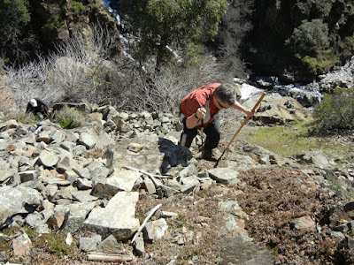

Following a few minutes photographing and enjoying the falls' spray, we headed UP through loose rock, through dry weeds and stickers, over boulders, to the top!

Look, no hands!  Another hint.  Watch and listen for rattlesnakes.


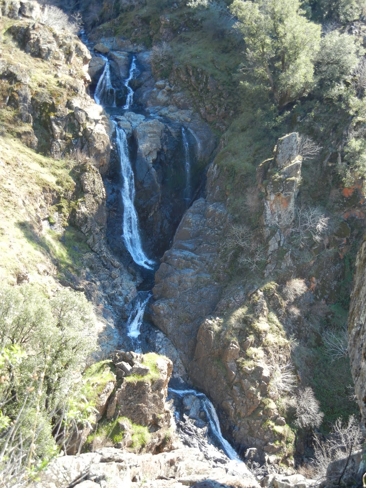
This is the top of Johntown Creek Falls; the first photograph on this entry is the same falls.


From the top, we had excellent views of the entire Dutch Creek Falls.
It was worth every sticker I brought home!


Here is the view downstream of both falls. Can you find all the poison oak
Again, take precautions because it IS there!


Here are your blog writer and photographer with a fellow bushwhacker who wore, note, motorcycle pants on this adventure!
Some photos included courtesy of our hiking club members.
This was a most excellent day!

Directions:

  • Go to Coloma on CA 49 between I-80 and Highway 50; pay for parking at the parking lot kiosk.  
  • Walk over the one lane bridge. (You can't miss it as the town is VERY small.) 
  • Turn right on Bayne and follow the paved road to the locked green gate on the left across from the house downhill by the river. It is also identifiable by small signs like rattlesnake warnings, says "State Park", and is a regular locked forestry green gate you climb over or through.
  • The trail is single file, but visible. 
It leads through the grassy meadow, into the trees, and then has some steep ups and downs, but they are short. There is some brush, a couple of tree falls you have to climb over, under, or around.  The trail is hard wet soil mostly.  Hiking pole(s) are handy balancing tools. If I can give any advice, it is wear GOOD hiking shoes. Follow the trail to the falls! Have an adventurous and happy day!
Latitude: 38-47'57'' N

Longitude: 120-52'54'' W
Thank you for checking in! There is another review of this hike on this blog dated April of 2010, and has some other information, and beautiful photos showing the differences you can come across.

Peachy Hiker's Table of Contents   Dutch Creek Trail in June 2013
updated 6-2013 with photos and cautions!

May 27, 2013

The Botany Song


I am making some progress in life...taking natural resources coursework!  In my California Wildflowers class, a friend of one of my classmates wrote and performed this!  Who says botanists are boring???   We saw Jamie in concert and she played this one for we flower freaks....not a better song in her set!  Get ready for a good belly laugh!
P.S. I finished the class with an "A", and having learned fun things, the pressure is off and I will just enjoy hiking again!
updated May 2013

April 08, 2013

Grizzly Island Wildlife Area

We saw numerous small groups of tule elk, beaver, otter, and signs of coyote, raccoon, and other wildlife, including a variety of birds. 

 This reserve is not too far from Fairfield. A map is provided to help you manage driving directions.


This reserve has hunting seasons for waterfowl, pheasant, Jr pheasant hunts, rabbit, tule elk, doves and falconry.

  The headquarters is open Monday - Friday 8-4:30, offering free literature and has a large mounted bird collection.  When the center is closed you can enjoy the outdoor kiosks for information.  Self-guided tours begin at the headquarters, taking the unpaved Grizzly Island Road for 7 miles and stopping at parking and walking or viewing areas.

Cormorants, when they swim you only see their head and neck.  Their bodies are submerged!
Grizzly Island has 8600 acres in the heart of the Suisun Marsh, the largest contiguous estuarian marsh, comprised of 84,000 acres, and where over 200 species of birds and a variety of endangered or threatened wildlife and plant species live.
Tule Elk tracks

Courtesy of Google Maps


The acreage is full of endemic species that can only live here.  Many are endangered

and protected. 

The pickle weed is the habitat element the harvest mouse
cannot live without.  It nests there and the plants have adapted to salty marsh
by pulling in lots of water, then sending the salt to the tips of their leaves.  In the fall they turn reddish colored and drop off, taking the salty residue with them. 

Wild things!


Otters like this type of area and left tracks and scat (poop).
 

In the distance you see the huge windmills.


Taking a trail guide book to help you and the kids determine what left the tracks makes a fun discovery adventure.  The tracks are often fresh, so it is likely you'll have the joy of viewing critters.

Animal Tracks

Animal Tracks


You can park and walk back into these areas along gated dirt roads.  Watch out for ticks though!

Animal Tracks

Animal Tracks


People like to fish in this area.  Bring the kids and the poles!

Probably raccoon tracks.  We also found rabbit, beaver, coyote, bobcat, otter and elk prints.


  Using binoculars, going for drives and taking short hikes feel like you have gone back in time.  The views are beautiful.  Kids will love all of the tracks they can find, and if you don't see wildlife, go slower!  The weather is cooler than the Sacramento Valley, and warmer than the beach.


Happy Trails and Come Again!  For more to do, check: