Trails in Northern California

Trails in Northern California

Leave No Trace!

Visit desovw.org for more information about Desolation Wilderness. Visit Recreation.gov or call 1- 877-444-6777 to make park reservations. Visit Campfire Permits to get a permit online. More about Leave No Trace principles.
Showing posts with label Trinity Alps. Show all posts

August 19, 2011

Trinity Alps Coffee Creek Loop

For Amazing Views,

a challenging backpacking trip, and to experience wild back country, this is the place.  Photo bugs will be snap happy here!

We took Monday - Friday to hike this loop.  Including vistas, hikes around the lakes we visited, and just touring interesting areas, we figure we totaled almost 40 miles.  The degree of ascents and descents went from 99% to pretty level.  Yes, really, 99%, but not for long!   Topo map included at bottom of page and a graph of the elevation changes. For GPS tracks click here.


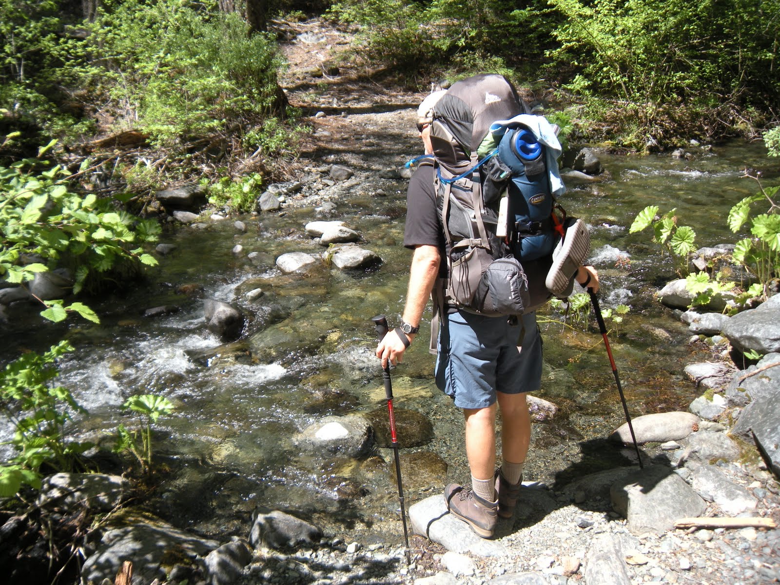
The trail starts at Coffee Creek Road and the follows North Fork Coffee Creek up the canyon, winding, hard packed dirt and was far better maintained than last year.  With a few very short exceptions the trail is fairly easy for about the first five miles or so.  There are a couple of solid bridges along this section, and then a couple of creek crossings that were manageable, this trip, without getting water in my boots (using gaiters).


At one crossing you'll see a campsite straight ahead or the crossing at a 90 degree right turn.  We read there was an enticing flat spot between the creeks ahead, so we opted to go for it.  We didn't find any wide level spot as described so CJ snd I hunted out a small exotic feeling place with a mini-waterfall and large ferns, with easy water supply access.
The next day we headed out for South Fork Lakes.  This sign is at a fork where you head to the right.


Here is where you find the first challenge of any length.  This section follows a narrow creek bed very steeply uphill through an expansive meadow into the woods.  In the forested area, the trail traverses but it's still a steep challenge.  The bright side is that it is wide and you can rest as frequently as you need to catch your breath.


Once you get over the ridge, there is the excellent vista on the right, shown below, with CJ, our graduate!


We caught a glimpse of a lake so we knew we were getting close!  Traverse downward to make it to the first lake with campsites available.


There were grass and willows growing around the edges, and it was a breeding ground for mosquitoes and little black flies that bit!


We chose to hike over to the lower lake (shown above) and what a beauty!  This lake gets few visitors and supposedly has good fishing too.  The campsite we chose was back from the lake which sits in a nice granite bowl.  Directly across from us was a waterfall the full length from the crest to the lake, and snow still was hanging along the sides of the deeply carved crevice the water flowed down.  We couldn't walk all the way around this lake, but had a great time swimming and resting here.  At a glance it looked as though is was just thickly covered with bloodthirsty mosquitoes, but they turned out to be some friendly damselflies, non-biting "fish bait" larger than mosquitoes and smaller than typical dragonflies that hung out in grassier areas around the lake. Firewood was reported to be depleted but we found plenty.


To return to the trail we had to go back to the first lake and wind around the western side. Leaving the South Fork Lakes we went through too great a variety of terrain and trail types to list, but one wonder was going through wet acres of cornflowers almost as tall as ourselves!  Amazingly beautiful!  In places like this the guys would holler out "GO Away Bear!" as if they were boy scouts practicing a drill. 
We hiked toward Wolford Cabin, which we had read was open for use of hikers, and hiked another section of the Pacific Crest Trail.  Across the ridge that lead to the Mavis Lake, PCT, Wolford junction, we enjoyed wide opened views across both sides (photo below).


CJ was in a hurry to get further for some reason, so we abandoned our planned stop at Mavis and went south for the Wolford Cabin. The trail going down to Wolford Cabin was horrendous:


Wood debris was laid thickly and randomly over the ground with difficult and unsafe footing.  At first it was barely visible and damaged from water runoff.  NO real trail left for some distance although we saw equine prints and boot prints here and there.  The trail, as it were, followed the creek down roughly to the meadow the cabin sat romantically situated in.  Well, no more open cabin.  It has gotten too dilapidated for safe use and is locked like a bank vault. There is a campsite set up near the creek, but we opted to move on. Quite a disappointment but remains a real postcard gem!

Wolford Cabin
There are two trails that exit that area.  Our tracks leave uphill at N41 11.748 W122 49.685, starting away from the creek and the other trail is guided beside the creek.  We were moving on to Granite Lake that night and Doe Lake the next day. 

If you  think about side trips to additional lakes, I put waypoints marked as Mavis, Fox Creek Lakes, and Stoddard Lakes.

Onward to Granite Lake for a 12 mile day.


Night fell and we finally made it to Granite Lake but couldn't see much of anything.  Thirsty, tired and hungry, even nauseous, a camper showed us the closest camp...haha.  The photo below shows a widow maker had fallen right over the firepit! (Widow Makers are dead trees that could fall on you and your camp...potentially lethal, really!) Seriously always look for those standing dangerously close before you set up camp! 


Below is the rest area for us that night, Granite Lake:


We found the water mossy.  Our water was obtained with great effort from a slow flowing spring with silty debris, but it was pure.  We could hardly wait to get out by going south then curving west in a giant u-turn which then took us east to Doe Lake.  This was one of the hardest sections we climbed.  The hike was short between the lakes but narrow, washed out, loose surface, and very steep with a drop off down the mountain in the event of a false step. Not for the faint of heart or inexperienced.


Once over the worst, there was still an ascent, but wide, better, safer trail which gave beautiful absorbing views and rest areas.


Above was our favored destination: Doe Lake.  Fish jumped alll over the place.  A fishing rod would have been nice to have!  Snow still lay in blankets on the far side of the large granite bowl, slowly melting into the lake.  But the sun over rode the chill and it was swimmingly refreshing!  Good blocks of sunning rocks for drying out lined one side of the lake.  Camp was far enough away that the mosquitoes were less annoying, but anywhere near the water in the early evening and morning was war!  Several campsites are hidden in the woods, but we escaped having company and got it all to our quiet selves.  Plenty of firewood, practically cut to fit our fire pit!  Pretty wildflowers were abundant this year with all of the melting snow still running off; it made bogs and meadows fresh and colorful.


We hiked out through meadows and manzanita.  From Doe Lake you can take a side trip to Stoddard Lake for a camp or rest, but we again opted for more of a wilderness experience.  Stoddard is accessible by road to boaters and picnickers, is larger, and more populated. The trail we took, East Fork Coffee Creek Trail, becomes rocky and narrow and at times, steep downhills. A few tree fall crossings and creek crossings along with some seeps, through some bogs and meadows, but overall, enjoyable.


Then it opens into an old mining road that lead us down to Coffee Creek Road. From there we hiked up a mile along the dirt road to get to our vehicle. We had an ice chest with cool drinks waiting, rested our weary dogs and congratulated CJ for carrying a heavy backpack, hiking the miles with blisters, and never complaining!!!  He is now initiated into the world of backpacking!  Glad to have shared our passion for the woods with him. 


Hike Difficulty and grades: Strenuous (STEEP areas,see graph, higher elevations harder for "flatlanders", length, technical backpacking skills required over some sections, steep washed out sections, heavy debris sections). Range was up to a 99% grade upward around the 6.6 miles area. Much ranged in the 20%s.
Distance Hiked: 32.98+ miles
Ascent and Descent: 16,858 feet total, per Garmin Basecamp (only including the tracks per GPS, not side trips).
Trail Tread Types: Pine needle covered packed soil, old road width to barely single tread, loose rocks on steep narrow sections, wet and dry stream beds, boggy, very tall thick vegetation to navigate through, rocky, some boulders to step around and/or climb.

For a general idea of this trail location here is a map from Wikiloc to help you locate it and get driving directions to Coffee Creek, CA 96901, from your locale.:

GPS Tracks

For other nearby hikes:
Trinity Alps (near Redding, CA)


·         Trinity Alps Coffee Creek Loop
40
Strenuous
12
Strenuous and Difficult
·         Trinity Alps (Hobo Gulch)
backpack
Strenuous!

Peachy Hiker's Table of Contents

Trails by Locations

Happy Trails!

edited 5-7-2013
Edited 7-2014


July 28, 2011

Trinity Alps Castle Lake Trail to Mount Bradley Lookout

Castle Lake, Shasta National Forest, California to
Mount Bradley Lookout is a 12 mile day hike, excellent to
view wildflowers, but best of all, Mount Shasta from
numerous angles for fabulous photographs!

Mount Shasta 2011
Hike Difficulty: Strenuous and Difficult  (for miles and lack of trail maintenance, hard to find at times)
Distance Hiked:  just under 12 miles out and back
Elevation Change:  2582 feet per Garmin Basecamp
Trail Tread Types:  Pine needle covered packed soil, double tread to single tread, loose rocks, wet and dry stream beds.

     Along the trail Shasta would reward our efforts with stunning views, before the trail would turn or descend and hide her glory again and again.  I hope this post entices you to consider this hike soon! The trail head began at Castle Lake.
Driving Directions:  We drove on I-5 to Central Shasta exit, then followed signs to Castle Lake. Go to Wikiloc Trails  for GPS tracks; a small map is shown below.

     The trail was mostly clear to follow but GPS helped us navigate since in some places it simply vanished.  Long sleeves and long pants (convertibles) with good hiking boots and poles are recommended due to thick overgrown manzanita.


      There were swimmers and fishermen and a crowded parking area when we arrived, but they filtered out quickly as evening approached and we found our first campsite by following the trail to the left toward a small creek crossing.

TAKE THE BUG SPRAY!  No Joke!


     Several campsites are available alongside this trail toward the east of the lake, but we veered left at a small fork and meandered until we found our more private site away from the lake and its visitors.  The creek (possible water source) near us was through this little bushwhacking shown in the left photo above.

     The trail starts at Castle Lake and climbs to the east of the lake.  
There is an unnamed pond and then you'll come to Little Castle Lake (not much more than a pond and difficult to get close to due to the thick brush.

     The trail ranges from rocky to meadows to forest to very old double tread and through unmanaged vegetation.  We had luck with breezes to cool us despite a hot day and areas without shade.


     Hike uphill through the forest and then you begin crossing the saddles and will find astoundingly beautiful views, one after another.


     The heavy manzanita is difficult to wedge through especially if you are wearing a pack.  It stood taller than us and caught on my pack, pockets, poles, shoes.....  but onward to the promising views that are as breathtaking as any hiker imagines.

"The Crags"
Sneak previews of Shasta along the trail ahead.


     Across the last two saddles we enjoyed the vistas in every direction!  We could see the trail far ahead going up and down the saddles over to the barely perceptible lookout.  The oddity was traveling all this way on foot and arriving at the dirt road leading into the lookout area!  Surreal!  Where is the holy grail now?


Black Buttes
More of Shasta tantalizing hikers onward!

Mount Bradley Lookout
     We put up our dusty feet and soaked in Mount Shasta and the surrounding views in the shade of the lookout.

     This hike could be satisfying and shorter if you stop at the last saddle.  It is a narrow old section of wide rocky trail but the views, in our estimation, were best from the top of the peak before the last saddle that crosses to the lookout.  If you're interested in the historic and now unmanned lookout, it was a pleasant resting place.

As we continued......

     Upon our return to camp, having hiked this as an "out and back", we found a closer camp than before and settled in.  The bugs must have bred while we were away...I was sure there were more of them!
Here are some shots of the lake (and flowers) before the breezes or people disturbed it in the morning:


     Castle Lake is very shallow at the side nearest parking, but is 120 feet deep across on the granite side of the bowl, and its surface covers 47 acres. It is classified as a glacial lake.

     Enjoy your hike and let me know how you fare!
     I read an account of this hike in Trinity Alps Vicinity by Mike White.  He offers a multitude of hikes in the area with directions and extensive details.  Note that it can't be updated about trail conditions so check out your interests with the Forestry and the internet before you set out on your hikes.

Trinity Alps (near Redding, CA)
miles


·         Trinity Alps Coffee Creek Loop
40ish
Strenuous
12
Strenuous and Difficult
·         Trinity Alps (Hobo Gulch)
backpack
Strenuous!
 and check out
Peachy Hiker's Table of Contents

Happy Trails!
Edited 7-2014


June 17, 2010

Trinity Alps

Trinity Alps Backpacking June 2010


We chose this trip to upgrade our skills and fitness levels. I've seen photographs, read blogs and trail reviews about the Trinity Alps which planted visions of sugarplums in my head about what it would be like. The weather turned on us a bit and the Forestry informed us most of the lakes are inaccessible from snow and trail damages, and they are as much as 90% iced over! It is mid-June!!!


Furthermore, most of the trails are unmaintained due to a huge shortfall of funding so climbing over fallen trees and crossing swollen creeks that were unpredictable from one hour to the next. Many trails have become impassable due to lack of travel and maintenance. With the worst and best cases presented to us, we took our maps and GPS and made a run for it.

The trail head we chose was an hour drive up a dirt road, with a conveniently located campground very nearby. As the day grew short, we decided to do an over-nighter there then start out refreshed and organized in the morning.


The camp was secluded, a mile down a narrow dirt road; we were there on a weeknight anyway, with recent stormy weather, and with rain forecast for the next couple of days. Not all brochure ads for drawing crowds! So we did have the area almost entirely to ourselves.


A runoff creek tumbled over mossy rocks alongside our chosen campsite giving us easy access and a nice stereo effect from that and the river. A small trail wandered uphill beside it and made a pleasant evening walk. We also walked up the dirt road to the trail head to take a peek.


Along the way was an old wood building, looked like it could house a couple of pack animals, and a nearby old "outhouse" of sorts. There was a great sawed out bench seat and a fire pit.

We meandered further up the road, checking out the scenery and vegetation, and stretching
our legs from the drive. So far, the weather was holding out for us.

We set up camp, finally deciding to use the rain fly just in case, and kept most of our gear in our
vehicle. They say "Early to Bed", and so we were! Yes, the rain came through and our insurance of having the rain fly paid off! In the morning, the ground was only damp, and the air was warmer thanks to the clouds. Breakfast was oatmeal, as usual, for an energy boost! And of course we indulged in our personal luxury, COFFEE! Not powder, brewed! Ah, cowboys knew how to do it!
We did spend some time reading the trail head signs and checking out our options at the map there, counted creek and river crossings and tried to minimize those due to advice from the forestry. We made a plan and after the obligatory first photos, we stepped off into the woodlands, lazy, excited, anxious, and determined. Prepared for almost anything! From there it becomes self hypnotic for me, one foot in front of the other, listen, look around for photo opportunities, and keep pressing on at a steady pace.

Our first creek crossing was small, but an exciting gateway into the alps, and into our fantasies of what we would be able to see.
The trail of course diverged and left us wondering where to go...up, up, up? To the right but only 5 or 6 miles? or to the unknown left that we thought might be the trail to the lake we hoped to get to. We turned left and hiked through a thickly forested area, fire bitten in the last few years, but recovering well.

This is me returning on a trail that is supposedly in good condition, but we hiked a section without our gear to see how it looked...where are my trekking poles and a rope?!?!?! No wait! A parachute!


Wildflowers dotted wet areas, and even bamboo grew around one of the creek areas. It seemed to me the creeks were growing and I found us looking for logs to cross or bigger, less slippery rocks, doing a little bushwhacking (or we were on untraveled and unmaintained old trails) searching for better, safer routes. We found a great log crossing and several of our efforts to reroute ourselves proved unfruitful so we backtracked.

Finally, the great challenge we were forewarned about...the river. We could COULD cross there, but there was one fairly deep area with a swift current. Now that was okay, but what about a sunny day (it was raining just then) or how the rain would effect the melt and runoff had to be considered too. At that point we weren't even sure that to get to our destination, this was the best or only route. Deliberation lasted about 45 minutes, and we tried the high road of unused but visible trail on our side of the river but up higher along the canyon walls. LOTS of tree falls made it difficult, but also allowed great backpack rests here and there. We took a break and contemplated our options again, and studied maps again. Meanwhile, we ate and got some electrolytes in us to prepare for whatever challenge we took. We finally decided to return to the Up up up trail we left behind and give it a try, thinking it may get us closer to the lake. We backtracked. There it loomed. Up. So we climbed. The further we went it seemed like this may have been where we should have gone all along.
We were able to log many more miles back this way with less dangerous creek crossings and found a camp at a trail junction called Rattlesnake Camp. Quietly nearby were some other backpackers, well hidden, and two more passed us later in the day after we had settled in. The next day was enjoyable, and our bear canister and food bag we had hung were both untouched. Our ritual of cowboy coffee got us off to a great start and after a nutritious dehydrated meal, we made it back onto the trail.


At long last we "car-camped" in Hobo Gulch Campground, with a table, fire pit, the river just across the way, and deer wandering through to the river. We waded in the river, played with a little sunning snake, and took in a little sun ourselves. That evening we had fun watching the deer pass through and we played our camera games capturing Ken's knees, then feet, and close ups of the tent netting, my ridiculous expressions, ...arm pits, you know, good old fashioned fun! It gave us the day to relax and review the funny things, options we could have taken, food issues, future packing ideas, and get our things and selves organized before returning to city life!

Peachy Hiker's Table of Contents