Trails in Northern California

Trails in Northern California

Leave No Trace!

Visit desovw.org for more information about Desolation Wilderness. Visit Recreation.gov or call 1- 877-444-6777 to make park reservations. Visit Campfire Permits to get a permit online. More about Leave No Trace principles.

May 27, 2013

The Botany Song


I am making some progress in life...taking natural resources coursework!  In my California Wildflowers class, a friend of one of my classmates wrote and performed this!  Who says botanists are boring???   We saw Jamie in concert and she played this one for we flower freaks....not a better song in her set!  Get ready for a good belly laugh!
P.S. I finished the class with an "A", and having learned fun things, the pressure is off and I will just enjoy hiking again!
updated May 2013

April 08, 2013

Grizzly Island Wildlife Area

We saw numerous small groups of tule elk, beaver, otter, and signs of coyote, raccoon, and other wildlife, including a variety of birds. 

 This reserve is not too far from Fairfield. A map is provided to help you manage driving directions.


This reserve has hunting seasons for waterfowl, pheasant, Jr pheasant hunts, rabbit, tule elk, doves and falconry.

  The headquarters is open Monday - Friday 8-4:30, offering free literature and has a large mounted bird collection.  When the center is closed you can enjoy the outdoor kiosks for information.  Self-guided tours begin at the headquarters, taking the unpaved Grizzly Island Road for 7 miles and stopping at parking and walking or viewing areas.

Cormorants, when they swim you only see their head and neck.  Their bodies are submerged!
Grizzly Island has 8600 acres in the heart of the Suisun Marsh, the largest contiguous estuarian marsh, comprised of 84,000 acres, and where over 200 species of birds and a variety of endangered or threatened wildlife and plant species live.
Tule Elk tracks

Courtesy of Google Maps


The acreage is full of endemic species that can only live here.  Many are endangered

and protected. 

The pickle weed is the habitat element the harvest mouse
cannot live without.  It nests there and the plants have adapted to salty marsh
by pulling in lots of water, then sending the salt to the tips of their leaves.  In the fall they turn reddish colored and drop off, taking the salty residue with them. 

Wild things!


Otters like this type of area and left tracks and scat (poop).
 

In the distance you see the huge windmills.


Taking a trail guide book to help you and the kids determine what left the tracks makes a fun discovery adventure.  The tracks are often fresh, so it is likely you'll have the joy of viewing critters.

Animal Tracks

Animal Tracks


You can park and walk back into these areas along gated dirt roads.  Watch out for ticks though!

Animal Tracks

Animal Tracks


People like to fish in this area.  Bring the kids and the poles!

Probably raccoon tracks.  We also found rabbit, beaver, coyote, bobcat, otter and elk prints.


  Using binoculars, going for drives and taking short hikes feel like you have gone back in time.  The views are beautiful.  Kids will love all of the tracks they can find, and if you don't see wildlife, go slower!  The weather is cooler than the Sacramento Valley, and warmer than the beach.


Happy Trails and Come Again!  For more to do, check:


March 23, 2013

POISON OAK, Besides Preventing Rashes…


We hear about it a lot here in the Sacramento area, and my motive isn’t to address the well-known issues of allergic reaction, prevention, or treatment of it from contact with the oils carried in the stems. 

There are more interesting facts that are less widely circulated, and worth knowing. 


This "meadow" is carpeted by poison oak along One Eye Creek Trail near Georgetown, CA.
by Laura Sheffield


Poison oak is native to North America’s Pacific West Coast, south into Baja and north to British Columbia.  It lives in a variety of habitats up to elevations of 5,000-6,000 feet.  It is a woody shrub or vine, and looks rubbery with reddish hues, rather than having a usual bark like texture or color. 

Poison Oak is the most prevalent shrub in California! 
  Its habitats include the understories of mixed evergreen forests, woodlands, chaparral, coastal scrub sage, redwoods, and riparian areas. 


That "shrub" growing in front of the tree is poison oak in the Knickerbocker area, at Cool, CA.  Compare to the adult off to the right for size!
By Laura Sheffield
It has even earned the name diversilobum, the Latin term used to make reference to its diversity in form.  It thrives in undisturbed areas, but will invade pastures and recreation areas (trails).  This is one plant with flexible requirements!  It can grow in a variety of soil types, elevations, light intensities, temperatures, and water conditions.  It is NOT related to ivy.
Taken by Laura Sheffield

As an angiosperm in the Anacardiaceae family, it is deciduous, dioecious or polygamous. Poison oak has pinnately compound, alternate, trifoliate leaves. They can be rotund to ovate, with margins that are lobate, denticulate, serrulate, or entire, all of which may be present on a single plant.  One of its apparent survival skills is to masquerade as other surrounding plants. Leaves are in groups of 3, 5, 7, and some sources say 9.  At the tip of the stem is where you find a longer center leaf on a pediole and two leaves at the base of the pediole growing opposite of each other. Poison oak is spread by birds that eat the fruits, and it passage through their digestive tracts actually enables its germination by reducing its period of dormancy once it is deposited by the bird.  It is rhizomatous, and can be grown from cuttings of roots or stems (in other words, rototilling won’t get rid of it).  Poison oak blooms each spring with little bunches of small greenish white flowers where leaves attach to the stems. Being dioecious, the male plants have 5 stamen, 1 sterile pistil, 5 petals, and 5 sepals.  The female has a fertile pistil and reduced sterile stamens. The plant bears fruit that is also whitish green little round berries.
If you zoom in, the dark lines on the fruit contain the substance people are allergic to.
Taken by Laura Sheffield in Granite Bay, CA. in late fall.
Its blossoms are a good source of honey.  The plant is considered a good food source for black tailed deer and livestock, although ratings of palatability range from good to poor.  Nutritionally, it has been measured from cuttings throughout California to provide 24.2% crude protein in March to 6.5% in September, along with other important nutrients.


Aside from all that goodness, the endangered Bell’s vireo uses poison oak for its nesting sites! 
The ringtail, a fully protected mammal in California has a rare documented colony living in a Freemont cottonwood/Pacific poison oak woodland along the Sacramento River.
Of course the Native Americans found medicinal uses for poison oak said to include curing ringworm, removing warts, calluses, and corns.  It was used to cauterize sores and stop bleeding, and to treat rattlesnake bites.  The Chumash drank a decoction made with poison oak roots to treat dysentery. 

Most importantly, current research is

being done to develop a serum from the resin to desensitize people. 
Best of all, a bonus is the research that is using poison oak resin with AIDS patients to stimulate T-cell production!

The most intriguing article I found was a blog written by a guy who eats the new tiny leaves and does this several times a year, and has supposedly developed resistance to it!  Try it if you like, but don’t say I told you to!  Check out his blog at Eating Poison Oak
I have a friend who is trying it.  He ate leaves for several days while hiking this spring.  It took several days of this before he had some strange feeling in the roof of his mouth so he took a break.  No reactions of any kind and I will update you when he tries it again.  Not saying you should do it...

Sources:

University of CA Agriculture & Natural Resources @ http://www.ipm.ucdavis.edu/index.html


 edited 4-30-2013
Removed photos that were not showing up for readers on June 16, 2015


January 13, 2013

Donner Summit Royal Gorge Future Trails

"Historic Royal Gorge Acquisition"

12/21/2012
Royal Gorge is described as one of our "pre-eminent natural wonders". Placer Land Trust and other conservationists and individuals contributed to providing funds to acquire land that had almost become 3,000 acres of neighborhoods and condos, rather than publicly accessable, historically significant land. Placer Land Trust has worked diligently to raise funds for this and other land preservation activities. Congratulations to the new owners the Truckee Donner Land Trust and the Trust for Public Land, both connceted to the Northern Sierra Partnership. This one one of the most sought after properties for conservationists, as you well know, due to its beauty and history.

Sugar Bowl will manage the land use, including hiking trails and additional opportunites including cross counrty skiing.  The no trespassing signs are things of the past, and the executive director or Sierra Watch, Tom Mooers, commented that the fun will be organizing trails. The groups are trying to raise about $4 million more to pay for maintenance and improvements.

Mooers commented, "We're going to look back even five years from now," he said, "and be amazed by what we got."

Both webpages for Northern Sierra Partnership and Truckee Donner Land Trust are great links and Northern Sierra has beautiful photos!

December 12, 2012

Donner's Castle Pass via PCT Snowshoeing

 
Difficulty: Strenuous.  Difficult to follow trail.  Undermelt hazards.  Numerous creek crossings of varying difficulty.  Could be more fun as an overnighter.  Fires are allowed during winter.
Length:  Ours was a 9.3 mile loop.
Directions and details:  Take I-80 to the Boreal exit west of Donner and east of Kingvale.  South of the exit make a left.  Stop at the hotel for a parking permit.  Your regular state park pass does not apply. The hotel has some vending machines with snacks. It is snowplowed in the event of snowy weather and has a nice restroom with vault toilets.  The kids can build snowmen and tabogan there.  Great places for snowball fights, too!  During the regular hiking season, there is an interpretive loop trail.

Taken by Peachy from Castle Pass looking south.
This was my second time out snowshoeing in my new MSRs made for virtually every condition.   You may remember that we each broke one of our trekking poles on our last trip so I had one of each set this time.  I ordered the new ones but they hadn't arrived so "Make do" as grandma used to say.  This time the sun was on our side rather than stormy weather, and I had mapped out a plan for a longer trail.  It seemed like a reasonable day's hike at 1 mile an hour average, expecting about 7+ miles and time for a meal. We used the sno park paid parking last week so we knew the ropes and were able to waste less time and get out on the trail.  (Pay at the hotel as you enter the parking area.  There are vending machines there, too.) Near the trailhead that is down the road in the loop is a vault toilet. Use the trailhead at the billboard sign turning north instead of south at the junction.  I was excited because our last trip was so much fun despite bad bad weather; this day promised to be stellar!
Our first creek crossing was wide and frozen.  We detoured a bit for a safer route. 
(Funny note!  Those are my mismatched poles!)  Those marks in the tree are trail markers.
The snow was sparkling, the weather was crisp but not bone chilling.  The snow was icy but I thought with sun it would soften up through the day.  (Guess again).

This widow maker is about to fall and is right on the trailside.

These photos are for fun and to show you to see what the trail was like:


Unlike the perfect dry powder we had last time, more effort was required to walk on this crunchy  snow and I found myself tempted to take the snowshoes off and just hike in my snow boots.  There were bootprints to follow and not much sinking, and I've done it before!  From the trailhead we made our way easily to the tunnel snown above that goes north under I-80 for the PCT.

You can see the trail to the left.


Once we crossed the highway it took some effort to stay on the trail because no one had been on it this far back  The sports store said lots of people were here yesterday so we expected broken trail all the way. 


There are few markers along the way and the GPS was a frequent help.
We wound through the woods and conquered one undocumented creek crossing after another.
I like those, but in the deep, crusty, unbroken snow there may or may not be a faint look of a trail buried. At the creeks we faced steep banks of one to three feet, the water (sometimes a foot deep) and the other bank would be as much or more of a drop off. 

The water running under the snow made the possibility of the bank breaking
into the creek, taking the hikers with it, an unpleasant thought. 
Here we went downstream to cross.

Troopers that we are, we kept going and with umpteen detours
for "safer" passage, we would leave and refind the trail. 

One of the few PCT markers, and imagine, no bicycles!
After several miles of detouring, it seemed like the GPS predicted the same distance to our destination which was confusing because it continued showing our tracks as progressing right along. 


In so much shade we had to stop and get me some layers, but we were dry and still happily challenged.  No conversation was possible unless we stopped because the crunching of the snow under our snowshoes was so loud we couldn't hear each other!  No kidding!

Finally we reached an intersection of trail junctions and had to choose that all go northerly, just more east to more west.  None was the obviously correct route and GPS wasn't a help at this time. Upward to the most northeastern direction was our choice. My quads, calves and even the tops of my feet were so achy, my usual penchant for going uphill had vanished.  I just wanted to stop and heat water and eat. 

We were finally heading up out of the woods and getting some distant views.

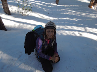
Peachy Hiker taking a rest!

At the top we were on a wide open ridge with breathtaking views all the way around!  We were buffeted by extreme winds that actually took me and another hiker completely off of our feet, in snowshoes, and threw us to the ground - me twice!  First time in my life!

The ski runs to the southeast.


Castle Pass to Castle Peak, and by our shadows you can see the sun is falling in the west.
The GPS showed us on another ridge to the north!  It wouldn't move either so clearly it had lost function.  Now getting later in the day, and being tired, we knew we faced a headlamp snowshoe back to the parking in possibly more unbroken and invisible trail. 


Achy and sore, but invigorated by the fantastic views, we headed downhill to the west southwest.  It was like a freeway.  Snowshoers, a snowmobile, cross country skiers, and hikers had made it so much easier by packing the snow and making the trail clear, plus it was all downhill.  How often do you hear me being glad about going downhill, but I was rapturous! 


Our whole hike totaled 9+ miles (we expected 7) and we did end up using headlamps, but only at the end and not a concern. 

Advisory:
The PCT wound through the woods and if you are experienced at finding your way in snow without anything but a map and compass, this route was untouched and had everything the backcountry offers. 


We had fun crossing creeks and identifying animal prints in the snow. If it were powder I would have been more thrilled!  At the end of the day I had sore muscles and an enormous sense of accomplishment.  Honestly I am not as sore from this hike as the last snow trek.  Our photos are prettier without the stormy grey images we got last time, too.  The views made it tempting to stay on Castle Pass for sunset and if I were familiar with the trail back, I would have.  The GPS failed twice on the trip so I posted our tracks but suggest searching for additional tracks to Castle Pass, PCT, and Peter Grubb Hut. Our map is shown below.  I drew in the places the GPS didn't record.  A handful of people have GPS tracks posted of hikes in this area, but be aware that in the snow, the trail is virtually undetectable in many places.


HAPPY TRAILS and as usual, remember to take plenty of water, snacks and food, layers for warmth and a first aid / safety kit.  I always say take a light source and way to start a fire.

Trails by Locations
Peachyhiker's GPS Tracks
Articles by Titles


If you appreciate our state parks (and sno parks), consider this letter I received and join in!  With membership you get a parking pass and other amenities, plus help keep our parks all open.
Dear Reader,Double Your Donation
Throughout 2012, our parks faced budget cuts, development threats and more. And next year's budget battle will be challenging.
The good news is you can double your impact with your tax-deductible gift today, which will be matched dollar-for-dollar!
That means your contribution of $75 or even $150 to California State Parks Foundation will go twice as far. But time is quickly running out – as this match only lasts until midnight on December 31st!
Your support has never been more important! We nearly lost 70 of our state parks this year. But it would have been a lot worse without supporters like you.
Stand with us and stand for parks today by making your tax-deductible, year-end contribution to the California State Parks Foundation.
Don’t lose any time! There are just a few weeks left for your support to do twice as much for our state parks! So please, double your gift – and your impact – before the clock runs out at midnight on December 31st.
Thank you again for your continued support this year and in the year to come.

Sincerely,
Elizabeth Goldstein
CSPF President and fellow supporter
Updated 12-14-12