Olmstead Loop is within a network of trails and old roads rambling through miles of rolling hills in Cool, California.
*At the end of this page are details including a map, elevation graph, and data information. You can click on any photo and then view them sequentially, enlarged for more detailed viewing.
Knickerbocker Creek is a lush green, shady area,
pleasant for kids to play in, finding bullfrogs and tadpoles.
The trailhead is located south of Auburn from CA49 coming from I-80, and north of Coloma on CA49 from Highway 50, which you can see on the map at the bottom of this page.
 |
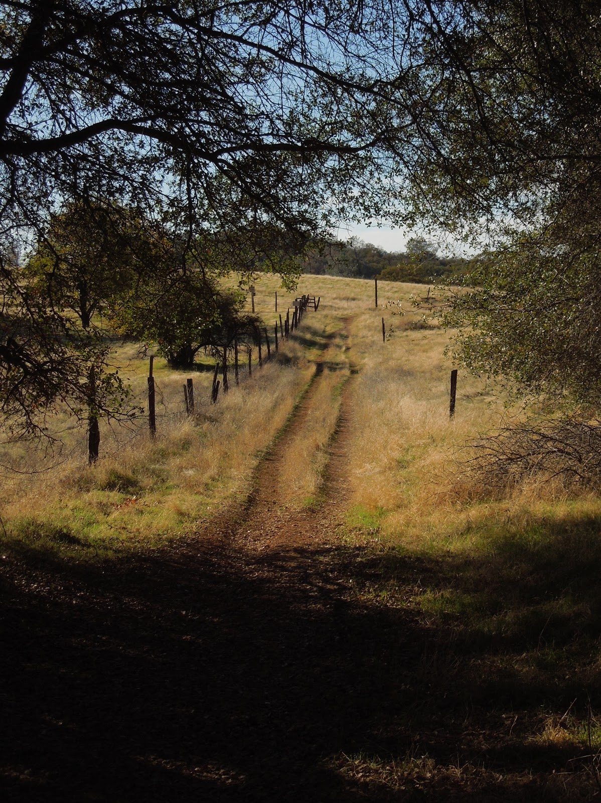
| Check out the acorns stashed in holes in the old fence posts! |
Distance: 3+ miles. On this hike we traveled over 9 miles.
Location: Cool, CA, CA49 near CA193.
Difficulty: Easy to difficult depending on your choices.
 |
| The trails vary from a paved road to old unused dirt roads, trail wide enough for several persons, down to single file. |
 |
| Shade is provided by several species of oak, along with some old walnut trees, pines, and a few cottonwoods. |
 |
| To my delight, we crossed paths with turkeys enjoying the shade. |
 |
Other wildlife you may see include coyotes, skunks, raccoons, deer, hawks, ducks, geese, pheasants, bluebirds and other varieties of smaller birds. I have also met a bear back here, face to face. An acquaintance got bitten by a rattlesnake last year and had to hike out. She was hospitalized for 5 days, so keep your eyes and ears open. |
 |
Poison oak is taller than I knew existed!Look closely at the dry, already leafless branches and stems,in the forefront of the pine tree ~ that's poison oak! |
Above is a closeup of a poison oak stem. It is nubby and looks rubbery. The troublefor you who are allergic: it is easy to miss while leafless. On the bright sideit really doesn't grow into the path on this hike, but is quite healthy alongside it. |

 |
| There are two somewhat seasonal creek crossings and some wet depressions that support cattails. The ground may be soft and muddy but some short wood plank footbridges are installed to help you through. Wear suitable shoes! |
 |
| In the spring this is a popular hiking trail while wildflowers are abundant. Is this a Common Madia relative? In November we still found some very small unidentified purple flowers, yellow thistles, clarkia, larger purple thistles, and poppies. |
 |
| The thistles ruled on this hike in autumn, and displayed sparkling giant fluffs for children to wish on.
|
 |
| You may come across this pond which is host to the birds and wildlife, and has evidence of a rich history. |
 | ||
Beside it are old grinding rocks with deep wells,thankfully shaded in the hot afternoons.
|

 |
| Closer to Cool the wide trail is lined with trees bending over it and shading hikers. |
 |
TRAIL SUMMARY
This set of trails is most excellent for the many options to determine the length of your journey (shown on the map below) and even how much sun or shade to spend your time in. Heading south from the parking takes you across rolling hills brown with dried thistles and grasses. On the west, the loop zigzags through a less generously wooded area. Then it leads you near the top of the canyon wall heavily shaded by pines and oaks, with distant views of the river and canyon far below.
As you descend to the Knickerbocker Creek crossing the moisture in the air is cool and luxurious on a warm day. From there I am told the adventurous can hike down the canyon and see the Knickerbocker Falls. Otherwise, head uphill (some say it gets a little arduous) and turn northeast. The trail returns to sunny rolling hills with distant views to the south and southeast of snowy mountain caps, then runs alongside a charming old walnut grove. Turning toward the east, you'll pass by the photogenic weathered "home" where the trail is wide and well-shaded. The sounds of Highway 49 grow, and once there, there is a trail set off the roadside running parallel to 49 with the firehouse now in sight.
In the winter and after storms, water pools and this trail is known (and loved by some) for becoming deep mud, most appreciated by mountain bikers! Equestrians love the area, too and the parking behind the Cool Fire Station has ample room for large horse trailers.
You can enlarge the map of area trails by clicking on it:

There were also single file trail choices not shown on the map. The very top of the map is where you head north and can connect with the Training Hill. From there it is possible to go to Western States Trail from the bottom of the Training Hill and take it back uphill toward Cool, making an even longer loop. There are signs for these and other options. I have hiked everything I posted on this map, but we hiked 9.14 miles without that TH-WST section.
Here is a map of our hike as described above:


 Click here for my Everytrail GPS tracks
Wikiloc has these trails posted individually by "Clipper Creek Wanderer".
Here is a map of our hike as described above:


Wikiloc has these trails posted individually by "Clipper Creek Wanderer".
Parking and Trailhead Information:
The official parking area is located west of Highway 49 behind the fire station, northwest of the only signalled intersection in Cool, where CA193 meets CA49. (Some people park at the nearby market, southeast of the fire station.)
The parking has state fees now. The Olmstead loop, if you go clockwise, heads out of the southeast side of the equestrian parking area. There is a picnic table in the sun and a vault toilet.
***Check out my Tables of Contents by Titles and Trails by Locations for other trails, topics of interest, and wildflower photos.
HAPPY TRAILS!
Updated 11-14-2012
No comments:
Post a Comment
Thank you for your visit to Peachy Hiker's place and for taking the time to share your thoughts!