DIFFICULTY: Moderate
ADVISORIES: Poison Oak is everywhere! The trail is steep, sometimes wet and slippery.
 |
| This marks the place you will either park or turn right and park at a junction of three roads. |
1. Take Highway 193 from Highway 49 toward Georgetown, California.
2. If you are coming from Highway 50, turn right on Traverse Creek Road, or from Highway 80, turn left on Traverse Creek Road.
3. Take Bear Creek Road to the right and pass Bear Creek Picnic area on the right (although this is a good place to stop and use restrooms since there aren't any at the trailhead).
4. Continue for 0.7 miles to Forest Service Road 12N81 on the right, visible due to park signs posted.
5. In winter park in the wide area on your left, and walk straight down the Forest Service Road until you come to the junction of three roads. In months the road is open you can drive back and park along here.
6. Walk straight ahead and you will see a small post on your slight right at the One Eye Creek trailhead. Follow this trail all the way to the falls.

At the beginning of the trail, there was scrub brush on either side, but the trail itself was clear and wouldn't be confused with animal trails. At one point it opened out into a small sunny meadow, but most of the area had manzanita and other brush.
Early on One Eye Creek Trail, these stickery bushes and vines had grown over the trail and caught on our backs and backpacks which made them a nuisance. The terrain is hilly and not too steep for any length of time until you descend to the creek and waterfalls. There was less poison oak in that area, except where the sun had more access to the trail. In May wildflowers were blooming.

And next is the most wild of all, the seeming meadow that when you look closely, you discover it is mostly poison oak!
About a mile into the trail you come to the "mine" shown below which is actually only a few feet deep, but a trail hazard that is fenced in with a small trail down the hill for hikers to see in.
The rolling trail finally opened up into this beautiful, cooler forest area that goes until you traverse downward to the creek. Keep in mind it is deceiving because you are heading downward and on your return you will be heading upward, though slightly, you feel it.
.
After hiking all the way in, we had to bushwhack a little, but this time wasn't too bad.
Going in we hiked the steady downhill and fairly easy trail. From about a mile away from the creek, we began to hear the waterfalls! As we made our way closer, the trail got steeper, and the pine needles were thickly layered and are sometimes slippery. Hiking poles and good shoes helped me navigate this section more safely.
This
section of trail could be dangerous due to steep slippery hills. It makes having inexperienced hikers,
inadequate equipment, or having children present inadvisable. Lat/Long:38.82396, -120.759
It has been reported that the falls have been as much as 100 feet wide in flood stage. Here, there was a powerful current and as you can see, a large stretch of the 100 feet was, in fact, covered. The falls have also been estimated to be only a 25 foot drop, but with the current rushing almost violently, they were quite impressive! To get to the bottom you had to creek cross and then climb down. Others were there so we stayed up top beside the creek.
 |
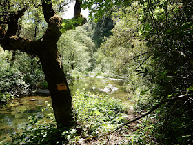
| Our picnic spot along Bear Creek. |
Another alert: If you sat anywhere along the trail, it was on the damp ground with pine needles or poison oak! We also noted ticks, so check yourselves when you get out and wash all of your gear.
For fun here are some photos of wildflowers that were blooming:
This was a very worthwhile hike! On this trail, I have never met other hikers until this trip, when only two guys passed us, suggesting it gets little traffic, but the trail was in overall adequate condition. The views were memorable, and the trail was well marked. It isn't for the casual city hiker, due to the length and the difficulty near the falls. The elevation changes also required fitness, and being accustomed to ups and downs. Take some food, wear good hiking shoes with deep tread, and maybe take something dry to sit on in case it’s wet. Again, my hiking poles were helpful, especially on the climb out of the creek canyon. I wouldn't advise taking kids due to length, safety and difficulty level, until you have done the hike yourself and can make your own judgment about their abilities. Don't forget the camera!
The closest hikes you may also be interested in:
2010-06
|
3 miles
|
Difficult
|
|
2014-06
|
Stifle Claim Trail
(Traverse Botanical Special Interest Area)
|
0+ miles
|
Easy +
|
2010-04
|
Moderate
|
or see the Table of Contents.


