Trails in Northern California

Trails in Northern California

Leave No Trace!

Visit desovw.org for more information about Desolation Wilderness. Visit Recreation.gov or call 1- 877-444-6777 to make park reservations. Visit Campfire Permits to get a permit online. More about Leave No Trace principles.

August 24, 2012

Codfish Creek Falls, River Access, Family Fun

This is an especially fun family day trip.  The 50 foot waterfalls tickle the kids and it is a short, mostly shady, hike.  Then for the heat of the day enjoy the swimming holes back toward the bridge with room to sun in, shade to picnic, and natural pools to swim and fish.  Near Auburn.


The 2.8 mile out and back trail heads downriver along North Fork American River, near Weimar, and ends at the beautiful year round 40-50 foot waterfall and creek. 


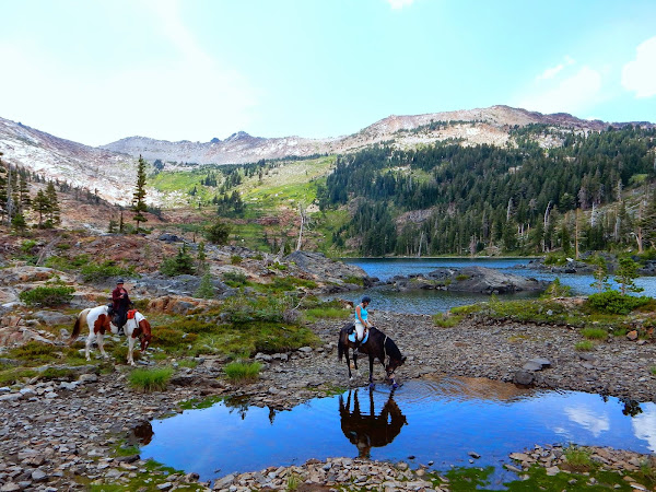
Parking is alongside the dirt road that is in car condition this August, 2012. 


Codfish Falls also known as Codfish Creek Falls

is reportedly 40-50 feet high. 

There are large flat boulder areas beside the falls,

great for picnicking in the shade!


The trail has some steep offshoots that take you to the river
but it's well maintained to the falls
and gets morning sun and
afternoon shade. 
Perfect! 
I have seen families with all ages of children here.

 The creek flows down to the river and adds
to the pleasant atmosphere for just hanging out.
 
There is a trail less maintained that heads uphill to
a boulder that two can comfortably sit on and view the falls,
hidden from the visitors below.

Of course, fun wildlife lives back there!

I may not recommend it, but I bushwhacked up the other side of the falls. 
The rocks are slippery and the blackberry vines get prickly!  A person
gives you some perspective on the height of the falls. 
Find Peach Hiker at the falls!

Back at the bridge,

Families can find areas near the shoreline to swim and picnic.


There is plenty of room to get comfortable and cast out some lines. 
The couple is Brandon and Jen. 

We caught a nice trout,


and well, a frog that day!
That's me, Peachy Hiker with my fishing pole enjoying the sun and company!


Get out your poles and fishing gear. 

Pack a picnic and your swimming stuff,

to have a perfect family day!

Directions:

  • From Highway 80 (east of Auburn),  exit at Weimar Cross Road.

  • Turn right onto Ponderosa Way, heading south. (Stay to the right at Cross Road. )

  • Drive south for 5.8 miles down the canyon.

  • 2.5 miles before the river the road becomes a dirt road that is suitable for most cars at this time. 

  • This is now a fee area.  They are collected by park rangers at the top at the dirt road.  You will see park personnel there and at the river. Carry your fishing license.

To go to the falls,

Start hiking downriver from the bathrooms. Just follow the trail and you'll find the falls. 

To swim and fish, there are quite a few places to get down to the river.  Across the bridge is where we fished and swam.

More hikes for you in this area:

 
ASRA ~ Auburn State Recreation District

BLM ~ Bureau of Land Management


Near Auburn, CA


OR:     Trails by Locations
Happy Trails!
edited 8-2012

August 19, 2012

Donner Area Hike for Families to Backpackers


Old Donner Pass to Azalea Lake Loop

(or you can park at the Sno Park parking near Boreal
and hike from that direction for a shorter, easier hike. 
*GPS links are at the bottom of this page.)
 
 
Suitable for beginners, families, and backpackers to PCTers!  Hike this 6 mile semi-loop with views of Donner Lake and the covered train tracks running across the range to the south.  Visit George S Stewart Peak to scramble sunny boulders, then retreat to the shady forest trail that will have numerous runoff creeks earlier in the season.  On the return you'll pass ponds and small lakes including Azalea and Flora, and finally Angela Lake.  For a 6 mile loop you get fantastic views, and a family friendly hike!  I met a 5 year old and 7 year old happily making the trek.
The bonus is arriving at Azalea and Flora Lakes with plenty of campsites for backpackers
But back to the beginning, parking!  I parked across the street from this favorite rock wall  and began my hike at the marker shown below.  Enlarge to see the climbers.

There are several easy options: You could park across the Old Donner Bridge and just walk back across the the nearest TH, or park at Mt Judah PCT parking and catch a TH there.

The trail will traverse uphill and the tracks I linked you to from my own hike will ascend all the way to the top of George S Stewart Peak.  It isn't too hard, even for the kids, although it isn't stroller worthy.

I started in the heat of the day so it was nice to photograph Donner Lake and the surrounding sights while snacking.  I could see the covered railroad tracks to the south, the Old Donner Bridge, to the west Lake Angela, and to the north through the forest see 80 carved in.
The Donner Pass Railway was covered for protection from snow, according to my grandfather who worked on the rails.
Descend into the forest and find wildflowers even in August despite the runoff creeks being dry.

This widow maker is a landmark that you are nearing the trail leading into Azalea Lake.  Me?  Got impatient as the sun dropped and bushwhacked over the rocks to get to the lake's basin.

Finally I arrived at Azalea Lake.  The trail went around the east side of the lake and continued past campsites and a small ascent on to Flora Lake.  I was the only one there!


Flora Lake is also set in a beautiful bowl.  If you climb a small distance to the east you get views of Donner again.  I added waypoints to my GPS tracks along this section as the trail isn't always clear, but is easy.


Pink is the old Donner Pass Highway.  Orange is Highway 80.   The small dark line at the top is where you could park and begin your hike rather than from my starting point.   
The Garmin Elevation Profile can be read more easily if you click on it to enlarge it.

Links for GPS:

Peachy Hiker GPS tracks  from Old Donner Pass
and
From 80 to Azalea by ClipperCreekWanderer  from 80 near Boreal.

Articles about other hikes you may be interested in:

Tahoe National Forest

Trails listed by Location

Thank you for stopping by.  Happy Trails!

edited 6-2013

August 11, 2012

Miners Ravine near Roseville, CA

The trail head is behind UA Theaters on Eureka! 

Updated on Nov. 9, 2012: This local dirt trail is ideal for getting the kids outdoors. There is a stream with beaver dams, indian grinding rocks, shade, and room to run.  First I am posting new photos of the dazzling autumn colors (not edited or enhanced) from my hike yesterday (Nov, 2012) then the previously written article, photos, and information I had posted here before will follow.


Often you see ducks and geese here and occasionally some other wildlife.

Autumn 2012
 
Here in our community is this wonderful trail with rolling hills, trees, wildlife, a pond, and as strenuous or easy a hike as you personally choose. 


This is one view of the pond in Miners Ravine that invites geese, ducks, and other wildlife. Its a great place for a picnic with the kids!

This is where you leave the paved bike trail and head into the woods. It will be on your left just after you cross a foot bridge.

Foothill Hikers introduced me to this area or I wouldn't have know to get off of the bike trails!

At times you will walk along the creek and often in the shade.


You'll cross under this bridge, not picturesque yet, but it gets better!


One of my favorite ways to kick this one up a notch is to jog up and down these hills.  They are steeper than they look!

Ducks, geese and other wildlife visit the Miners Ravine Pond.  There aren't tables, but a blanket would do..

Soon you'll see the beaver dam and evidence of their residency! 

There are a couple of dams in place although I guess for flood reasons, sometimes they get disturbed.  The beavers are ambitious though and they erect new ones!

A little history here in our own backyard...historic indian grinding rocks!
More of the hills I like to jog...

I couldn't resist the reflections here!
Remember to look up for wildlife too!  Birds of prey live here as well as garden variety birds.


This is the creek as you near the end of this hike.

Miners Ravine Trail Map
Distance: 5.9 miles as posted, but so many options make it totally adjustable to fit your needs.
Difficulty: This can be easy to moderate as a hike. It would make a nice trail run also.
Location: It is in the Rocklin/Roseville area but easy access for Sacramento and Loomis right off of 80 near 65. I park at the back of the UA Theaters parking lot on Eureka Road near the marked trail head . It is posted and leaves the parking lot paved as a bicycle trail, but you'll turn off and hike as shown above.
You can park on the dead end street at the other end of the loop by taking Sierra College Road east off of Highway 80. Turn right on El Don Road. Turn left on Foothill Road. At the corner you turn right and it is then Greenbrae. Follow it to the end taking the left fork as shown on the map below.
Click on this Miners Ravine Trail elevation profile and see the details clearly.

Foothill Hikers also have tracks posted on Wikiloc with a hiking variation of this same area.

Happy Trails!

updated Nov. 2012